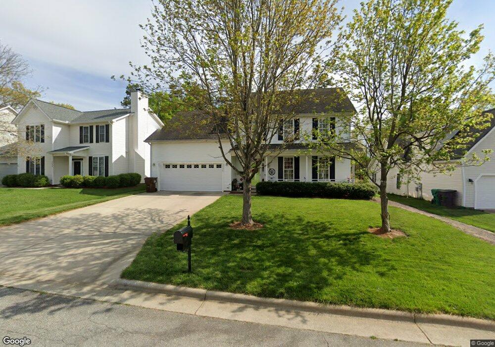
3640 Shadow Ridge Dr High Point, NC 27265
Bent Tree NeighborhoodEstimated Value: $356,000 - $399,000
4
Beds
4
Baths
2,270
Sq Ft
$164/Sq Ft
Est. Value
About This Home
This home is located at 3640 Shadow Ridge Dr, High Point, NC 27265 and is currently estimated at $372,415, approximately $164 per square foot. 3640 Shadow Ridge Dr is a home located in Guilford County with nearby schools including Southwest Elementary School, Southwest Guilford Middle School, and Southwest Guilford High School.
Ownership History
Date
Name
Owned For
Owner Type
Purchase Details
Closed on
Jan 15, 2003
Sold by
D R Horton Inc Greensboro
Bought by
Hall David W and Hall Loree C
Current Estimated Value
Home Financials for this Owner
Home Financials are based on the most recent Mortgage that was taken out on this home.
Original Mortgage
$168,100
Outstanding Balance
$71,661
Interest Rate
6.01%
Estimated Equity
$300,754
Create a Home Valuation Report for This Property
The Home Valuation Report is an in-depth analysis detailing your home's value as well as a comparison with similar homes in the area
Home Values in the Area
Average Home Value in this Area
Purchase History
| Date | Buyer | Sale Price | Title Company |
|---|---|---|---|
| Hall David W | $177,500 | -- |
Source: Public Records
Mortgage History
| Date | Status | Borrower | Loan Amount |
|---|---|---|---|
| Open | Hall David W | $168,100 |
Source: Public Records
Tax History
| Year | Tax Paid | Tax Assessment Tax Assessment Total Assessment is a certain percentage of the fair market value that is determined by local assessors to be the total taxable value of land and additions on the property. | Land | Improvement |
|---|---|---|---|---|
| 2025 | $4,226 | $306,700 | $60,000 | $246,700 |
| 2024 | $4,226 | $306,700 | $60,000 | $246,700 |
| 2023 | $4,226 | $306,700 | $60,000 | $246,700 |
| 2022 | $4,134 | $306,700 | $60,000 | $246,700 |
| 2021 | $2,702 | $196,100 | $34,000 | $162,100 |
| 2020 | $2,702 | $196,100 | $34,000 | $162,100 |
| 2019 | $2,702 | $196,100 | $0 | $0 |
| 2018 | $2,689 | $196,100 | $0 | $0 |
| 2017 | $2,702 | $196,100 | $0 | $0 |
| 2016 | $2,568 | $183,100 | $0 | $0 |
| 2015 | $2,582 | $183,100 | $0 | $0 |
| 2014 | $2,626 | $183,100 | $0 | $0 |
Source: Public Records
Map
Nearby Homes
- 3650 Single Leaf Ct
- 3477 Lilliefield Ln
- 4413 Edbury Ct
- 3273 Alyssa Way
- 4323 Holstein Dr
- 1515 Skeet Club Rd
- 4335 Holstein Dr
- 748 Carneros Cir
- 1517 Skeet Club Rd
- 715 Piedmont Crossing Dr Unit 14
- 3855 Thistleberry Rd
- 3740 Cottesmore Dr
- 4710 Willowstone Dr
- 4712 Willowstone Dr
- 4714 Willowstone Dr
- 4716 Willowstone Dr
- 4722 Willowstone Dr
- 3924 Braddock Rd
- 4711 Willowstone Dr
- 4713 Willowstone Dr
- 3644 Shadow Ridge Dr
- 3636 Shadow Ridge Dr
- 3632 Shadow Ridge Dr
- 3648 Shadow Ridge Dr
- 3628 Shadow Ridge Dr
- 3652 Shadow Ridge Dr
- 3633 Shadow Ridge Dr
- 4300 Shade Tree Ct
- 3637 Shadow Ridge Dr
- 3624 Shadow Ridge Dr
- 3641 Shadow Ridge Dr
- 4304 Shade Tree Ct
- 3645 Shadow Ridge Dr
- 3620 Shadow Ridge Dr
- 4301 Shade Tree Ct
- 4308 Shade Tree Ct
- 3649 Shadow Ridge Dr
- 3660 Shadow Ridge Dr
- 4305 Shade Tree Ct
- 3580 Bent Trace Dr
Your Personal Tour Guide
Ask me questions while you tour the home.