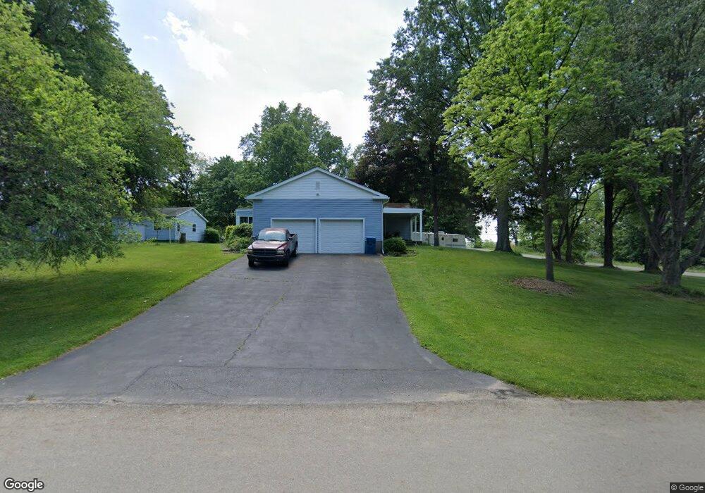
3640 Shellhart Rd Norton, OH 44203
Estimated Value: $257,000 - $337,000
4
Beds
2
Baths
1,960
Sq Ft
$149/Sq Ft
Est. Value
About This Home
This home is located at 3640 Shellhart Rd, Norton, OH 44203 and is currently estimated at $292,758, approximately $149 per square foot. 3640 Shellhart Rd is a home located in Summit County with nearby schools including Norton Primary Elementary School, Norton Middle School, and Norton High School.
Ownership History
Date
Name
Owned For
Owner Type
Purchase Details
Closed on
May 19, 2023
Sold by
Sudomir Jospeph A and Sudomir Bonnie L
Bought by
Bonnie And Joseph Sudomir Living Trust
Current Estimated Value
Purchase Details
Closed on
Dec 20, 2022
Sold by
Sudomir Jospeph A and Sudomir Bonnie L
Bought by
Bonnie And Joseph Sudomir Living Trust and Sudomir
Create a Home Valuation Report for This Property
The Home Valuation Report is an in-depth analysis detailing your home's value as well as a comparison with similar homes in the area
Home Values in the Area
Average Home Value in this Area
Purchase History
| Date | Buyer | Sale Price | Title Company |
|---|---|---|---|
| Bonnie And Joseph Sudomir Living Trust | -- | None Listed On Document | |
| Bonnie And Joseph Sudomir Living Trust | -- | None Listed On Document |
Source: Public Records
Tax History Compared to Growth
Tax History
| Year | Tax Paid | Tax Assessment Tax Assessment Total Assessment is a certain percentage of the fair market value that is determined by local assessors to be the total taxable value of land and additions on the property. | Land | Improvement |
|---|---|---|---|---|
| 2025 | $3,216 | $66,858 | $12,310 | $54,548 |
| 2024 | $3,216 | $66,858 | $12,310 | $54,548 |
| 2023 | $3,216 | $66,858 | $12,310 | $54,548 |
| 2022 | $3,153 | $53,624 | $9,769 | $43,855 |
| 2021 | $3,166 | $53,624 | $9,769 | $43,855 |
| 2020 | $2,988 | $53,630 | $9,770 | $43,860 |
| 2019 | $3,292 | $52,820 | $8,890 | $43,930 |
| 2018 | $2,769 | $52,820 | $8,890 | $43,930 |
| 2017 | $2,844 | $52,820 | $8,890 | $43,930 |
| 2016 | $2,844 | $49,690 | $8,890 | $40,800 |
| 2015 | $2,844 | $49,690 | $8,890 | $40,800 |
| 2014 | $2,817 | $49,690 | $8,890 | $40,800 |
| 2013 | $2,842 | $50,640 | $8,890 | $41,750 |
Source: Public Records
Map
Nearby Homes
- S/L 271 Creedmoor Rd
- Grand Bahama Plan at Brookside Greens - Ranches
- Aruba Bay Plan at Brookside Greens - Ranches
- Eden Cay Plan at Brookside Greens - Ranches
- Grand Cayman Plan at Brookside Greens - Ranches
- 3762 Alumina Dr
- 3748 Alumina Dr
- 3757 Alumina Dr
- 3738 Kirkham Dr
- 3746 Kirkham Dr
- 3923 Higgins Dr
- Birch w/ Basement Plan at Brookside Greens - 2-Story
- Cedar w/ Basement Plan at Brookside Greens - 2-Story
- Elder w/ Basement Plan at Brookside Greens - 2-Story
- Hazel w/ Basement Plan at Brookside Greens - 2-Story
- 3966 Wadsworth Rd
- 2848 Fair Oaks Dr
- 3080 Pleasant Dr
- V/L 3837 S Cleveland Massillon Rd
- 2981 Greenridge Rd
- 3650 Shellhart Rd
- 3602 Shellhart Rd
- 3588 Shellhart Rd
- 3603 Shellhart Rd
- 3589 Weyrick Dr
- 3662 Belt Line Dr
- 3678 Shellhart Rd
- 3576 Shellhart Rd
- 3577 Weyrick Dr
- 3564 Little Blvd
- 3566 Shellhart Rd
- 3690 Shellhart Rd
- 3565 Weyrick Dr
- 3572 Pillar Cir
- 3596 Weyrick Dr
- 3536 Little Blvd
- 3536 Little Blvd
- 3601 Little Blvd
- 3549 Weyrick Dr
- 3661 Belt Line Dr Unit S/L 179