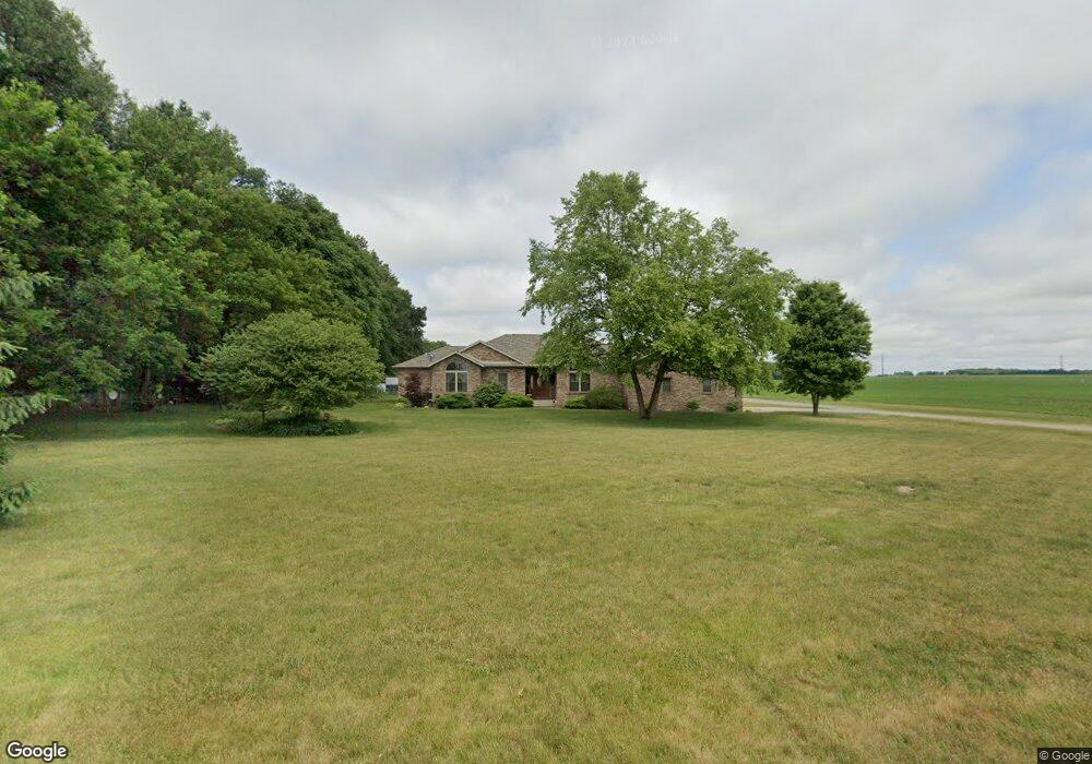
3645 E 200 N Rolling Prairie, IN 46371
Estimated Value: $427,000 - $540,000
4
Beds
3
Baths
2,092
Sq Ft
$233/Sq Ft
Est. Value
About This Home
This home is located at 3645 E 200 N, Rolling Prairie, IN 46371 and is currently estimated at $488,170, approximately $233 per square foot. 3645 E 200 N is a home located in LaPorte County with nearby schools including New Prairie High School and Sacred Heart Apostolic School.
Ownership History
Date
Name
Owned For
Owner Type
Purchase Details
Closed on
Jul 12, 2024
Sold by
Hawkins Carrie L
Bought by
Johnson Blake and Johnson Paige
Current Estimated Value
Purchase Details
Closed on
May 1, 2017
Sold by
Hawkins Carrie L and Haverstock Tim A
Bought by
Hawkins Carrie L
Purchase Details
Closed on
May 4, 2007
Sold by
Johnson Gina
Bought by
Johnson Robert
Create a Home Valuation Report for This Property
The Home Valuation Report is an in-depth analysis detailing your home's value as well as a comparison with similar homes in the area
Home Values in the Area
Average Home Value in this Area
Purchase History
| Date | Buyer | Sale Price | Title Company |
|---|---|---|---|
| Johnson Blake | $515,000 | Chicago Title | |
| Hawkins Carrie L | -- | None Available | |
| Hawkins Carrie L | -- | None Available | |
| Johnson Robert | -- | None Available |
Source: Public Records
Tax History Compared to Growth
Tax History
| Year | Tax Paid | Tax Assessment Tax Assessment Total Assessment is a certain percentage of the fair market value that is determined by local assessors to be the total taxable value of land and additions on the property. | Land | Improvement |
|---|---|---|---|---|
| 2024 | $3,275 | $314,900 | $35,100 | $279,800 |
| 2023 | $3,198 | $292,700 | $34,300 | $258,400 |
| 2022 | $3,365 | $285,600 | $33,400 | $252,200 |
| 2021 | $3,150 | $258,000 | $32,900 | $225,100 |
| 2020 | $3,251 | $258,000 | $32,900 | $225,100 |
| 2019 | $3,114 | $248,000 | $33,500 | $214,500 |
| 2018 | $3,157 | $252,400 | $33,600 | $218,800 |
| 2017 | $6,649 | $419,900 | $197,900 | $222,000 |
| 2016 | $7,404 | $434,900 | $208,100 | $226,800 |
| 2014 | $8,739 | $434,900 | $210,500 | $224,400 |
Source: Public Records
Map
Nearby Homes
- 2692 N Morning Glory Ave
- 2945 N Morning Glory Ave Unit 73
- 2983 N Morning Glory Ave Unit 72
- 2979 N Morning Glory Ave
- 2893 N Morning Glory Ave
- 2897 N Morning Glory Ave
- 2952 N Morning Glory Ave
- 3429 E Sand Ridge Rd
- 3202 N 300 E
- 3803 E State Road 2
- 4222 N 400 E
- 2088 N 150 E
- 67 Acres E 300 N
- 2027 N Coachlight Dr
- 4271 E 50 N
- 109 N Depot St
- 1709 E Lincolnway
- 6798 E 350 N
- 4233 N Blueridge Dr
- 0 N Fail Rd Unit NRA818156