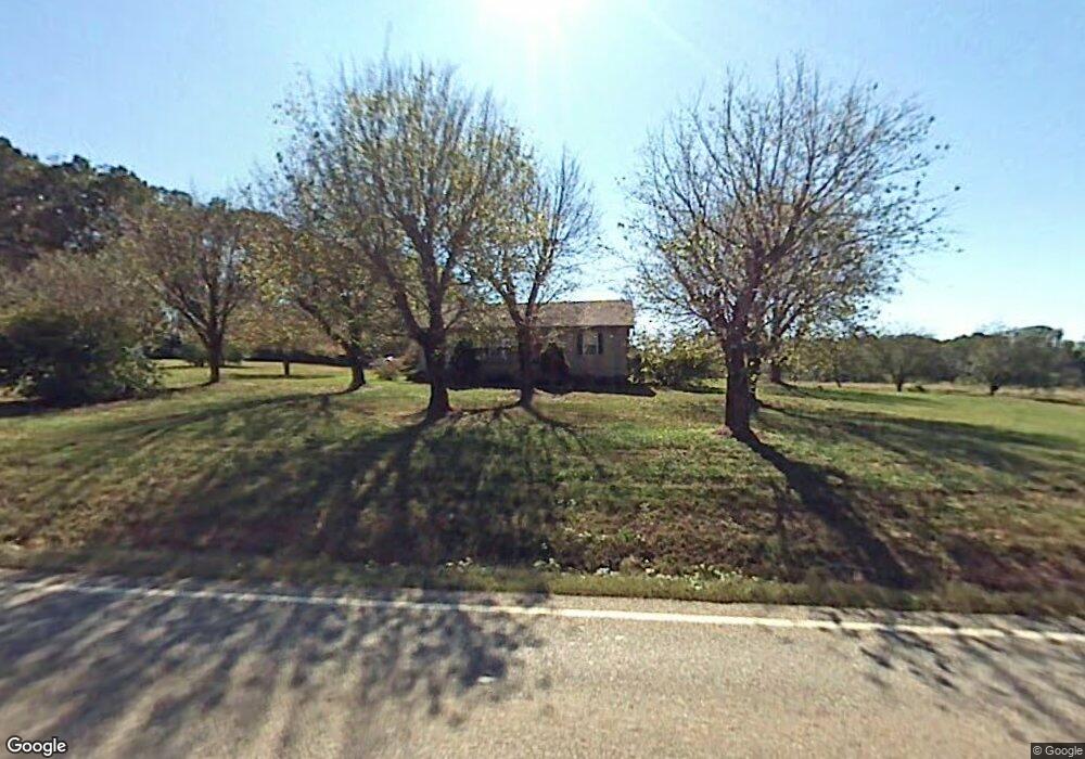
3645 Matt Hwy Cumming, GA 30028
Estimated Value: $492,000 - $655,054
3
Beds
2
Baths
960
Sq Ft
$597/Sq Ft
Est. Value
About This Home
This home is located at 3645 Matt Hwy, Cumming, GA 30028 and is currently estimated at $573,527, approximately $597 per square foot. 3645 Matt Hwy is a home with nearby schools including Coal Mountain Elementary School, North Forsyth Middle School, and North Forsyth High School.
Ownership History
Date
Name
Owned For
Owner Type
Purchase Details
Closed on
Oct 16, 2015
Sold by
Orchards Of Stoney Point Llc
Bought by
Bentley Angela
Current Estimated Value
Purchase Details
Closed on
Sep 9, 2009
Sold by
Moss Beth
Bought by
Citizens Bk Of Forsyth Cnty
Purchase Details
Closed on
Oct 17, 2006
Sold by
Dinsmore Annette
Bought by
Moss Beth
Home Financials for this Owner
Home Financials are based on the most recent Mortgage that was taken out on this home.
Original Mortgage
$328,589
Interest Rate
6.39%
Mortgage Type
Commercial
Create a Home Valuation Report for This Property
The Home Valuation Report is an in-depth analysis detailing your home's value as well as a comparison with similar homes in the area
Home Values in the Area
Average Home Value in this Area
Purchase History
| Date | Buyer | Sale Price | Title Company |
|---|---|---|---|
| Bentley Angela | $310,055 | -- | |
| Citizens Bk Of Forsyth Cnty | -- | -- | |
| Moss Beth | $200,000 | -- |
Source: Public Records
Mortgage History
| Date | Status | Borrower | Loan Amount |
|---|---|---|---|
| Previous Owner | Moss Beth | $328,589 |
Source: Public Records
Tax History Compared to Growth
Tax History
| Year | Tax Paid | Tax Assessment Tax Assessment Total Assessment is a certain percentage of the fair market value that is determined by local assessors to be the total taxable value of land and additions on the property. | Land | Improvement |
|---|---|---|---|---|
| 2025 | $1,235 | $96,588 | $96,000 | $588 |
| 2024 | $1,235 | $50,380 | $49,920 | $460 |
| 2023 | $1,317 | $50,484 | $49,920 | $564 |
| 2022 | $544 | $20,452 | $20,000 | $452 |
| 2021 | $565 | $20,452 | $20,000 | $452 |
| 2020 | $565 | $20,452 | $20,000 | $452 |
| 2019 | $567 | $20,492 | $20,000 | $492 |
| 2018 | $1,121 | $40,532 | $40,000 | $532 |
| 2017 | $1,128 | $40,656 | $40,000 | $656 |
| 2016 | $2,239 | $80,656 | $80,000 | $656 |
| 2015 | $2,243 | $80,656 | $80,000 | $656 |
| 2014 | $2,137 | $80,736 | $0 | $0 |
Source: Public Records
Map
Nearby Homes
- 4420 Belcrest Way
- 3995 Sierra Lake Dr
- 3725 Sierra Lake Dr
- 3735 Sierra Lake Dr
- 3810 Sierra Lake Dr
- The Colton Plan at Sierra Lake
- The Beckett Plan at Sierra Lake
- The Charleston Plan at Sierra Lake
- The Claire Plan at Sierra Lake
- The Margaret Plan at Sierra Lake
- The Sophia Plan at Sierra Lake
- 4115 Sierra Vista Cir
- 4095 Sierra Vista Cir
- 4015 Sierra Vista Cir
- 4010 Sierra Knolls Ct
- 4020 Sierra Knolls Ct
- 4090 Sierra Knolls Ct
- 3455 Buffington Ln
- 3530 Dahlonega Hwy
- 3534 Dahlonega Hwy
- 3625 Matt Hwy
- 4080 Mayhill Cir
- 4090 Mayhill Cir
- 3665 Matt Hwy
- 4070 Mayhill Cir Unit 17
- 4070 Mayhill Cir
- 4110 Mayhill Cir
- 4060 Mayhill Cir Unit 16
- 4060 Mayhill Cir
- 4120 Mayhill Cir
- 4120 Mayhill Cir Unit 21
- 3603 Sierra Lake Dr
- 4085 Mayhill Cir Unit 31
- 4085 Mayhill Cir
- 4075 Mayhill Cir Unit 32
- 4075 Mayhill Cir
- 4095 Mayhill Cir Unit 30
- 4095 Mayhill Cir Unit 29
- 4095 Mayhill Cir
- 0 Mayhill Cir Unit 30 8826845