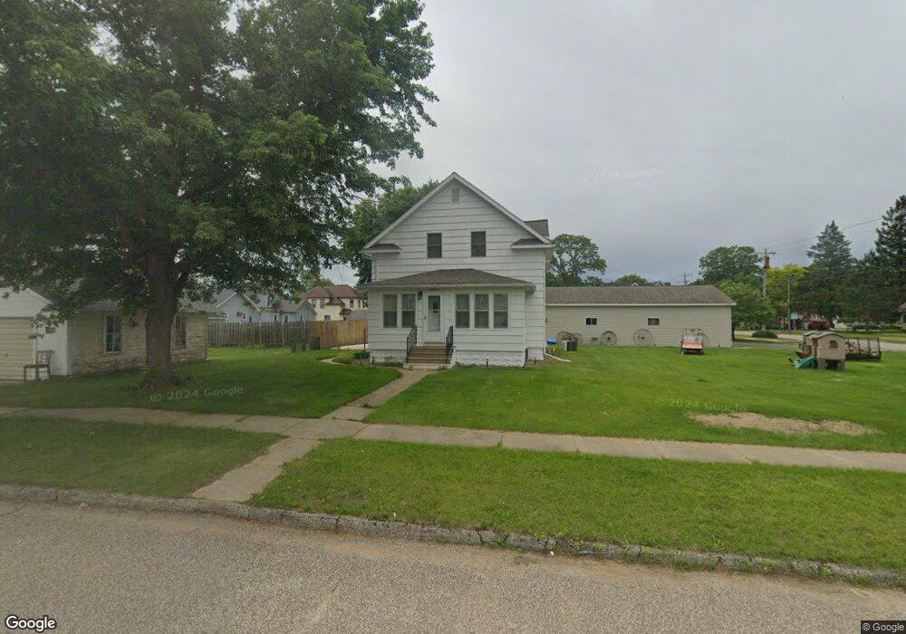
36451 Earle St Whitehall, WI 54773
Estimated Value: $193,000 - $241,000
--
Bed
--
Bath
--
Sq Ft
0.33
Acres
About This Home
This home is located at 36451 Earle St, Whitehall, WI 54773 and is currently estimated at $214,587. 36451 Earle St is a home located in Trempealeau County with nearby schools including Whitehall Memorial Elementary School, Whitehall Memorial Jr./Sr. High School, and Fly Creek Amish School.
Ownership History
Date
Name
Owned For
Owner Type
Purchase Details
Closed on
May 29, 2012
Sold by
Bere Tony J and Bere Valarie D
Bought by
Peters Troy M and Peters Wanda
Current Estimated Value
Home Financials for this Owner
Home Financials are based on the most recent Mortgage that was taken out on this home.
Original Mortgage
$128,250
Outstanding Balance
$89,132
Interest Rate
3.89%
Mortgage Type
New Conventional
Estimated Equity
$125,455
Create a Home Valuation Report for This Property
The Home Valuation Report is an in-depth analysis detailing your home's value as well as a comparison with similar homes in the area
Home Values in the Area
Average Home Value in this Area
Purchase History
| Date | Buyer | Sale Price | Title Company |
|---|---|---|---|
| Peters Troy M | $135,000 | None Available |
Source: Public Records
Mortgage History
| Date | Status | Borrower | Loan Amount |
|---|---|---|---|
| Open | Peters Troy M | $128,250 |
Source: Public Records
Tax History Compared to Growth
Tax History
| Year | Tax Paid | Tax Assessment Tax Assessment Total Assessment is a certain percentage of the fair market value that is determined by local assessors to be the total taxable value of land and additions on the property. | Land | Improvement |
|---|---|---|---|---|
| 2024 | $3,760 | $186,500 | $11,400 | $175,100 |
| 2023 | $3,539 | $186,500 | $11,400 | $175,100 |
| 2022 | $3,554 | $186,500 | $11,400 | $175,100 |
| 2021 | $3,668 | $132,700 | $9,500 | $123,200 |
| 2020 | $3,601 | $21,820 | $9,500 | $12,320 |
| 2019 | $3,496 | $132,700 | $9,500 | $123,200 |
| 2018 | $3,181 | $132,700 | $9,500 | $123,200 |
| 2017 | $3,315 | $132,700 | $9,500 | $123,200 |
| 2016 | $3,218 | $132,700 | $9,500 | $123,200 |
| 2015 | $3,125 | $132,700 | $9,500 | $123,200 |
| 2014 | $2,964 | $132,700 | $9,500 | $123,200 |
| 2011 | $2,696 | $107,500 | $8,600 | $98,900 |
Source: Public Records
Map
Nearby Homes
- 36015 Main St
- 36290 Camp St
- 18430 Hillside Dr
- 18144 Anderson St
- 18124 Fredrickson St
- N36836 Us Highway 53 121
- N32838 Briten Rd
- 36121 Ash St
- 35979 Osseo Rd
- 35433 Wayne St
- 23898 Adams St
- 23942 Tracy St
- N34701 County Rd N
- N34855 County Rd S
- N30732 Square Bluff Rd
- 39971 Anderson St
- 517 W Broadway St
- 39885 Winsand Dr
- 102 S Peterson Ave
- N34701 County Rd S
- 36381 Earle St
- 36492 Earle St
- 18668 Scranton St
- 18651 Blair St
- 18626 Blair St
- 18632 Blair St
- 18654 Blair St
- 18648 Blair St
- 18668 Blair St
- 18672 Blair St
- 18696 Blair St
- 18650 Scranton St
- 18678 Scranton St
- 36443 Hancock St
- 36446 West St
- 18684 Scranton St
- 36437 Hancock St
- 18684 Blair St
- 18624 Scranton St
- 18696 Scranton St