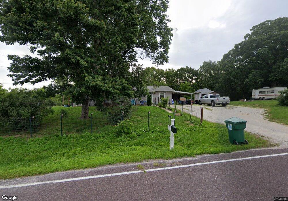
3647 Lollar Branch Rd Sullivan, MO 63080
Estimated Value: $237,412 - $298,000
3
Beds
1
Bath
1,488
Sq Ft
$183/Sq Ft
Est. Value
About This Home
This home is located at 3647 Lollar Branch Rd, Sullivan, MO 63080 and is currently estimated at $272,137, approximately $182 per square foot. 3647 Lollar Branch Rd is a home located in Franklin County with nearby schools including Sullivan Primary School, Sullivan Elementary School, and Sullivan Middle School.
Ownership History
Date
Name
Owned For
Owner Type
Purchase Details
Closed on
Oct 7, 2013
Sold by
Koelling Landon W and Koelling Tracy L
Bought by
Bull Ronald D and Bull Opal M
Current Estimated Value
Home Financials for this Owner
Home Financials are based on the most recent Mortgage that was taken out on this home.
Original Mortgage
$95,243
Outstanding Balance
$71,900
Interest Rate
4.62%
Mortgage Type
FHA
Estimated Equity
$200,237
Create a Home Valuation Report for This Property
The Home Valuation Report is an in-depth analysis detailing your home's value as well as a comparison with similar homes in the area
Home Values in the Area
Average Home Value in this Area
Purchase History
| Date | Buyer | Sale Price | Title Company |
|---|---|---|---|
| Bull Ronald D | -- | -- |
Source: Public Records
Mortgage History
| Date | Status | Borrower | Loan Amount |
|---|---|---|---|
| Open | Bull Ronald D | $95,243 |
Source: Public Records
Tax History Compared to Growth
Tax History
| Year | Tax Paid | Tax Assessment Tax Assessment Total Assessment is a certain percentage of the fair market value that is determined by local assessors to be the total taxable value of land and additions on the property. | Land | Improvement |
|---|---|---|---|---|
| 2024 | $1,135 | $20,968 | $0 | $0 |
| 2023 | $1,135 | $20,968 | $0 | $0 |
| 2022 | $1,020 | $18,884 | $0 | $0 |
| 2021 | $1,026 | $18,884 | $0 | $0 |
| 2020 | $962 | $17,406 | $0 | $0 |
| 2019 | $963 | $17,406 | $0 | $0 |
| 2018 | $954 | $17,047 | $0 | $0 |
| 2017 | $963 | $17,047 | $0 | $0 |
| 2016 | $898 | $16,099 | $0 | $0 |
| 2015 | $901 | $16,099 | $0 | $0 |
| 2014 | $888 | $16,389 | $0 | $0 |
Source: Public Records
Map
Nearby Homes
- 00 Lollar Branch Rd
- 3080 Westwood Rd
- 0 Lollar Branch Rd Unit 24419048
- 000 Westwood Rd
- 000
- 0 Highland Fling
- 205 Harmony Hills Rd
- 0 Perkins Rd Unit MIS25042480
- 6730 Highway Jj
- Lot B Pea Ridge Farms Dr
- 0 Lot C Pea Ridge Farms Dr
- 0 Lot 1 Pea Ridge Farms Dr
- 0 Lot G Armadillo Ln Unit MIS25030849
- 0 Lot E Pea Ridge Farms Dr
- 0 Lot H Armadillo Ln Unit MIS25030851
- 8 Sherwood Ln
- 2683 Ridge Rd
- 665 Anaconda Rd
- 1921 W Springfield Rd
- 0 St Clair Station Ln Unit MIS25068128
- 3655 Lollar Branch Rd
- 3675 Lollar Branch Rd
- 3675 Lollar Branch Rd
- 0 Lollar Branch Unit 15064578
- 3575 Lollar Branch Rd
- 419 Dorwood Ln
- 427 Dorwood Ln
- 3739 Lollar Branch Rd
- 0 Lake Dr
- 0 Dorwood Ln Unit 15064575
- 0 Dorwood Ln Unit 19040947
- 3780 Lollar Branch Rd
- 3496 Lollar Branch Rd
- 3464 Westwood Rd
- 3505 Lollar Branch Rd
- 3476 Lollar Branch Rd
- 3474 Lollar Branch Rd
- 3471 Lollar Branch Rd
- 3549 Westwood Rd
- 3392 Westwood Rd