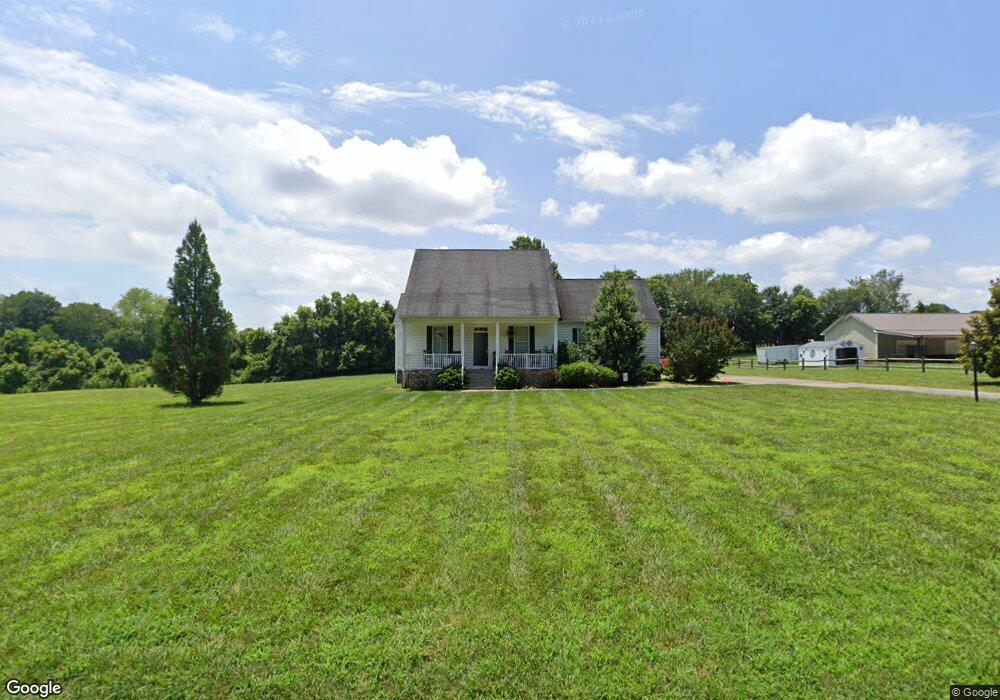
3647 Weaver Rd Salisbury, NC 28147
Estimated Value: $371,399 - $475,000
--
Bed
2
Baths
1,548
Sq Ft
$288/Sq Ft
Est. Value
About This Home
This home is located at 3647 Weaver Rd, Salisbury, NC 28147 and is currently estimated at $445,350, approximately $287 per square foot. 3647 Weaver Rd is a home located in Rowan County with nearby schools including Millbridge Elementary School, West Rowan Middle School, and West Rowan High School.
Ownership History
Date
Name
Owned For
Owner Type
Purchase Details
Closed on
Oct 30, 2020
Sold by
Hartley Thomas and Hartley Mary
Bought by
Belt Daniel C and Belt Shelby F
Current Estimated Value
Home Financials for this Owner
Home Financials are based on the most recent Mortgage that was taken out on this home.
Original Mortgage
$269,515
Outstanding Balance
$239,830
Interest Rate
2.8%
Mortgage Type
New Conventional
Estimated Equity
$205,520
Purchase Details
Closed on
Oct 6, 2006
Sold by
Dougherty Norman L
Bought by
Hartley Thomas and Hartley Mary
Create a Home Valuation Report for This Property
The Home Valuation Report is an in-depth analysis detailing your home's value as well as a comparison with similar homes in the area
Home Values in the Area
Average Home Value in this Area
Purchase History
| Date | Buyer | Sale Price | Title Company |
|---|---|---|---|
| Belt Daniel C | $284,000 | Fortified Title | |
| Hartley Thomas | $55,000 | None Available |
Source: Public Records
Mortgage History
| Date | Status | Borrower | Loan Amount |
|---|---|---|---|
| Open | Belt Daniel C | $269,515 |
Source: Public Records
Tax History Compared to Growth
Tax History
| Year | Tax Paid | Tax Assessment Tax Assessment Total Assessment is a certain percentage of the fair market value that is determined by local assessors to be the total taxable value of land and additions on the property. | Land | Improvement |
|---|---|---|---|---|
| 2025 | $1,833 | $270,521 | $54,040 | $216,481 |
| 2024 | $1,833 | $270,521 | $54,040 | $216,481 |
| 2023 | $1,833 | $270,521 | $54,040 | $216,481 |
| 2022 | $1,299 | $172,013 | $38,128 | $133,885 |
| 2021 | $1,286 | $172,013 | $38,128 | $133,885 |
| 2020 | $1,286 | $172,013 | $38,128 | $133,885 |
| 2019 | $1,286 | $172,013 | $38,128 | $133,885 |
| 2018 | $1,145 | $154,410 | $38,128 | $116,282 |
| 2017 | $1,145 | $154,410 | $38,128 | $116,282 |
| 2016 | $1,145 | $154,410 | $38,128 | $116,282 |
| 2015 | $1,158 | $154,410 | $38,128 | $116,282 |
| 2014 | $1,226 | $171,407 | $55,125 | $116,282 |
Source: Public Records
Map
Nearby Homes
- 611 Davis Farm Dr
- 1045 Castle Mill Ln Unit 38
- 210 Goldenrod Cir
- 4860 Patterson Rd
- 1110 Coppergate Dr
- 3D Sloan Rd
- 1120 Coppergate Dr
- 1160 Coppergate Dr
- 203 Trinity Ct
- 7245 Mooresville Rd
- 1030 Stonegate Dr
- 1150 Coppergate Dr
- 1033 Stonegate Dr
- 1213 Stonegate Dr
- Azalea II Plan at Yorkshire Farms
- Daffodil Plan at Yorkshire Farms
- 1240 Coppergate Dr
- 1280 Coppergate Dr
- 1340 Coppergate Dr
- 1335 Coppergate Dr
- 3647 Weaver Rd
- 3671 Weaver Rd
- 5035 Millbridge Rd
- 3551 Weaver Rd
- 4930 Millbridge Rd
- 4950 Millbridge Rd
- 5080 Millbridge Rd
- 5020 Millbridge Rd
- 5090 Millbridge Rd
- 5165 Millbridge Rd
- 3451 Weaver Rd
- 5155 Millbridge Rd
- 3417 Weaver Rd
- 5195 Millbridge Rd
- 4665 Millbridge Rd
- 5130 Millbridge Rd
- 8950 Fannie Sloan Ln
- 5220 Millbridge Rd
- 9075 Fannie Sloan Ln
- 9085 Fannie Sloan Ln