Estimated Value: $218,945 - $325,000
3
Beds
3
Baths
2,393
Sq Ft
$118/Sq Ft
Est. Value
About This Home
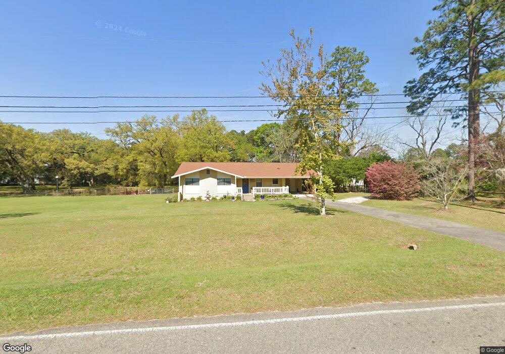
This home is located at 365 Airport Rd, Cairo, GA 39828 and is currently estimated at $282,486, approximately $118 per square foot. 365 Airport Rd is a home located in Grady County with nearby schools including Cairo High School.
Ownership History
Date
Name
Owned For
Owner Type
Purchase Details
Closed on
Oct 31, 2000
Bought by
Ingles Joseph Paul
Current Estimated Value
Purchase Details
Closed on
Oct 4, 1996
Sold by
Dekle Andrew A
Bought by
Rawls Joseph H
Purchase Details
Closed on
Mar 25, 1983
Bought by
Dekle Andrew A
Create a Home Valuation Report for This Property
The Home Valuation Report is an in-depth analysis detailing your home's value as well as a comparison with similar homes in the area
Home Values in the Area
Average Home Value in this Area
Purchase History
| Date | Buyer | Sale Price | Title Company |
|---|---|---|---|
| Ingles Joseph Paul | $54,000 | -- | |
| Rawls Joseph H | $60,000 | -- | |
| Dekle Andrew A | $40,100 | -- |
Source: Public Records
Tax History Compared to Growth
Tax History
| Year | Tax Paid | Tax Assessment Tax Assessment Total Assessment is a certain percentage of the fair market value that is determined by local assessors to be the total taxable value of land and additions on the property. | Land | Improvement |
|---|---|---|---|---|
| 2024 | $2,905 | $75,196 | $2,720 | $72,476 |
| 2023 | $1,747 | $48,854 | $3,600 | $45,254 |
| 2022 | $1,820 | $48,854 | $3,600 | $45,254 |
| 2021 | $1,824 | $48,854 | $3,600 | $45,254 |
| 2020 | $1,829 | $48,854 | $3,600 | $45,254 |
| 2019 | $1,829 | $48,854 | $3,600 | $45,254 |
| 2018 | $1,739 | $48,854 | $3,600 | $45,254 |
| 2017 | $1,673 | $48,854 | $3,600 | $45,254 |
| 2016 | $1,520 | $43,550 | $3,600 | $39,950 |
| 2015 | $1,505 | $43,550 | $3,600 | $39,950 |
| 2014 | -- | $43,550 | $3,600 | $39,950 |
| 2013 | -- | $24,777 | $3,600 | $21,177 |
Source: Public Records
Map
Nearby Homes
- 0 NE Airport Rd Unit 145784
- 78.6 Ac Strickland Rd
- 2600 U S 84
- 66 22nd St NE
- 21 24th St NE
- 0 20th St NE
- 00 20th St NE
- 3109 U S 84
- 3109 U S 84
- 00 #10 Oak Bend Circle 4 38 Acres
- 00 State Route 188
- 0 State Route 188
- 00 NW 9th Ave
- 711 2nd Ave NE
- 236 Helton Ln
- 225 Helton Ln
- Lot #15, 3 64 Acres Oakbend Cir
- 530 6th Ave SE
- 471 4th St SE
- 530 6th St
- 530 Loblolly Ln
- 2853 Bark Ave NE
- 2847 Bark Ave NE
- 2845 Slash Ave NE
- 2829 Bark Ave NE
- 2829 Bark Ave NE
- 2880 Slash Ave NE
- 375 Airport Rd
- 2827 Bark Ave NE
- 2848 Slash Ave NE
- 390 Loblolly Ln
- 2800 Bark Ave NE
- 2860 Bark Ave NE
- 320 Airport Rd
- 2851 Slash Ave NE
- 385 Airport Rd
- 2846 Bark Ave NE
- 290 Airport Rd
- 2849 Slash Ave NE
- 2809 Slash Ave NE