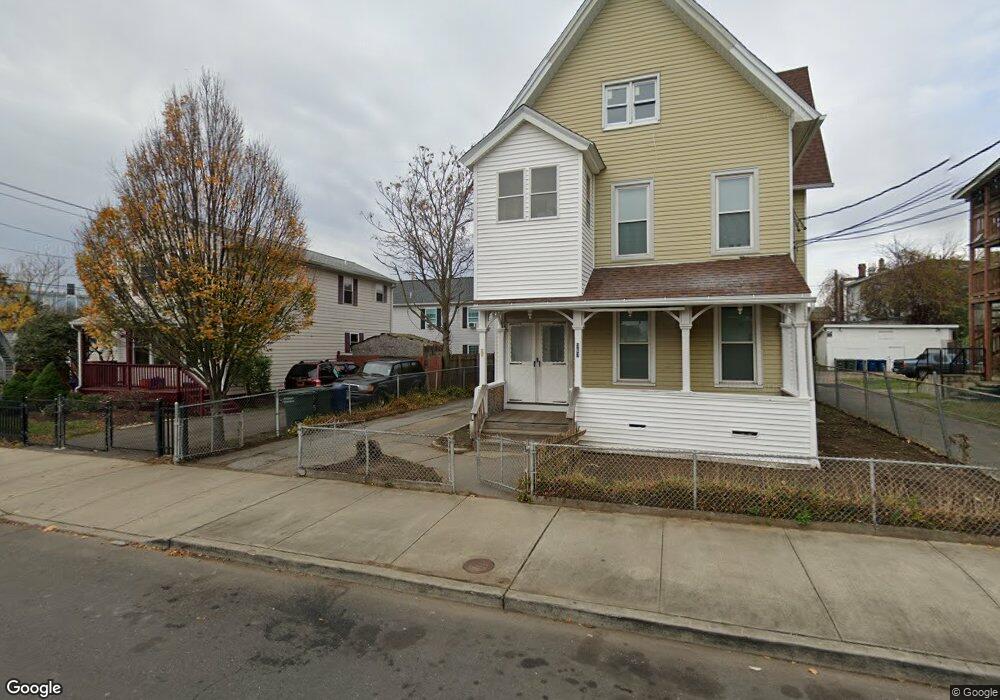
365 Brooks St Unit 367 Bridgeport, CT 06608
East Side Bridgeport NeighborhoodEstimated Value: $421,850 - $568,000
4
Beds
3
Baths
3,312
Sq Ft
$143/Sq Ft
Est. Value
About This Home
This home is located at 365 Brooks St Unit 367, Bridgeport, CT 06608 and is currently estimated at $473,963, approximately $143 per square foot. 365 Brooks St Unit 367 is a home located in Fairfield County with nearby schools including Barnum School, Harding High School, and Achievement First Bridgeport Academy Elementary School.
Ownership History
Date
Name
Owned For
Owner Type
Purchase Details
Closed on
Mar 30, 1990
Sold by
Cotto Pedro
Bought by
Andrews Roosevelt
Current Estimated Value
Home Financials for this Owner
Home Financials are based on the most recent Mortgage that was taken out on this home.
Original Mortgage
$96,000
Interest Rate
9.96%
Mortgage Type
Purchase Money Mortgage
Create a Home Valuation Report for This Property
The Home Valuation Report is an in-depth analysis detailing your home's value as well as a comparison with similar homes in the area
Home Values in the Area
Average Home Value in this Area
Purchase History
| Date | Buyer | Sale Price | Title Company |
|---|---|---|---|
| Andrews Roosevelt | $120,000 | -- |
Source: Public Records
Mortgage History
| Date | Status | Borrower | Loan Amount |
|---|---|---|---|
| Open | Andrews Roosevelt | $78,723 | |
| Closed | Andrews Roosevelt | $104,000 | |
| Closed | Andrews Roosevelt | $96,000 |
Source: Public Records
Tax History Compared to Growth
Tax History
| Year | Tax Paid | Tax Assessment Tax Assessment Total Assessment is a certain percentage of the fair market value that is determined by local assessors to be the total taxable value of land and additions on the property. | Land | Improvement |
|---|---|---|---|---|
| 2025 | $7,648 | $176,010 | $41,550 | $134,460 |
| 2024 | $7,648 | $176,010 | $41,550 | $134,460 |
| 2023 | $7,648 | $176,010 | $41,550 | $134,460 |
| 2022 | $7,648 | $176,010 | $41,550 | $134,460 |
| 2021 | $7,648 | $176,010 | $41,550 | $134,460 |
| 2020 | $6,909 | $127,960 | $17,700 | $110,260 |
| 2019 | $6,909 | $127,960 | $17,700 | $110,260 |
| 2018 | $6,957 | $127,960 | $17,700 | $110,260 |
| 2017 | $6,957 | $127,960 | $17,700 | $110,260 |
| 2016 | $6,945 | $127,740 | $17,700 | $110,040 |
| 2015 | $7,964 | $188,730 | $30,940 | $157,790 |
| 2014 | $7,964 | $188,730 | $30,940 | $157,790 |
Source: Public Records
Map
Nearby Homes
- 355 Brooks St
- 375 Brooks St Unit 377
- 505 Shelton St
- 495 Shelton St
- 385 Brooks St Unit 387
- 537 Shelton St
- 491 Shelton St
- 376 Brooks St
- 337 Brooks St
- 486 Ogden St Unit 492
- 486 Ogden St Unit 2
- 382 Brooks St
- 1200 E Main St
- 329 Brooks St
- 545 Shelton St
- 510 Shelton St
- 1214 E Main St
- 1192 E Main St
- 504 Shelton St
- 338 Brooks St