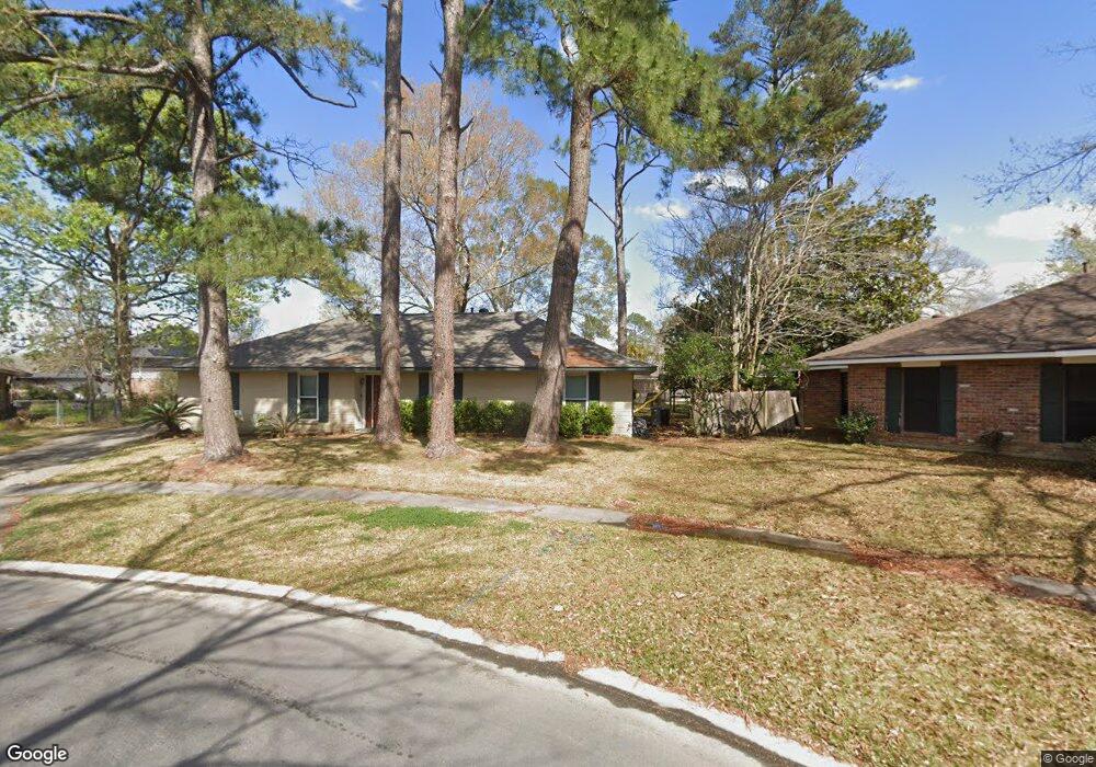
365 Dunstan Cir Baton Rouge, LA 70815
Broadmoor/Sherwood NeighborhoodEstimated Value: $213,764 - $225,000
--
Bed
--
Bath
1,866
Sq Ft
$117/Sq Ft
Est. Value
About This Home
This home is located at 365 Dunstan Cir, Baton Rouge, LA 70815 and is currently estimated at $219,191, approximately $117 per square foot. 365 Dunstan Cir is a home located in East Baton Rouge Parish with nearby schools including Twin Oaks Elementary School, Southeast Middle School, and Broadmoor Senior High School.
Ownership History
Date
Name
Owned For
Owner Type
Purchase Details
Closed on
Mar 23, 2007
Sold by
Dykes Nicole D
Bought by
Forman Jeremi H
Current Estimated Value
Home Financials for this Owner
Home Financials are based on the most recent Mortgage that was taken out on this home.
Original Mortgage
$165,000
Outstanding Balance
$99,872
Interest Rate
6.26%
Mortgage Type
New Conventional
Estimated Equity
$119,319
Purchase Details
Closed on
Jun 11, 1999
Sold by
Johnson Emmett Sherman
Bought by
Dykes Drew L and Dykes Nicole Dubroc
Home Financials for this Owner
Home Financials are based on the most recent Mortgage that was taken out on this home.
Original Mortgage
$81,697
Interest Rate
6.92%
Mortgage Type
FHA
Create a Home Valuation Report for This Property
The Home Valuation Report is an in-depth analysis detailing your home's value as well as a comparison with similar homes in the area
Home Values in the Area
Average Home Value in this Area
Purchase History
| Date | Buyer | Sale Price | Title Company |
|---|---|---|---|
| Forman Jeremi H | $165,000 | -- | |
| Dykes Drew L | $99,900 | -- |
Source: Public Records
Mortgage History
| Date | Status | Borrower | Loan Amount |
|---|---|---|---|
| Open | Forman Jeremi H | $165,000 | |
| Previous Owner | Dykes Drew L | $81,697 |
Source: Public Records
Tax History Compared to Growth
Tax History
| Year | Tax Paid | Tax Assessment Tax Assessment Total Assessment is a certain percentage of the fair market value that is determined by local assessors to be the total taxable value of land and additions on the property. | Land | Improvement |
|---|---|---|---|---|
| 2024 | $2,261 | $18,660 | $3,000 | $15,660 |
| 2023 | $2,261 | $16,500 | $3,000 | $13,500 |
| 2022 | $2,045 | $16,500 | $3,000 | $13,500 |
| 2021 | $2,000 | $16,500 | $3,000 | $13,500 |
| 2020 | $2,024 | $16,500 | $3,000 | $13,500 |
| 2019 | $2,113 | $16,500 | $3,000 | $13,500 |
| 2018 | $2,088 | $16,500 | $3,000 | $13,500 |
| 2017 | $2,088 | $16,500 | $3,000 | $13,500 |
| 2016 | $1,477 | $11,775 | $3,000 | $8,775 |
| 2015 | $2,043 | $16,500 | $3,000 | $13,500 |
| 2014 | $2,035 | $16,500 | $3,000 | $13,500 |
| 2013 | -- | $16,500 | $3,000 | $13,500 |
Source: Public Records
Map
Nearby Homes
- 305 Woodcliff Dr
- 12875 King John Place
- 13212 Avants Ave
- 13243 Avants Ave
- 12511 E Robinhood Dr
- 12651 Parnell Ave
- 12435 Parnell Dr
- 13070 Wallis St
- 522 S Flannery Rd Unit A
- 12424 Cate Ave Unit 12426
- 13358 Wenham Ave
- 13343 E Parnell Ave
- 12547 Lorna Ave
- 388 Wingate Dr
- 578 S Flannery Rd
- 379 Wilton Dr
- 346 Wilton Dr
- 371 Kay Dr
- 1466 Harco Dr
- 12343 Mollylea Dr
- 365 Dunstan CI
- 357 Dunstan Cir
- 357 Dunstan CI
- 342 Shelby Dr
- 383 Dunstan CI
- 383 Dunstan Cir
- 364 Shelby Dr
- 338 Shelby Dr
- 358 Dunstan Cir
- 326 Shelby Dr
- 378 Shelby Dr
- 366 Dunstan Cir
- 13040 Norma Ct
- 384 Dunstan Cir
- 384 Dunstan CI
- 13030 Norma Ct
- 13030 Norma Ct
- 12964 Arlingford Ave
- 314 Shelby Dr
- 13020 Norma Ct