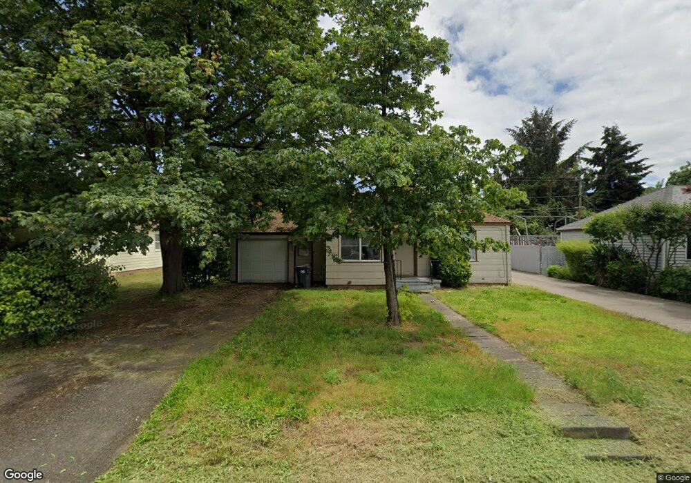
365 Maple St Eugene, OR 97402
Bethel NeighborhoodEstimated Value: $285,000 - $313,000
2
Beds
1
Bath
892
Sq Ft
$337/Sq Ft
Est. Value
About This Home
This home is located at 365 Maple St, Eugene, OR 97402 and is currently estimated at $300,211, approximately $336 per square foot. 365 Maple St is a home located in Lane County with nearby schools including Fairfield Elementary School, Cascade Middle School, and Willamette High School.
Ownership History
Date
Name
Owned For
Owner Type
Purchase Details
Closed on
Sep 9, 2008
Sold by
Petersen Carl A
Bought by
Baker Warren B
Current Estimated Value
Purchase Details
Closed on
Jan 30, 2007
Sold by
Petersen Carl A
Bought by
Baker Warren B
Home Financials for this Owner
Home Financials are based on the most recent Mortgage that was taken out on this home.
Original Mortgage
$115,600
Interest Rate
6.11%
Mortgage Type
Purchase Money Mortgage
Purchase Details
Closed on
Jul 16, 2003
Sold by
Payne Bonnie J
Bought by
B J P Inc
Create a Home Valuation Report for This Property
The Home Valuation Report is an in-depth analysis detailing your home's value as well as a comparison with similar homes in the area
Home Values in the Area
Average Home Value in this Area
Purchase History
| Date | Buyer | Sale Price | Title Company |
|---|---|---|---|
| Baker Warren B | -- | None Available | |
| Baker Warren B | $144,500 | Cascade Title Co | |
| B J P Inc | $33,500 | -- | |
| B J P Inc | $12,000 | -- |
Source: Public Records
Mortgage History
| Date | Status | Borrower | Loan Amount |
|---|---|---|---|
| Previous Owner | Baker Warren B | $115,600 |
Source: Public Records
Tax History
| Year | Tax Paid | Tax Assessment Tax Assessment Total Assessment is a certain percentage of the fair market value that is determined by local assessors to be the total taxable value of land and additions on the property. | Land | Improvement |
|---|---|---|---|---|
| 2025 | $2,195 | $126,183 | -- | -- |
| 2024 | $2,140 | $122,508 | -- | -- |
| 2023 | $2,140 | $118,940 | $0 | $0 |
| 2022 | $1,992 | $115,476 | $0 | $0 |
| 2021 | $1,950 | $112,113 | $0 | $0 |
| 2020 | $1,893 | $108,848 | $0 | $0 |
| 2019 | $1,800 | $105,678 | $0 | $0 |
| 2018 | $1,749 | $99,612 | $0 | $0 |
| 2017 | $1,672 | $99,612 | $0 | $0 |
| 2016 | $1,629 | $96,711 | $0 | $0 |
| 2015 | $1,597 | $93,894 | $0 | $0 |
| 2014 | $1,573 | $91,159 | $0 | $0 |
Source: Public Records
Map
Nearby Homes
- 465 Davis St
- 630 Gilbert St
- 166 Iowa St
- 0 Elmira Rd
- 3118 Richard Ave Unit 1
- 280 Baxter St
- 3520 Elmira Rd
- 279 Lacasa St
- 1035 Madera St
- 2494 Roosevelt Blvd
- 338 Archie St
- 1293 Highway 99 N
- 1281 Highway 99 N
- 201 Lacasa St
- 1047 Baxter St
- 734 Filbert Ave
- 0 Wallis St Unit 19292181
- 150 N Cleveland St
- 780 Cherry Ave
- 168 150 N Cleveland St
Your Personal Tour Guide
Ask me questions while you tour the home.