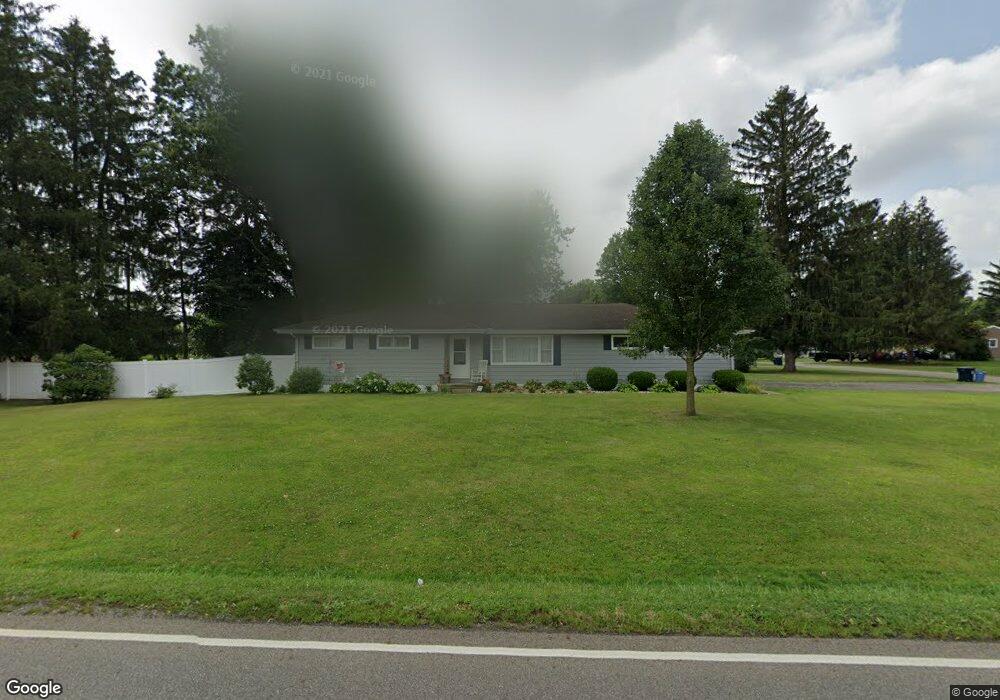
365 Pierson Blvd Newark, OH 43055
Estimated Value: $273,000 - $297,022
3
Beds
2
Baths
1,409
Sq Ft
$202/Sq Ft
Est. Value
About This Home
This home is located at 365 Pierson Blvd, Newark, OH 43055 and is currently estimated at $284,256, approximately $201 per square foot. 365 Pierson Blvd is a home located in Licking County with nearby schools including John Clem Elementary School, Liberty Middle School, and Newark High School.
Ownership History
Date
Name
Owned For
Owner Type
Purchase Details
Closed on
Jun 18, 2004
Sold by
Holdbrook Doris E
Bought by
Athey Roy L and Athey Michele A
Current Estimated Value
Home Financials for this Owner
Home Financials are based on the most recent Mortgage that was taken out on this home.
Original Mortgage
$110,457
Outstanding Balance
$54,610
Interest Rate
6.17%
Mortgage Type
FHA
Estimated Equity
$229,646
Create a Home Valuation Report for This Property
The Home Valuation Report is an in-depth analysis detailing your home's value as well as a comparison with similar homes in the area
Home Values in the Area
Average Home Value in this Area
Purchase History
| Date | Buyer | Sale Price | Title Company |
|---|---|---|---|
| Athey Roy L | $121,500 | -- | |
| Holdbrook Doris E | -- | -- |
Source: Public Records
Mortgage History
| Date | Status | Borrower | Loan Amount |
|---|---|---|---|
| Open | Athey Roy L | $110,457 |
Source: Public Records
Tax History Compared to Growth
Tax History
| Year | Tax Paid | Tax Assessment Tax Assessment Total Assessment is a certain percentage of the fair market value that is determined by local assessors to be the total taxable value of land and additions on the property. | Land | Improvement |
|---|---|---|---|---|
| 2024 | $2,856 | $79,880 | $23,560 | $56,320 |
| 2023 | $2,850 | $79,880 | $23,560 | $56,320 |
| 2022 | $2,236 | $55,760 | $13,440 | $42,320 |
| 2021 | $2,345 | $55,760 | $13,440 | $42,320 |
| 2020 | $2,398 | $55,760 | $13,440 | $42,320 |
| 2019 | $2,054 | $45,990 | $13,440 | $32,550 |
| 2018 | $2,055 | $0 | $0 | $0 |
| 2017 | $1,969 | $0 | $0 | $0 |
| 2016 | $1,903 | $0 | $0 | $0 |
| 2015 | $1,944 | $0 | $0 | $0 |
| 2014 | $2,491 | $0 | $0 | $0 |
| 2013 | $1,900 | $0 | $0 | $0 |
Source: Public Records
Map
Nearby Homes
- 440 Reverie Place
- 370 Meadowbrook Dr
- 1049 Sunrise Dr
- 473 Meadowbrook Dr
- 403 Meadowbrook Dr
- 227 N Quentin Rd
- 988 Mount Vernon Rd
- 259 Goosepond Rd Unit C
- 261 Goosepond Rd Unit D
- 584 Moull St Unit A
- 267 Goosepond Rd Unit A
- 11 Waterworks Rd
- 27 E Channel St
- 74 Cherry St
- 892 Shelbourne Place Unit 892
- 188 Meadow Dr
- 184 Meadow Dr
- 52 Charles St
- 1495 Kenarbre Dr
- 425 N 11th St
- 1142 Cranwood Dr
- 349 Pierson Blvd
- 1060 Cranwood Dr Unit Newark
- 1080 Cranwood Dr
- 1038 Cranwood Dr
- 1060 Cranwood Dr
- 366 Pierson Blvd
- 393 Pierson Blvd
- 1130 Cranwood Dr
- 350 Pierson Blvd
- 1137 Cranwood Dr
- 350 Stare Rd
- 1171 Cranwood Dr
- 1186 Cranwood Dr
- 332 Stare Rd
- 1185 Drexel Ave
- 1125 Cranwood Dr
- 331 Pierson Blvd
- 1152 Pierson Dr
- 1185 Cranwood Dr