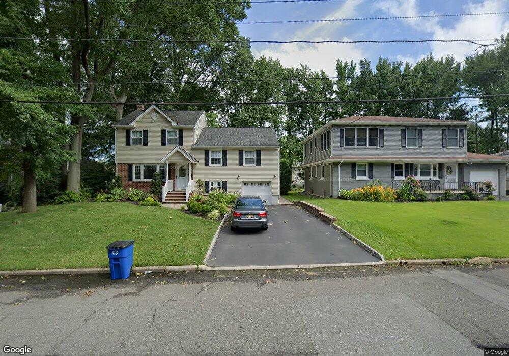
365 Retford Ave Cranford, NJ 07016
Estimated Value: $870,000 - $1,063,000
--
Bed
--
Bath
--
Sq Ft
8,146
Sq Ft Lot
About This Home
This home is located at 365 Retford Ave, Cranford, NJ 07016 and is currently estimated at $949,644. 365 Retford Ave is a home located in Union County with nearby schools including Cranford Sr High School, St Michael School, and Lightbridge Academy of Westfield.
Ownership History
Date
Name
Owned For
Owner Type
Purchase Details
Closed on
Nov 14, 1996
Sold by
Varenick Richard A and Varenick Veronica A
Bought by
Mcgann Ronald G and Mcgann Jennifer D
Current Estimated Value
Home Financials for this Owner
Home Financials are based on the most recent Mortgage that was taken out on this home.
Original Mortgage
$171,950
Outstanding Balance
$15,511
Interest Rate
7.12%
Estimated Equity
$934,133
Create a Home Valuation Report for This Property
The Home Valuation Report is an in-depth analysis detailing your home's value as well as a comparison with similar homes in the area
Home Values in the Area
Average Home Value in this Area
Purchase History
| Date | Buyer | Sale Price | Title Company |
|---|---|---|---|
| Mcgann Ronald G | $181,000 | -- |
Source: Public Records
Mortgage History
| Date | Status | Borrower | Loan Amount |
|---|---|---|---|
| Open | Mcgann Ronald G | $171,950 |
Source: Public Records
Tax History Compared to Growth
Tax History
| Year | Tax Paid | Tax Assessment Tax Assessment Total Assessment is a certain percentage of the fair market value that is determined by local assessors to be the total taxable value of land and additions on the property. | Land | Improvement |
|---|---|---|---|---|
| 2025 | $16,107 | $237,600 | $80,300 | $157,300 |
| 2024 | $15,841 | $237,600 | $80,300 | $157,300 |
| 2023 | $15,841 | $237,600 | $80,300 | $157,300 |
| 2022 | $15,710 | $237,600 | $80,300 | $157,300 |
| 2021 | $15,641 | $237,600 | $80,300 | $157,300 |
| 2020 | $15,591 | $237,600 | $80,300 | $157,300 |
| 2019 | $15,492 | $237,600 | $80,300 | $157,300 |
| 2018 | $15,211 | $237,600 | $80,300 | $157,300 |
| 2017 | $14,688 | $237,600 | $80,300 | $157,300 |
| 2016 | $14,154 | $237,600 | $80,300 | $157,300 |
| 2015 | $13,783 | $237,600 | $80,300 | $157,300 |
| 2014 | $13,500 | $177,600 | $80,300 | $97,300 |
Source: Public Records
Map
Nearby Homes
- 108 James Ave
- 45 Hillcrest Ave
- 113 Retford Ave
- 205 Locust Ave
- 312 Hazel Ave
- 59 Willow Ave
- 2 Pine St
- 10 Alan O Kell Place
- 213 Welch Way
- 501 Center St
- 247 Walnut Ave
- 1920 Boynton Ave
- 118 Cambridge Rd
- 443 Pine Ave
- 106 Virginia St
- 213 North Ave W
- 113 Winslow Place Unit 3
- 211 High St
- 343 South Ave
- 11 Mendell Ave
- 367 Retford Ave
- 361 Retford Ave
- 369 Retford Ave
- 359 Retford Ave
- 328 Stoughton Ave
- 330 Stoughton Ave
- 326 Stoughton Ave
- 332 Stoughton Ave
- 357 Retford Ave
- 371 Retford Ave
- 324 Stoughton Ave
- 334 Stoughton Ave
- 364 Retford Ave
- 360 Retford Ave
- 366 Retford Ave
- 336 Stoughton Ave
- 322 Stoughton Ave
- 358 Retford Ave
- 355 Retford Ave
- 368 Retford Ave