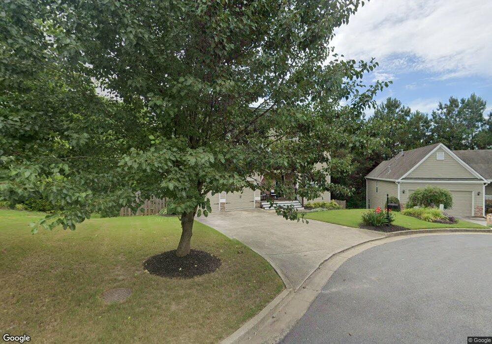
365 Springhill Dr Canton, GA 30115
Estimated Value: $486,994 - $526,000
5
Beds
4
Baths
2,204
Sq Ft
$230/Sq Ft
Est. Value
About This Home
This home is located at 365 Springhill Dr, Canton, GA 30115 and is currently estimated at $506,497, approximately $229 per square foot. 365 Springhill Dr is a home located in Cherokee County with nearby schools including Hasty Elementary School Fine Arts Academy, Teasley Middle School, and Cherokee High School.
Ownership History
Date
Name
Owned For
Owner Type
Purchase Details
Closed on
May 29, 2009
Sold by
Adamson Timothy C and Adamson Rebekah L
Bought by
Foll Curtis L and Foll Greta
Current Estimated Value
Home Financials for this Owner
Home Financials are based on the most recent Mortgage that was taken out on this home.
Original Mortgage
$188,000
Outstanding Balance
$117,950
Interest Rate
4.8%
Mortgage Type
New Conventional
Estimated Equity
$388,547
Purchase Details
Closed on
Dec 23, 2003
Sold by
Custom One Homes Llcd
Bought by
Adamson Rebekah L and Adamson Timothy
Home Financials for this Owner
Home Financials are based on the most recent Mortgage that was taken out on this home.
Original Mortgage
$38,068
Interest Rate
5.82%
Mortgage Type
New Conventional
Create a Home Valuation Report for This Property
The Home Valuation Report is an in-depth analysis detailing your home's value as well as a comparison with similar homes in the area
Home Values in the Area
Average Home Value in this Area
Purchase History
| Date | Buyer | Sale Price | Title Company |
|---|---|---|---|
| Foll Curtis L | $235,000 | -- | |
| Adamson Rebekah L | $190,400 | -- |
Source: Public Records
Mortgage History
| Date | Status | Borrower | Loan Amount |
|---|---|---|---|
| Open | Foll Curtis L | $188,000 | |
| Previous Owner | Adamson Rebekah L | $38,068 | |
| Previous Owner | Adamson Rebekah L | $152,250 |
Source: Public Records
Tax History
| Year | Tax Paid | Tax Assessment Tax Assessment Total Assessment is a certain percentage of the fair market value that is determined by local assessors to be the total taxable value of land and additions on the property. | Land | Improvement |
|---|---|---|---|---|
| 2025 | $4,772 | $187,640 | $34,000 | $153,640 |
| 2024 | $4,614 | $179,360 | $32,000 | $147,360 |
| 2023 | $4,077 | $177,080 | $32,000 | $145,080 |
| 2022 | $3,968 | $151,720 | $30,000 | $121,720 |
| 2021 | $3,568 | $125,840 | $24,000 | $101,840 |
| 2020 | $3,217 | $111,880 | $19,600 | $92,280 |
| 2019 | $3,105 | $107,360 | $19,600 | $87,760 |
| 2018 | $3,020 | $103,480 | $19,600 | $83,880 |
| 2017 | $2,786 | $233,900 | $16,800 | $76,760 |
| 2016 | $2,273 | $230,800 | $16,800 | $75,520 |
| 2015 | $2,746 | $222,400 | $16,000 | $72,960 |
| 2014 | $2,617 | $208,300 | $14,000 | $69,320 |
Source: Public Records
Map
Nearby Homes
- 150 Mountain Vista Blvd
- 161 Mountain Vista Blvd
- 313 Spring Hill Dr
- 302 and 304 Garland Way
- 199 Mountain Vista Blvd
- 1720 Hickory Flat Hwy
- 105 Summerlin Dr
- 312 Hillcrest Ln
- 414 Lewis Rd
- 204 Hillcrest Ridge
- 1187 Lightfoot Dr
- 365 Russell King Ln
- 3789 Cherokee Overlook Dr
- 3714 Cherokee Overlook Dr Unit 2
- 3548 Cherokee Overlook Dr
- 206 Brick Mill Dr
- 145 E Killian St
- 131 E Killian St
- 251 E Killian St
- 241 E Killian St
- 367 Spring Hill Dr Unit 1
- 363 Spring Hill Dr Unit 210
- 369 Spring Hill Dr Unit 1
- 361 Spring Hill Dr Unit 1
- 390 Springhill Dr
- 394 Spring Hill Dr Unit 1
- 392 Spring Hill Dr
- 503 Autumn Ridge Dr
- 359 Spring Hill Dr
- 359 Springhill Dr
- 501 Autumn Ridge Dr
- 388 Spring Hill Dr
- 357 Spring Hill Dr Unit 1
- 505 Autumn Ridge Dr
- 386 Springhill Dr
- 386 Spring Hill Dr
- 355 Spring Hill Dr
- 500 Autumn Ridge Dr
- 507 Autumn Ridge Dr
Your Personal Tour Guide
Ask me questions while you tour the home.