Estimated Value: $439,661
--
Bed
--
Bath
820
Sq Ft
$536/Sq Ft
Est. Value
About This Home
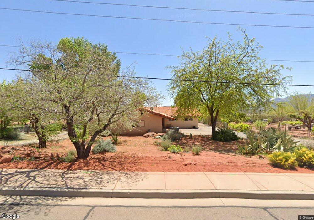
This home is located at 365 W 450 N, Ivins, UT 84738 and is currently priced at $439,661, approximately $536 per square foot. 365 W 450 N is a home located in Washington County with nearby schools including Red Mountain School, Snow Canyon Middle School, and Lava Ridge Intermediate School.
Ownership History
Date
Name
Owned For
Owner Type
Purchase Details
Closed on
Nov 17, 2020
Sold by
Atkin Revocable Trust and Atkin Sara M
Bought by
Mary A Curtis Revocable Living Trust and Curtis
Current Estimated Value
Purchase Details
Closed on
Jul 3, 2006
Sold by
Buckskin Land & Livestock Llc
Bought by
East Star Farm Land Llc
Purchase Details
Closed on
Oct 4, 2005
Sold by
East Star Farm Land Llc
Bought by
Buckskin Land & Livestock Llc
Purchase Details
Closed on
Sep 30, 2005
Sold by
Atkin Family Ltd
Bought by
East Star Farm Land Llc
Create a Home Valuation Report for This Property
The Home Valuation Report is an in-depth analysis detailing your home's value as well as a comparison with similar homes in the area
Home Values in the Area
Average Home Value in this Area
Purchase History
| Date | Buyer | Sale Price | Title Company |
|---|---|---|---|
| Mary A Curtis Revocable Living Trust | -- | None Listed On Document | |
| East Star Farm Land Llc | -- | None Available | |
| Buckskin Land & Livestock Llc | -- | None Available | |
| East Star Farm Land Llc | -- | Southern Utah Title Co |
Source: Public Records
Tax History Compared to Growth
Tax History
| Year | Tax Paid | Tax Assessment Tax Assessment Total Assessment is a certain percentage of the fair market value that is determined by local assessors to be the total taxable value of land and additions on the property. | Land | Improvement |
|---|---|---|---|---|
| 2025 | $25 | -- | -- | -- |
| 2023 | $28 | -- | -- | -- |
| 2022 | $38 | $438,650 | $434,350 | $4,300 |
| 2021 | $33 | $386,950 | $383,250 | $3,700 |
| 2020 | $32 | $386,650 | $383,250 | $3,400 |
| 2019 | $32 | $233,250 | $229,950 | $3,300 |
| 2018 | $28 | $2,625 | $0 | $0 |
| 2017 | $0 | $25 | $0 | $0 |
| 2016 | $9 | $750 | $0 | $0 |
| 2015 | $9 | $750 | $0 | $0 |
| 2014 | $9 | $750 | $0 | $0 |
Source: Public Records
Map
Nearby Homes
- 469 N Bur Sage Trail
- 539 N Bur Sage Trail
- 378 Redstone Ct
- 747 E Crimson Flare Ln
- 704 E Crimson Flare Ln
- 782 E Crimson Flare Ln
- 699 E Crimson Flare Ln
- 683 E Crimson Flare Ln
- 683 E Crimson Flare Ln Unit 6
- 704 E Crimson Flare Ln Unit 2
- 782 E Crimson Flare Ln Unit 30
- TBD N Agave Way
- 184 Apex Ln
- TBD Mallow Way
- 506 W Tenaya Dr
- TBD N Yucca Ct
- 88 N Apex Ln
- 480 W Tonapah Way
- 108 N Arrowhead Ln
- 373 W Meridian Dr