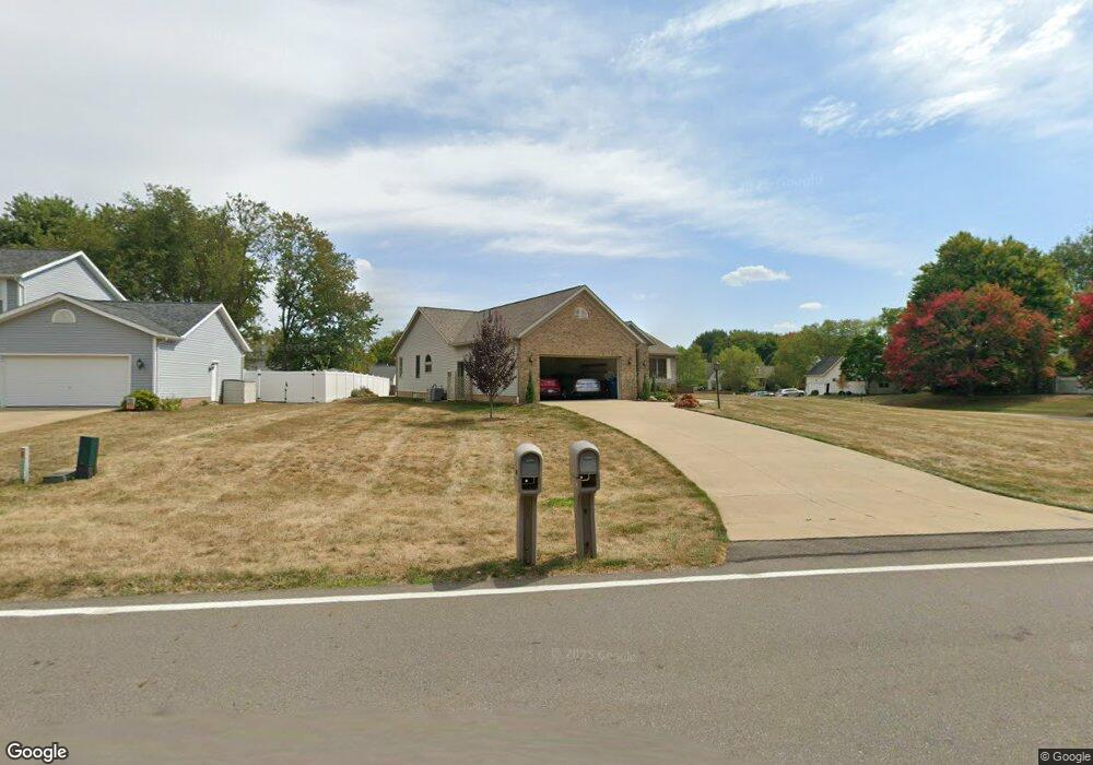
3651 Myersville Rd Uniontown, OH 44685
Estimated Value: $373,797 - $409,000
3
Beds
3
Baths
1,924
Sq Ft
$202/Sq Ft
Est. Value
About This Home
This home is located at 3651 Myersville Rd, Uniontown, OH 44685 and is currently estimated at $388,699, approximately $202 per square foot. 3651 Myersville Rd is a home located in Summit County with nearby schools including Greenwood Elementary School, Green Primary School, and Green Intermediate Elementary School.
Ownership History
Date
Name
Owned For
Owner Type
Purchase Details
Closed on
Oct 28, 2024
Sold by
Dejacimo Michael P and Dejacimo Patricia M
Bought by
Dejacimo Family Revocable Living Trust and Dejacimo
Current Estimated Value
Purchase Details
Closed on
Dec 14, 1999
Sold by
Integrity Homes Inc
Bought by
Dejacimo Michael P and Dejacimo Patricia M
Home Financials for this Owner
Home Financials are based on the most recent Mortgage that was taken out on this home.
Original Mortgage
$85,000
Interest Rate
7.69%
Mortgage Type
Purchase Money Mortgage
Purchase Details
Closed on
Apr 5, 1999
Sold by
Union Commerce Corp
Bought by
Integrity Homes Inc
Home Financials for this Owner
Home Financials are based on the most recent Mortgage that was taken out on this home.
Original Mortgage
$156,000
Interest Rate
7.1%
Create a Home Valuation Report for This Property
The Home Valuation Report is an in-depth analysis detailing your home's value as well as a comparison with similar homes in the area
Home Values in the Area
Average Home Value in this Area
Purchase History
| Date | Buyer | Sale Price | Title Company |
|---|---|---|---|
| Dejacimo Family Revocable Living Trust | -- | None Listed On Document | |
| Dejacimo Michael P | $206,000 | Meridian Title Agency Inc | |
| Integrity Homes Inc | $38,900 | Endress/Lawyers Title |
Source: Public Records
Mortgage History
| Date | Status | Borrower | Loan Amount |
|---|---|---|---|
| Previous Owner | Dejacimo Michael P | $85,000 | |
| Previous Owner | Integrity Homes Inc | $156,000 |
Source: Public Records
Tax History Compared to Growth
Tax History
| Year | Tax Paid | Tax Assessment Tax Assessment Total Assessment is a certain percentage of the fair market value that is determined by local assessors to be the total taxable value of land and additions on the property. | Land | Improvement |
|---|---|---|---|---|
| 2025 | $4,368 | $101,154 | $22,988 | $78,166 |
| 2024 | $4,368 | $101,154 | $22,988 | $78,166 |
| 2023 | $4,368 | $101,154 | $22,988 | $78,166 |
| 2022 | $3,859 | $81,645 | $18,540 | $63,105 |
| 2021 | $3,620 | $81,645 | $18,540 | $63,105 |
| 2020 | $3,551 | $81,650 | $18,540 | $63,110 |
| 2019 | $3,408 | $74,270 | $17,800 | $56,470 |
| 2018 | $3,483 | $74,270 | $17,800 | $56,470 |
| 2017 | $3,201 | $74,270 | $17,800 | $56,470 |
| 2016 | $3,186 | $65,200 | $17,800 | $47,400 |
| 2015 | $3,201 | $65,200 | $17,800 | $47,400 |
| 2014 | $3,181 | $65,200 | $17,800 | $47,400 |
| 2013 | $3,263 | $66,330 | $17,800 | $48,530 |
Source: Public Records
Map
Nearby Homes
- 3217 Deborah Ct
- 3212 Deborah Ct
- Northwood Plan at Spring Hill - Spring Hill Villas
- Kenai Plan at Spring Hill - Spring Hill Villas
- Bradbern Plan at Spring Hill - Spring Hill Villas
- Sarasota Plan at Spring Hill - Spring Hill Villas
- Holston Plan at Spring Hill - Spring Hill Villas
- Chester Plan at Spring Hill - Spring Hill Villas
- 2500 Marlborough Dr
- 3979 Northdale St NW
- 2418 Island Dr
- 3534 Chanticleer Ct
- 3514 Chanticleer Ct
- 2511 Royal County Down
- 2535 Royal County Down Unit B
- 2518 Glenshire Cir Unit 36A
- 3541 Elmhurst Cir
- 2538 Royal County Down
- 2944 Sunset Dr
- 3598 Elmhurst Cir
- 3639 Myersville Rd
- 3126 Bear Hollow Rd
- 3118 Bear Hollow Rd
- 3648 Myersville Rd
- 3627 Myersville Rd
- 3134 Bear Hollow Rd
- 3658 Myersville Rd
- 3636 Myersville Rd
- 3110 Bear Hollow Rd
- 3675 Myersville Rd
- 3666 Myersville Rd
- 61 Turtle Bay
- 3129 Turtle Bay Cir
- 3615 Myersville Rd
- 3142 Bear Hollow Rd
- 3102 Bear Hollow Rd
- 3127 Bear Hollow Rd
- 3678 Myersville Rd
- 3119 Bear Hollow Rd
- 3193 Deborah Ct