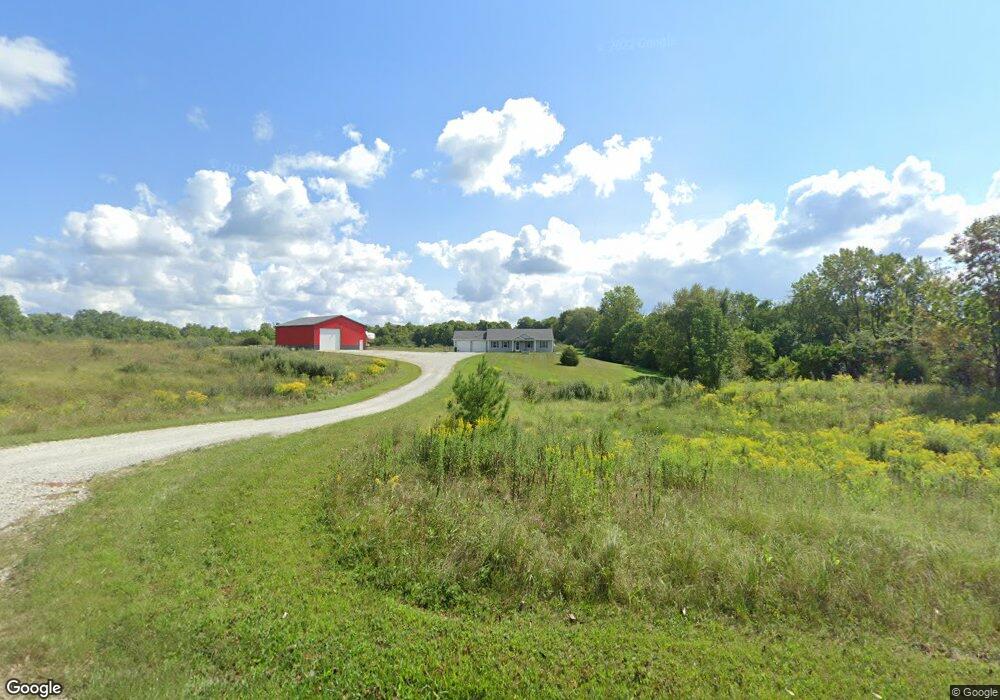
3651 N 900 W Andrews, IN 46702
Estimated Value: $193,000 - $594,466
4
Beds
2
Baths
2,000
Sq Ft
$185/Sq Ft
Est. Value
About This Home
This home is located at 3651 N 900 W, Andrews, IN 46702 and is currently estimated at $369,617, approximately $184 per square foot. 3651 N 900 W is a home with nearby schools including Andrews Elementary School, Riverview Middle School, and Huntington North High School.
Ownership History
Date
Name
Owned For
Owner Type
Purchase Details
Closed on
Dec 8, 2015
Sold by
Miller Carla J
Bought by
Dennis Joshua L and Dennis Monique R
Current Estimated Value
Purchase Details
Closed on
Jul 21, 2015
Sold by
Hess Austin T and Hess Elisha R
Bought by
Miller Caria J
Purchase Details
Closed on
Nov 20, 2013
Sold by
Hess Austin T and Hess Elisha R
Bought by
Williams Greg and Williams Carrie
Purchase Details
Closed on
Jul 30, 2010
Sold by
Donald D Henline Trustee
Bought by
Hess Elisha R and Hess Austin T
Create a Home Valuation Report for This Property
The Home Valuation Report is an in-depth analysis detailing your home's value as well as a comparison with similar homes in the area
Home Values in the Area
Average Home Value in this Area
Purchase History
| Date | Buyer | Sale Price | Title Company |
|---|---|---|---|
| Dennis Joshua L | -- | Attorney | |
| Miller Caria J | -- | Fidelity National Title Comp | |
| Williams Greg | $37,500 | -- | |
| Hess Elisha R | $75,000 | -- |
Source: Public Records
Tax History Compared to Growth
Tax History
| Year | Tax Paid | Tax Assessment Tax Assessment Total Assessment is a certain percentage of the fair market value that is determined by local assessors to be the total taxable value of land and additions on the property. | Land | Improvement |
|---|---|---|---|---|
| 2024 | $3,614 | $371,100 | $68,700 | $302,400 |
| 2023 | $3,428 | $340,800 | $68,700 | $272,100 |
| 2022 | $3,610 | $351,100 | $68,700 | $282,400 |
| 2021 | $3,662 | $326,200 | $68,700 | $257,500 |
| 2020 | $3,553 | $305,000 | $68,700 | $236,300 |
| 2019 | $3,036 | $285,000 | $68,700 | $216,300 |
| 2018 | $3,073 | $278,900 | $59,100 | $219,800 |
| 2017 | $2,699 | $273,500 | $59,100 | $214,400 |
| 2016 | $932 | $62,300 | $62,300 | $0 |
| 2014 | $286 | $17,600 | $17,600 | $0 |
| 2013 | $286 | $29,600 | $29,600 | $0 |
Source: Public Records
Map
Nearby Homes
- 874 N Jackson St
- 2848 N 800 E
- 330 W Mckeever St
- 187 S Snowden St
- 63 E Mckeever St
- TBD W Maple Grove Rd
- 5725 W 600 N
- 5562 W 100 N
- TBD 495 N
- 1920 Hunters Ridge Dr
- 58 Quayle Run
- 6709 N Goshen Rd
- 1513 Avon Place
- 3881 W 558 N
- 2217 Miami Trail
- 2207 Miami Trail
- 2200 Miami Trail
- 2210 Miami Trail
- 37 Northway Dr
- 1239 Lucas Ct
- 3695 N 900 W
- 3583 N 900 W
- 3501 N 900 W
- 8751 W Maple Grove Rd
- 8631 W Maple Grove Rd
- 3366 N 900 W
- 8830 W Maple Grove Rd
- 8622 W Maple Grove Rd
- 3285 N 900 W
- 8738 W Maple Grove Rd
- 9227 W Maple Grove Rd
- 8512 W Maple Grove Rd
- 9100 W Maple Grove Rd
- 8882 W Maple Grove Rd
- 8410 W Maple Grove Rd
- 3151 N 900 W
- 8365 W Maple Grove Rd
- 3470 N 825 W
- 3386 N 825 W
- 3420 N 825 W