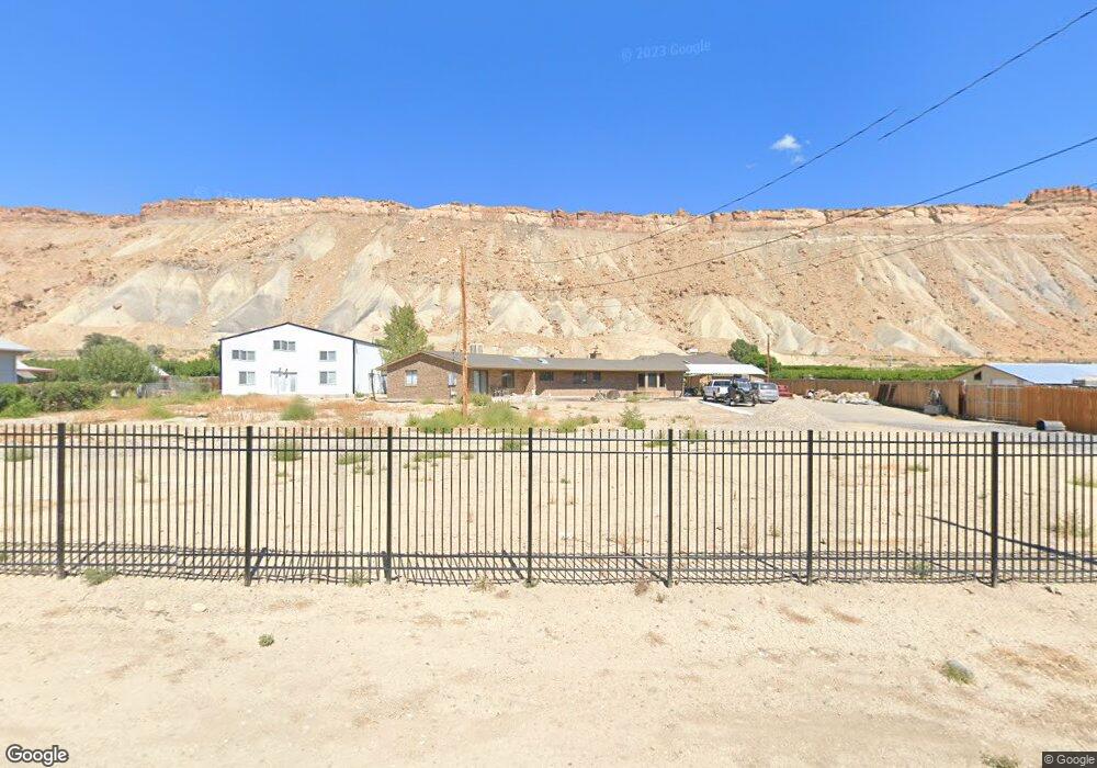
3652 G 7/10 Rd Palisade, CO 81526
Palisade Area NeighborhoodEstimated Value: $717,980 - $882,000
3
Beds
3
Baths
2,778
Sq Ft
$287/Sq Ft
Est. Value
About This Home
This home is located at 3652 G 7/10 Rd, Palisade, CO 81526 and is currently estimated at $796,745, approximately $286 per square foot. 3652 G 7/10 Rd is a home located in Mesa County with nearby schools including Taylor Elementary School, Mount Garfield Middle School, and Palisade High School.
Ownership History
Date
Name
Owned For
Owner Type
Purchase Details
Closed on
Dec 14, 2020
Sold by
Flanagan Nicholas K and Flanagan Brenda G
Bought by
Leebrick Michael and Leebrick Alicia
Current Estimated Value
Home Financials for this Owner
Home Financials are based on the most recent Mortgage that was taken out on this home.
Original Mortgage
$484,500
Outstanding Balance
$432,119
Interest Rate
2.8%
Mortgage Type
New Conventional
Estimated Equity
$364,626
Purchase Details
Closed on
Mar 20, 2019
Sold by
Wallce Flanagan Brenda G and Wallace Brenda G
Bought by
Flanagan Brenda G and Flanagan Nicholas K
Purchase Details
Closed on
Dec 4, 2012
Sold by
Covey Nolie S and Covey Eileen E
Bought by
Wallace Brenda G
Purchase Details
Closed on
Jun 2, 2004
Sold by
Covey Nolie S and Covey Eileen E
Bought by
Covey Nolie S and Covey Eileen E
Create a Home Valuation Report for This Property
The Home Valuation Report is an in-depth analysis detailing your home's value as well as a comparison with similar homes in the area
Home Values in the Area
Average Home Value in this Area
Purchase History
| Date | Buyer | Sale Price | Title Company |
|---|---|---|---|
| Leebrick Michael | $510,000 | None Available | |
| Flanagan Brenda G | -- | None Available | |
| Wallace Brenda G | $90,000 | None Available | |
| Covey Nolie S | -- | -- |
Source: Public Records
Mortgage History
| Date | Status | Borrower | Loan Amount |
|---|---|---|---|
| Open | Leebrick Michael | $484,500 |
Source: Public Records
Tax History Compared to Growth
Tax History
| Year | Tax Paid | Tax Assessment Tax Assessment Total Assessment is a certain percentage of the fair market value that is determined by local assessors to be the total taxable value of land and additions on the property. | Land | Improvement |
|---|---|---|---|---|
| 2024 | $2,250 | $31,910 | $450 | $31,460 |
| 2023 | $2,250 | $31,910 | $450 | $31,460 |
| 2022 | $2,816 | $39,320 | $350 | $38,970 |
| 2021 | $1,795 | $25,480 | $390 | $25,090 |
| 2020 | $1,289 | $18,670 | $310 | $18,360 |
| 2019 | $1,219 | $18,670 | $310 | $18,360 |
| 2018 | $1,168 | $16,250 | $410 | $15,840 |
| 2017 | $1,037 | $16,250 | $410 | $15,840 |
| 2016 | $1,037 | $16,370 | $330 | $16,040 |
| 2015 | $1,050 | $16,370 | $330 | $16,040 |
| 2014 | $1,184 | $18,660 | $240 | $18,420 |
Source: Public Records
Map
Nearby Homes
- 3652 1/2 G 7 10 Rd
- 759 36 3 10 Rd
- 707 36 3 10 Rd
- 3669 G Rd
- 577 Cicero Dr
- 549 Cicero Dr
- 602 Elberta Ave
- 548 Crawford Ln
- 822 Cabernet Ct
- 490 Wine Valley Rd
- 532 Crawford Ln
- 537 Crawford Ln
- 512 Crawford Ln
- 733 35 6 10 Rd
- 745 Fairhaven Rd
- 416 W 5th St
- 846 Cabernet Dr
- 379 W 5th St
- 828 Logan Ct
- 819 Elberta Ave
- 3652 1/2 G 7/10 Rd
- 3652 G 7 10 Rd
- 3654 G 7/10 Rd
- 3658 G 7/10 Rd
- 3648 G 7/10 Rd
- 3660 G 7/10 Rd
- 766 Garfield Dr
- 3644 G 7/10 Rd
- 3662 G 7/10 Rd
- 3662 G 7 10 Rd
- 765 Garfield Dr
- 764 Garfield Dr
- 3657 G 7/10 Rd
- 3661 G 7/10 Rd
- 3664 G 7/10 Rd
- 763 Garfield Dr
- 762 Garfield Dr
- 760 Garfield Dr
- 761 Garfield Dr
- 768 36 3/10 Rd