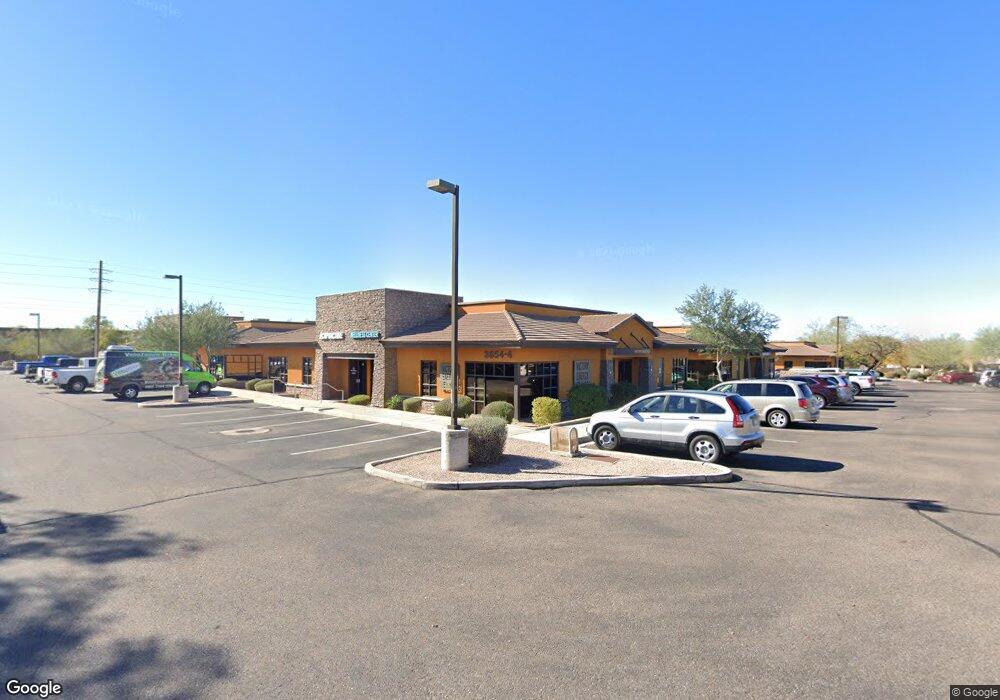
3654 N Power Rd Unit 127 Mesa, AZ 85215
Red Mountain Ranch NeighborhoodEstimated Value: $383,824
--
Bed
--
Bath
963
Sq Ft
$399/Sq Ft
Est. Value
About This Home
This home is located at 3654 N Power Rd Unit 127, Mesa, AZ 85215 and is currently estimated at $383,824, approximately $398 per square foot. 3654 N Power Rd Unit 127 is a home located in Maricopa County with nearby schools including Red Mountain Ranch Elementary School, Franklin at Brimhall Elementary School, and Franklin West Elementary School.
Ownership History
Date
Name
Owned For
Owner Type
Purchase Details
Closed on
Mar 24, 2023
Sold by
3654 N Power Ii Llc
Bought by
Maggie C Revocable Trust
Current Estimated Value
Purchase Details
Closed on
Sep 9, 2019
Sold by
Obsidian Health Llc
Bought by
3654 N Power I Llc and 3654 N Power Ii Llc
Home Financials for this Owner
Home Financials are based on the most recent Mortgage that was taken out on this home.
Original Mortgage
$155,250
Interest Rate
3.7%
Mortgage Type
Commercial
Purchase Details
Closed on
Jul 17, 2012
Sold by
Prp Sdl Limited Partnership
Bought by
Obsidian Health Llc
Purchase Details
Closed on
Aug 10, 2010
Sold by
Stearns Bank Na
Bought by
Power Road Partners Llc
Create a Home Valuation Report for This Property
The Home Valuation Report is an in-depth analysis detailing your home's value as well as a comparison with similar homes in the area
Home Values in the Area
Average Home Value in this Area
Purchase History
| Date | Buyer | Sale Price | Title Company |
|---|---|---|---|
| Maggie C Revocable Trust | $350,000 | First American Title Insurance | |
| 3654 N Power I Llc | $207,000 | Landmark Ttl Assurance Agcy | |
| Obsidian Health Llc | $75,500 | Fidelity National Title Phoe | |
| Power Road Partners Llc | $1,000,000 | None Available |
Source: Public Records
Mortgage History
| Date | Status | Borrower | Loan Amount |
|---|---|---|---|
| Previous Owner | 3654 N Power I Llc | $155,250 |
Source: Public Records
Tax History Compared to Growth
Tax History
| Year | Tax Paid | Tax Assessment Tax Assessment Total Assessment is a certain percentage of the fair market value that is determined by local assessors to be the total taxable value of land and additions on the property. | Land | Improvement |
|---|---|---|---|---|
| 2025 | $1,587 | $15,676 | -- | -- |
| 2024 | $1,648 | $15,396 | -- | -- |
| 2023 | $1,648 | $26,231 | $5,236 | $20,995 |
| 2022 | $1,662 | $19,828 | $3,955 | $15,873 |
| 2021 | $1,730 | $16,254 | $3,240 | $13,014 |
| 2020 | $1,707 | $16,974 | $3,384 | $13,590 |
| 2019 | $1,595 | $17,406 | $3,474 | $13,932 |
| 2018 | $1,531 | $15,930 | $3,186 | $12,744 |
| 2017 | $1,485 | $13,986 | $2,790 | $11,196 |
| 2016 | $1,458 | $13,374 | $2,664 | $10,710 |
| 2015 | $1,433 | $11,322 | $2,257 | $9,065 |
Source: Public Records
Map
Nearby Homes
- 6547 E Sierra Morena St
- 6742 E Regina St Unit 19
- 6531 E Star Valley St
- 3451 N Silverado Unit 23
- 6516 E Rochelle St
- 6620 E Sugarloaf St
- 3523 E Rollins St
- 3521 E Rollins St
- 6459 E Raftriver St
- 6534 E Riverdale St
- 3832 N Gallatin
- 3343 N Sericin
- 6459 E Sugarloaf St
- 3837 N Sonoran Hills
- 3304 N St Elias
- 6510 E Russell St
- 6521 E Russell St
- 6645 E Redmont Dr Unit 13
- 3930 N Pinnacle Hills Cir
- 6460 E Trailridge Cir Unit 8
- 3654 N Power Rd Unit 170
- 3654 N Power Rd Unit 168
- 3654 N Power Rd Unit 104
- 3654 N Power Rd Unit 101
- 3654 N Power Rd Unit 126
- 3654 N Power Rd Unit 152
- 3654 N Power Rd Unit 107
- 3654 N Power Rd Unit 131
- 3654 N Power Rd Unit 116
- 3654 N Power Rd Unit 117
- 3654 N Power Rd Unit 132
- 3654 N Power Rd Unit 129
- 3654 N Power Rd Unit 133
- 3654 N Power Rd Unit 150
- 3654 N Power Rd Unit 113
- 3654 N Power Rd Unit 142
- 3654 N Power Rd Unit 103
- 3654 N Power Rd
- 3654 N Power Rd Unit 146
- 3654 E Thomas Rd Unit 104