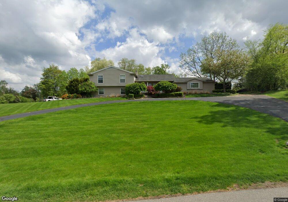
3655 Burning Tree Dr Unit Bldg-Unit Bloomfield Hills, MI 48302
Estimated Value: $810,004 - $937,000
4
Beds
4
Baths
3,557
Sq Ft
$249/Sq Ft
Est. Value
About This Home
This home is located at 3655 Burning Tree Dr Unit Bldg-Unit, Bloomfield Hills, MI 48302 and is currently estimated at $886,501, approximately $249 per square foot. 3655 Burning Tree Dr Unit Bldg-Unit is a home located in Oakland County with nearby schools including Way Elementary School, South Hills Middle School, and Bloomfield Hills High School.
Ownership History
Date
Name
Owned For
Owner Type
Purchase Details
Closed on
May 12, 2004
Sold by
Strandlie Svein T and Strandlie Anne Marie
Bought by
Sussman Michael S and Sussman Joan
Current Estimated Value
Home Financials for this Owner
Home Financials are based on the most recent Mortgage that was taken out on this home.
Original Mortgage
$332,000
Outstanding Balance
$143,207
Interest Rate
4.37%
Mortgage Type
Purchase Money Mortgage
Estimated Equity
$743,294
Purchase Details
Closed on
Aug 3, 2001
Sold by
Dolan T M
Bought by
Strandlie Svein T
Home Financials for this Owner
Home Financials are based on the most recent Mortgage that was taken out on this home.
Original Mortgage
$510,000
Interest Rate
7.03%
Create a Home Valuation Report for This Property
The Home Valuation Report is an in-depth analysis detailing your home's value as well as a comparison with similar homes in the area
Home Values in the Area
Average Home Value in this Area
Purchase History
| Date | Buyer | Sale Price | Title Company |
|---|---|---|---|
| Sussman Michael S | -- | Metropolitan Title Company | |
| Strandlie Svein T | $510,000 | -- |
Source: Public Records
Mortgage History
| Date | Status | Borrower | Loan Amount |
|---|---|---|---|
| Open | Sussman Michael S | $332,000 | |
| Previous Owner | Strandlie Svein T | $510,000 |
Source: Public Records
Tax History Compared to Growth
Tax History
| Year | Tax Paid | Tax Assessment Tax Assessment Total Assessment is a certain percentage of the fair market value that is determined by local assessors to be the total taxable value of land and additions on the property. | Land | Improvement |
|---|---|---|---|---|
| 2024 | $4,453 | $365,430 | $0 | $0 |
| 2023 | $4,309 | $340,950 | $0 | $0 |
| 2022 | $9,335 | $310,140 | $0 | $0 |
| 2021 | $9,344 | $318,170 | $0 | $0 |
| 2020 | $3,941 | $313,240 | $0 | $0 |
| 2019 | $7,574 | $290,850 | $0 | $0 |
| 2018 | $7,622 | $277,470 | $0 | $0 |
| 2017 | $7,546 | $273,660 | $0 | $0 |
| 2016 | $7,560 | $242,610 | $0 | $0 |
| 2015 | -- | $221,070 | $0 | $0 |
| 2014 | -- | $210,720 | $0 | $0 |
| 2011 | -- | $177,050 | $0 | $0 |
Source: Public Records
Map
Nearby Homes
- 3715 Lahser Rd
- 3797 Burning Tree Dr
- 3531 Brookside Dr
- 3515 Brookside Dr
- 3403 Chickering Ln
- 830 N Pemberton Rd
- 284 Woodwind Dr
- 3627 Shallow Brook Dr
- 3435 Devon Brook Dr
- 801 W Long Lake Rd
- 559 Barrington Park
- 3060 Chickering Ln
- 921 Pine Thistle Ln
- 965 Bloomfield Woods Unit 4
- 240 Applewood Ln
- 969 Bloomfield Woods
- 931 Vaughan Rd
- 112 E Hickory Grove Rd Unit 26
- 164 Timber Trace Ln
- 4255 Telegraph Rd
- 3655 Burning Tree Dr
- 3665 Burning Tree Dr
- 3645 Holly Ln
- 3652 Burning Tree Dr
- 3660 Burning Tree Dr
- 3644 Burning Tree Dr
- 570 Provencal Place
- 564 Provencal Place
- 3641 Burning Tree Dr
- 3711 Thornbrier Way
- 3635 Holly Ln
- 3670 Burning Tree Dr
- 3640 Holly Ln
- 571 Woodway Ct
- 3636 Burning Tree Dr
- 575 Woodway Ct
- 3721 Thornbrier Way
- 552 Provencal Place
- 561 Woodway Ct
- 3680 Burning Tree Dr