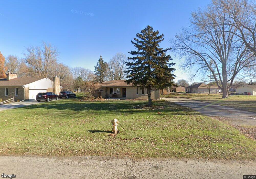
36556 Capper Dr Clinton Township, MI 48035
Estimated Value: $278,803 - $316,000
--
Bed
1
Bath
1,537
Sq Ft
$198/Sq Ft
Est. Value
About This Home
This home is located at 36556 Capper Dr, Clinton Township, MI 48035 and is currently estimated at $304,701, approximately $198 per square foot. 36556 Capper Dr is a home located in Macomb County with nearby schools including Walt Disney Elementary School, Richards Middle School, and Fraser High School.
Ownership History
Date
Name
Owned For
Owner Type
Purchase Details
Closed on
Feb 8, 2019
Sold by
Kernya Dennis and Kernya Sandra
Bought by
Clark Three Llc
Current Estimated Value
Purchase Details
Closed on
Jun 10, 2016
Sold by
Kernya Dennis and Kernya Sandra
Bought by
Bommarito Mark
Purchase Details
Closed on
Feb 11, 2011
Sold by
Kemya Dennis and Kernya Sandra F
Bought by
Wells Fargo Bank Na
Purchase Details
Closed on
Mar 4, 2007
Sold by
Kernya Michael
Bought by
Kernya Dennis
Purchase Details
Closed on
Feb 27, 2007
Sold by
Kernya Steve and The Estate Of Joseph Kernya
Bought by
Kernya Steve and Kernya Stephen
Create a Home Valuation Report for This Property
The Home Valuation Report is an in-depth analysis detailing your home's value as well as a comparison with similar homes in the area
Home Values in the Area
Average Home Value in this Area
Purchase History
| Date | Buyer | Sale Price | Title Company |
|---|---|---|---|
| Clark Three Llc | $134,791 | None Available | |
| Bommarito Mark | $90,363 | Attorney | |
| Wells Fargo Bank Na | $51,675 | None Available | |
| Kernya Dennis | -- | Andover Title & Escrow Agenc | |
| Kernya Dennis | -- | Andover Title & Escrow Agenc | |
| Kernya Dennis | -- | Andover Title & Escrow Agenc | |
| Kernya Dennis | -- | Andover Title & Escrow Agenc | |
| Kernya Dennis | -- | Andover Title & Escrow Agenc | |
| Kernya Steve | $190,000 | Andover Title & Escrow Agenc |
Source: Public Records
Tax History Compared to Growth
Tax History
| Year | Tax Paid | Tax Assessment Tax Assessment Total Assessment is a certain percentage of the fair market value that is determined by local assessors to be the total taxable value of land and additions on the property. | Land | Improvement |
|---|---|---|---|---|
| 2025 | $5,533 | $158,200 | $0 | $0 |
| 2024 | $3,206 | $155,400 | $0 | $0 |
| 2023 | $3,040 | $144,100 | $0 | $0 |
| 2022 | $5,013 | $132,600 | $0 | $0 |
| 2021 | $4,877 | $120,000 | $0 | $0 |
| 2020 | $3,102 | $109,000 | $0 | $0 |
| 2019 | $3,509 | $102,300 | $0 | $0 |
| 2018 | $4,537 | $94,200 | $0 | $0 |
| 2017 | $4,679 | $79,700 | $14,400 | $65,300 |
| 2016 | $4,451 | $79,700 | $0 | $0 |
| 2015 | -- | $70,900 | $0 | $0 |
| 2014 | -- | $64,500 | $0 | $0 |
| 2011 | -- | $69,200 | $17,300 | $51,900 |
Source: Public Records
Map
Nearby Homes
- 36069 Eaton Dr
- 18976 Dixie Dr
- 19128 Cheyenne St
- 18711 N Nunneley Rd
- 20002 S Great Oaks Cir
- 19975 S Great Oaks Cir
- 37218 Charter Oaks Blvd
- 37011 Brynford Dr Unit 21
- 18908 Monica Dr
- 18917 Monica Dr
- 35685 Griswald St
- 37236 Great Oaks Ct
- 37053 Brynford Dr
- 36120 Harcourt
- 36027 Vaughn St
- 35375 Groesbeck Hwy
- 37829 Pocahontas Dr
- 37377 Charter Oaks Blvd Unit 492
- 35501 Griswald St
- 37439 Charter Oaks Blvd Unit 114
- 36576 Capper Dr
- 36596 Capper Dr
- 19381 Dixie Dr
- 19349 Dixie Dr
- 36537 Eaton Dr
- 36557 Capper Dr
- 36616 Capper Dr
- 36539 Capper Dr
- 36575 Capper Dr
- 36515 Capper Dr
- 19409 Dixie Dr
- 36593 Capper Dr
- 19356 Dixie Dr
- 19055 Dixie Dr
- 36611 Capper Dr
- 19382 Dixie Dr
- 19336 Dixie Dr
- 36568 Boyce Dr
- 19316 Dixie Dr
- 36636 Capper Dr
