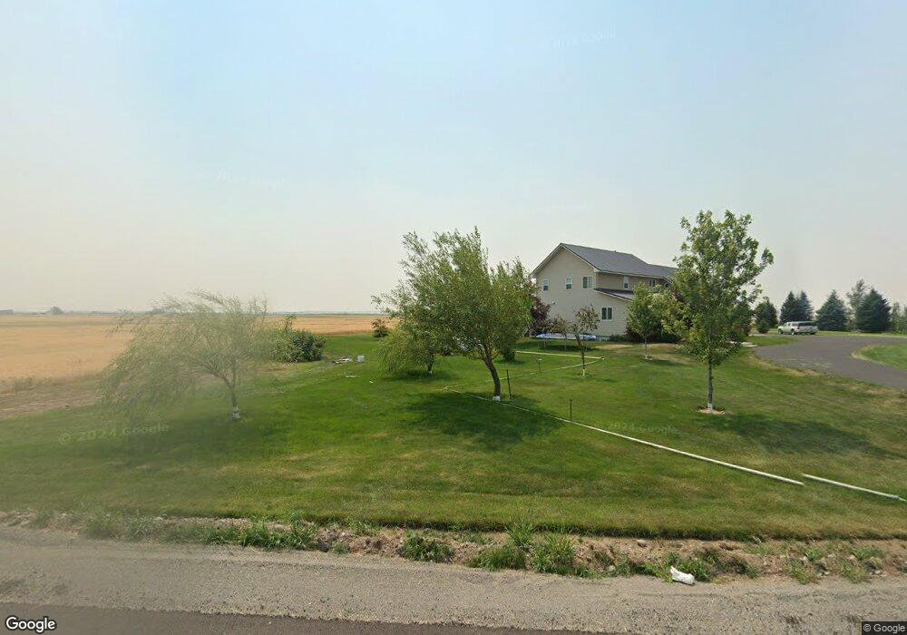
3658 E 1200 N Ashton, ID 83420
Estimated Value: $776,000 - $920,000
5
Beds
4
Baths
4,316
Sq Ft
$197/Sq Ft
Est. Value
About This Home
This home is located at 3658 E 1200 N, Ashton, ID 83420 and is currently estimated at $848,328, approximately $196 per square foot. 3658 E 1200 N is a home with nearby schools including Ashton Elementary School and North Fremont Junior/Senior High School.
Ownership History
Date
Name
Owned For
Owner Type
Purchase Details
Closed on
May 22, 2019
Sold by
Reynolds Steven J
Bought by
Reynolds Steven J and Reynolds Alecia
Current Estimated Value
Home Financials for this Owner
Home Financials are based on the most recent Mortgage that was taken out on this home.
Original Mortgage
$50,000
Interest Rate
4.1%
Mortgage Type
Credit Line Revolving
Create a Home Valuation Report for This Property
The Home Valuation Report is an in-depth analysis detailing your home's value as well as a comparison with similar homes in the area
Purchase History
| Date | Buyer | Sale Price | Title Company |
|---|---|---|---|
| Reynolds Steven J | -- | None Available |
Source: Public Records
Mortgage History
| Date | Status | Borrower | Loan Amount |
|---|---|---|---|
| Closed | Reynolds Steven J | $50,000 |
Source: Public Records
Tax History
| Year | Tax Paid | Tax Assessment Tax Assessment Total Assessment is a certain percentage of the fair market value that is determined by local assessors to be the total taxable value of land and additions on the property. | Land | Improvement |
|---|---|---|---|---|
| 2025 | $1,819 | $508,459 | $44,003 | $464,456 |
| 2024 | $1,861 | $494,364 | $43,943 | $450,421 |
| 2023 | $1,744 | $494,224 | $43,803 | $450,421 |
| 2022 | $2,337 | $371,946 | $33,803 | $338,143 |
| 2021 | $1,595 | $183,679 | $25,179 | $158,500 |
| 2020 | $1,751 | $190,382 | $20,917 | $169,465 |
| 2019 | $1,728 | $190,382 | $20,917 | $169,465 |
| 2018 | $1,723 | $179,095 | $20,857 | $158,238 |
| 2017 | $18 | $169,890 | $20,073 | $149,817 |
| 2016 | $1,811 | $175,145 | $20,073 | $155,072 |
| 2015 | $1,879 | $276,183 | $0 | $0 |
| 2014 | -- | $192,263 | $0 | $0 |
| 2013 | -- | $195,183 | $0 | $0 |
Source: Public Records
Map
Nearby Homes
- 3660 E 1100 N
- LOTS 1-3 E 1300 Rd N
- 1331 N 3687 E
- L4A B2 N 3706 E
- 641 Fremont St
- L5A B2 N 3706 E
- 118 N 8th St Unit 2
- 885 Maple St
- 863 Maple St
- L6A B2 N 3706 E
- 511 Id-47
- Lot 22 Sunflower Ln
- 417 Main St
- L2 BLK 1 E 1300 Rd N
- 540 N 4th St Unit 6
- 161 Walnut St
- 137 Spruce St
- 3887 Schaefer Ln
- 3938 Schaefer Ln
- 1105 N 3400 E
- 3565 E 1200 N
- 3667 E 1200 N
- HIGHWAY 32
- 1&2 Highway 32
- Lot 2 Highway 32
- Lot 1 Highway 32
- 943 N Hwy 32
- 99999 Highway 32
- 551 N-1 Highway 32
- 4.92 AC Highway 32 Unit L3
- 21.4 AC Highway 32 Unit 3Ls
- 11.7 AC Highway 32 Unit 1L
- 4.76 AC Highway 32 Unit 2L
- 3610 E 1200 N
- 1196 N 3700 E
- 2-C Hwy 32
- 3LTS Hwy 32
- 1253 N 3700 E
- 1251 N 3700 E
- 1239 Highway 32
Your Personal Tour Guide
Ask me questions while you tour the home.