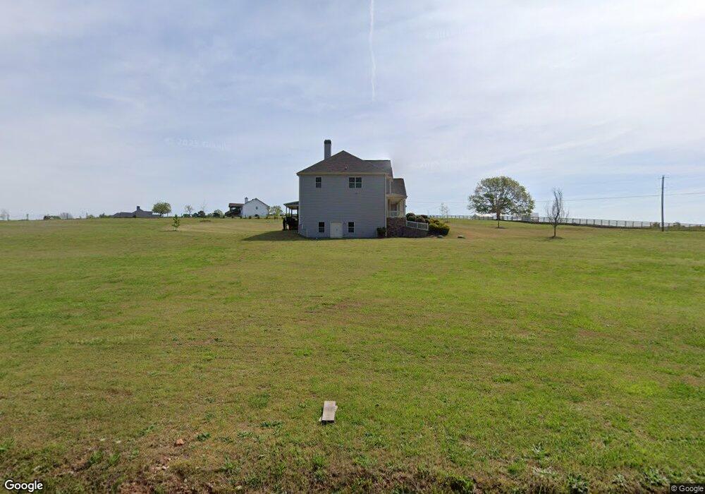
3659 Lower Tanners Bridge Rd Monroe, GA 30656
Estimated Value: $763,000 - $902,000
--
Bed
1
Bath
3,770
Sq Ft
$218/Sq Ft
Est. Value
About This Home
This home is located at 3659 Lower Tanners Bridge Rd, Monroe, GA 30656 and is currently estimated at $822,095, approximately $218 per square foot. 3659 Lower Tanners Bridge Rd is a home located in Walton County with nearby schools including Walker Park Elementary School, Carver Middle School, and Monroe Area High School.
Ownership History
Date
Name
Owned For
Owner Type
Purchase Details
Closed on
Mar 1, 2022
Sold by
Barfield Matthew
Bought by
Williams Ryan
Current Estimated Value
Home Financials for this Owner
Home Financials are based on the most recent Mortgage that was taken out on this home.
Original Mortgage
$576,300
Outstanding Balance
$537,036
Interest Rate
3.69%
Mortgage Type
Cash
Estimated Equity
$285,059
Purchase Details
Closed on
Nov 18, 2011
Sold by
Springleaf Financial Svcs
Bought by
Barfield Matthew and Barfield Caitlin
Purchase Details
Closed on
Apr 29, 1988
Bought by
Driggers Johnny W
Create a Home Valuation Report for This Property
The Home Valuation Report is an in-depth analysis detailing your home's value as well as a comparison with similar homes in the area
Home Values in the Area
Average Home Value in this Area
Purchase History
| Date | Buyer | Sale Price | Title Company |
|---|---|---|---|
| Williams Ryan | $678,000 | -- | |
| Barfield Matthew | $38,000 | -- | |
| Driggers Johnny W | $12,500 | -- |
Source: Public Records
Mortgage History
| Date | Status | Borrower | Loan Amount |
|---|---|---|---|
| Open | Williams Ryan | $576,300 |
Source: Public Records
Tax History Compared to Growth
Tax History
| Year | Tax Paid | Tax Assessment Tax Assessment Total Assessment is a certain percentage of the fair market value that is determined by local assessors to be the total taxable value of land and additions on the property. | Land | Improvement |
|---|---|---|---|---|
| 2024 | $8,263 | $286,480 | $43,000 | $243,480 |
| 2023 | $8,226 | $278,480 | $43,000 | $235,480 |
| 2022 | $5,820 | $236,040 | $24,000 | $212,040 |
| 2021 | $4,728 | $172,800 | $19,200 | $153,600 |
| 2020 | $4,734 | $167,320 | $19,200 | $148,120 |
| 2019 | $4,537 | $146,720 | $19,200 | $127,520 |
| 2018 | $4,287 | $146,720 | $19,200 | $127,520 |
| 2017 | $4,657 | $135,160 | $19,200 | $115,960 |
| 2016 | $3,590 | $110,920 | $15,360 | $95,560 |
| 2015 | $3,541 | $106,120 | $15,360 | $90,760 |
| 2014 | $3,651 | $103,200 | $0 | $0 |
Source: Public Records
Map
Nearby Homes
- 3589 Fannie Thompson Rd NW
- 3625 Fannie Thompson Rd NW
- 3601 Fannie Thompson Rd NW
- 3680 Apalachee Ridge
- 1101 Longleaf Trace
- 1074 Pine View Trail
- 3800 George Williams Rd
- 480 Raider Way
- 1252 White Columns Dr
- 410 Providence Club Dr
- 380 Fairway Cir
- 0 Tanners Bridge Cir Unit 10536031
- 3084 George Williams Rd
- 3051 Glenview Ln
- 436 James Powers Rd
- 3153 Lowell Rd
- 468 Grand Oaks Ave
- (GA)The Cooper | Side Entry Plan at Stonegate
- 760 Carl Davis Rd
- 460 Carl Davis Rd NW
- 1 Carl Davis Rd NW
- 01 Carl Davis Rd NW
- 3674 Lower Tanners Bridge Rd
- 740 Carl Davis Rd
- 0 Carl Davis Rd NW Unit 1019514
- 0 Carl Davis Rd NW Unit 7560691
- 0 Carl Davis Rd NW Unit 8265560
- 0 Carl Davis Rd NW Unit 6112680
- 0 Carl Davis Rd NW Unit Tract 3 8500306
- 0 Carl Davis Rd NW Unit Tract 2 8500304
- 0 Carl Davis Rd NW Unit Track 1 8500302
- 790 Carl Davis Rd
- 820 Carl Davis Rd NW
- 3694 Lower Tanners Bridge Rd
- 3551 Apalachee Ridge
- 831 Carl Davis Rd NW
- 840 Carl Davis Rd NW
- 3561 Apalachee Ridge