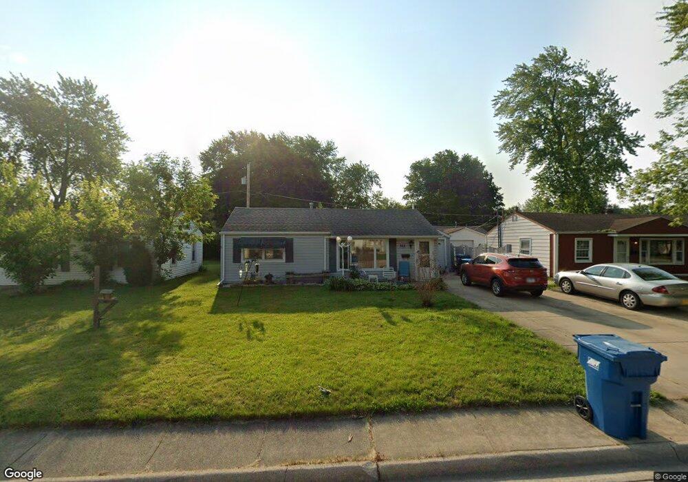
366 Belle Aire Ave Bourbonnais, IL 60914
Estimated Value: $143,000 - $201,062
2
Beds
1
Bath
1,480
Sq Ft
$111/Sq Ft
Est. Value
About This Home
This home is located at 366 Belle Aire Ave, Bourbonnais, IL 60914 and is currently estimated at $165,016, approximately $111 per square foot. 366 Belle Aire Ave is a home located in Kankakee County with nearby schools including Shabbona Elementary School, Liberty Intermediate School, and Bourbonnais Upper Grade Center.
Ownership History
Date
Name
Owned For
Owner Type
Purchase Details
Closed on
Jul 10, 2010
Sold by
Bradford Southard
Bought by
Ducharme Denise A
Current Estimated Value
Home Financials for this Owner
Home Financials are based on the most recent Mortgage that was taken out on this home.
Original Mortgage
$82,883
Outstanding Balance
$54,801
Interest Rate
4.62%
Mortgage Type
FHA
Estimated Equity
$110,215
Create a Home Valuation Report for This Property
The Home Valuation Report is an in-depth analysis detailing your home's value as well as a comparison with similar homes in the area
Home Values in the Area
Average Home Value in this Area
Purchase History
| Date | Buyer | Sale Price | Title Company |
|---|---|---|---|
| Ducharme Denise A | $84,000 | Attorney Only |
Source: Public Records
Mortgage History
| Date | Status | Borrower | Loan Amount |
|---|---|---|---|
| Open | Ducharme Denise A | $82,883 |
Source: Public Records
Tax History Compared to Growth
Tax History
| Year | Tax Paid | Tax Assessment Tax Assessment Total Assessment is a certain percentage of the fair market value that is determined by local assessors to be the total taxable value of land and additions on the property. | Land | Improvement |
|---|---|---|---|---|
| 2024 | $4,324 | $63,023 | $6,562 | $56,461 |
| 2023 | $3,911 | $58,355 | $6,076 | $52,279 |
| 2022 | $3,368 | $50,132 | $5,856 | $44,276 |
| 2021 | $3,150 | $47,364 | $5,727 | $41,637 |
| 2020 | $2,715 | $41,731 | $5,574 | $36,157 |
| 2019 | $2,574 | $39,828 | $5,412 | $34,416 |
| 2018 | $2,199 | $35,548 | $5,332 | $30,216 |
| 2017 | $2,136 | $34,681 | $5,202 | $29,479 |
| 2016 | $1,636 | $29,176 | $5,125 | $24,051 |
| 2015 | $1,631 | $28,887 | $5,074 | $23,813 |
| 2014 | $1,660 | $29,956 | $5,074 | $24,882 |
| 2013 | -- | $26,131 | $5,074 | $21,057 |
Source: Public Records
Map
Nearby Homes
- 899 Armour Rd
- 235 E John Casey Rd
- 279 W Country Ct
- 213 Bernard St
- 261 Mohawk Dr
- 118 Meadows Ct
- 404 E Grand Dr
- 273 Harvard Ave
- 635 Independence Dr
- 271 Toni St
- 482 S Rivard St
- 475 S Cryer Ave
- Lot 5/5A Almar Pkwy
- 52 Hanson Dr
- 717 Independence Dr
- 725 Independence Dr
- 631 Concord Place
- 590 Jonette Ave
- 530 Meadows Rd S
- 54 Bonds Dr
- 376 Belle Aire Ave
- 356 Belle Aire Ave
- 357 N Levasseur Ave
- 386 Belle Aire Ave
- 346 Belle Aire Ave
- 347 N Levasseur Ave
- 367 N Levasseur Ave
- 363 Belle Aire Ave
- 353 Belle Aire Ave
- 373 Belle Aire Ave
- 343 Belle Aire Ave
- 630 Armour Rd
- 326 Belle Aire Ave
- 327 N Levasseur Ave
- 387 N Levasseur Ave
- 333 Belle Aire Ave
- 348 N Levasseur Ave
- 362 N Levasseur Ave
- 338 N Levasseur Ave
- 316 Belle Aire Ave