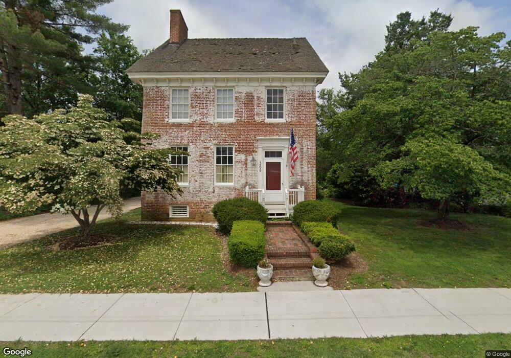
366 Cypress St Millington, MD 21651
Estimated Value: $358,000 - $407,000
--
Bed
3
Baths
2,887
Sq Ft
$134/Sq Ft
Est. Value
About This Home
This home is located at 366 Cypress St, Millington, MD 21651 and is currently estimated at $386,916, approximately $134 per square foot. 366 Cypress St is a home located in Kent County with nearby schools including Center for Innovation, Kent County Middle School, and Kent County High School.
Ownership History
Date
Name
Owned For
Owner Type
Purchase Details
Closed on
Apr 4, 2008
Sold by
Joyce Elizabeth G
Bought by
Beckley Elizabeth P and Beckley G
Current Estimated Value
Purchase Details
Closed on
Mar 27, 2008
Sold by
Joyce Elizabeth G
Bought by
Beckley Elizabeth P and Beckley G
Purchase Details
Closed on
Oct 22, 2004
Sold by
Johnson Charles A
Bought by
Joyce Elizabeth G
Purchase Details
Closed on
Feb 3, 1987
Sold by
Keane Robert E and Eleanor Ann
Bought by
Johnson Charles A and Vernie Th
Create a Home Valuation Report for This Property
The Home Valuation Report is an in-depth analysis detailing your home's value as well as a comparison with similar homes in the area
Home Values in the Area
Average Home Value in this Area
Purchase History
| Date | Buyer | Sale Price | Title Company |
|---|---|---|---|
| Beckley Elizabeth P | -- | -- | |
| Beckley Elizabeth P | -- | -- | |
| Joyce Elizabeth G | $220,000 | -- | |
| Johnson Charles A | $78,000 | -- |
Source: Public Records
Tax History Compared to Growth
Tax History
| Year | Tax Paid | Tax Assessment Tax Assessment Total Assessment is a certain percentage of the fair market value that is determined by local assessors to be the total taxable value of land and additions on the property. | Land | Improvement |
|---|---|---|---|---|
| 2025 | $3,556 | $310,967 | $0 | $0 |
| 2024 | $3,556 | $282,833 | $0 | $0 |
| 2023 | $3,652 | $254,700 | $50,300 | $204,400 |
| 2022 | $3,556 | $251,333 | $0 | $0 |
| 2021 | $3,452 | $247,967 | $0 | $0 |
| 2020 | $3,452 | $244,600 | $50,300 | $194,300 |
| 2019 | $3,459 | $244,600 | $50,300 | $194,300 |
| 2018 | $3,459 | $244,600 | $50,300 | $194,300 |
| 2017 | $3,451 | $248,400 | $0 | $0 |
| 2016 | -- | $248,400 | $0 | $0 |
| 2015 | $2,786 | $248,400 | $0 | $0 |
| 2014 | $2,786 | $251,400 | $0 | $0 |
Source: Public Records
Map
Nearby Homes
- 356 Cypress St
- 32155 River Rd
- 82 Kent Mill Dr
- Parcel 104 Pfalzgroff Rd
- 10434 Big Stone Rd
- 0 Carroll Clark Rd Unit MDKE2004182
- Lot 1 Carroll Clark Rd
- 10669 Chesterville Forest Rd
- 0 Chesterville Forest Rd Unit PARCEL 84A
- 0 Chesterville Forest Rd Unit PARCEL 60
- 0 Baxter Rd
- 0 Peters Corner Rd
- 218 Lakeside Dr
- 12035 Galena Rd
- 550 Bolton Woods Rd
- 32287 Quinn Rd
- 209 3rd St
- 404 Spring Rd
- 114 W Main St
- 112 W Main St