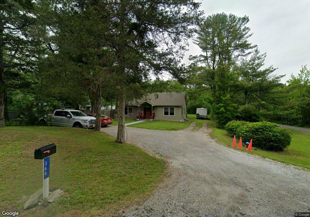
366 Newton Swartswood Rd Newton, NJ 07860
Estimated Value: $370,541 - $433,000
--
Bed
--
Bath
1,068
Sq Ft
$379/Sq Ft
Est. Value
About This Home
This home is located at 366 Newton Swartswood Rd, Newton, NJ 07860 and is currently estimated at $404,635, approximately $378 per square foot. 366 Newton Swartswood Rd is a home located in Sussex County with nearby schools including Fredon Township School, Kittatinny Regional High School, and Northwest Christian School.
Ownership History
Date
Name
Owned For
Owner Type
Purchase Details
Closed on
Oct 22, 2025
Sold by
Douglas Barry and Douglas Elizabeth
Bought by
Lambert Matthew and Lambert Kristina
Current Estimated Value
Home Financials for this Owner
Home Financials are based on the most recent Mortgage that was taken out on this home.
Original Mortgage
$260,000
Outstanding Balance
$260,000
Interest Rate
6.35%
Mortgage Type
New Conventional
Estimated Equity
$144,635
Purchase Details
Closed on
May 11, 2011
Sold by
Wells Fargo Bank N A
Bought by
Douglas Barry
Purchase Details
Closed on
Jun 15, 2010
Sold by
Whitenack Arnie L
Bought by
Wells Fargo Bank N A
Create a Home Valuation Report for This Property
The Home Valuation Report is an in-depth analysis detailing your home's value as well as a comparison with similar homes in the area
Home Values in the Area
Average Home Value in this Area
Purchase History
| Date | Buyer | Sale Price | Title Company |
|---|---|---|---|
| Lambert Matthew | $325,000 | Sunrise Title Services | |
| Douglas Barry | $40,000 | First American Title Ins Co | |
| Wells Fargo Bank N A | -- | None Available |
Source: Public Records
Mortgage History
| Date | Status | Borrower | Loan Amount |
|---|---|---|---|
| Open | Lambert Matthew | $260,000 |
Source: Public Records
Tax History Compared to Growth
Tax History
| Year | Tax Paid | Tax Assessment Tax Assessment Total Assessment is a certain percentage of the fair market value that is determined by local assessors to be the total taxable value of land and additions on the property. | Land | Improvement |
|---|---|---|---|---|
| 2025 | $6,695 | $214,800 | $78,500 | $136,300 |
| 2024 | $3,973 | $214,800 | $78,500 | $136,300 |
| 2023 | $3,973 | $133,100 | $78,500 | $54,600 |
| 2022 | $3,893 | $133,100 | $78,500 | $54,600 |
| 2021 | $3,981 | $133,100 | $78,500 | $54,600 |
| 2020 | $3,960 | $133,100 | $78,500 | $54,600 |
| 2019 | $3,910 | $133,100 | $78,500 | $54,600 |
| 2018 | $3,844 | $133,100 | $78,500 | $54,600 |
| 2017 | $3,860 | $133,100 | $78,500 | $54,600 |
| 2016 | $3,825 | $133,100 | $78,500 | $54,600 |
| 2015 | $3,704 | $133,100 | $78,500 | $54,600 |
| 2014 | $3,642 | $133,100 | $78,500 | $54,600 |
Source: Public Records
Map
Nearby Homes
- 20 Anderson Hill Rd
- 30 Old Swartswood Rd
- 63 Van Horn Rd
- 217 Newton Swartswood Rd
- 907 Meadowbrook Rd
- 965 Cedar Dr
- 936 Dove Island Rd
- 77 Swartswood Rd
- 13 Summit Ave
- 5 Babbitt Ct
- 37 Park Ave
- 41 Swartswood Rd
- 51 Paulinskill Lake Rd
- 931 Cedar Dr
- 37 Foster St
- 15 Cherry St
- 7 Cherry St
- 67 Ryerson Ave
- 208 Willows Rd
- 54 Plainfield Ave
- 368 Swartswood Rd
- 367 Newton-Swarouteswood Rd
- 368 Newton Swartswood Rd
- 365 Swartswood Rd
- 369 Newton Swartswood Rd
- 372 Newton Swartswood Rd
- 372 Swartswood Rd
- 372 Swartswood Rd
- 357 Newton Swartswood Rd
- 376 Newton Swartswood Rd
- 376 Swartswood Rd
- 374 Newton-Swarouteswood Rd
- 364 Newton Swartswood Rd
- 380 Newton Swartswood Rd
- 353 Newton Swartswood Rd
- 8 Hill Terrace
- 378 Newton Swartswood Rd
- 348 Newton Swartswood Rd
- 349 Newton Swartswood Rd
- 349 Swartswood Rd