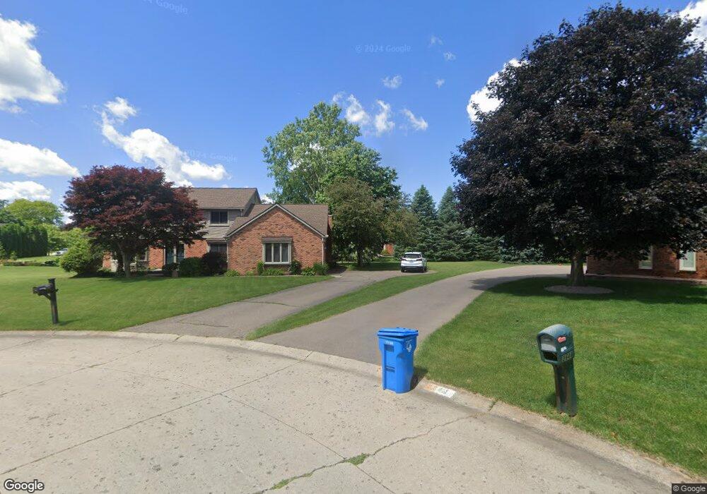
3660 Car Dr Commerce Township, MI 48382
Estimated Value: $531,000 - $615,000
4
Beds
3
Baths
2,546
Sq Ft
$225/Sq Ft
Est. Value
About This Home
This home is located at 3660 Car Dr, Commerce Township, MI 48382 and is currently estimated at $571,681, approximately $224 per square foot. 3660 Car Dr is a home located in Oakland County with nearby schools including Country Oaks Elementary School, Oak Valley Middle School, and Christ Lutheran Christian Day School.
Ownership History
Date
Name
Owned For
Owner Type
Purchase Details
Closed on
Mar 29, 2005
Sold by
Lee Jin Young and Lee Christine S
Bought by
Lane Kevin M and Lane Laura M
Current Estimated Value
Purchase Details
Closed on
Aug 25, 1995
Sold by
Whitty John J
Bought by
Lee Jin Y
Home Financials for this Owner
Home Financials are based on the most recent Mortgage that was taken out on this home.
Original Mortgage
$152,000
Interest Rate
7.76%
Mortgage Type
New Conventional
Create a Home Valuation Report for This Property
The Home Valuation Report is an in-depth analysis detailing your home's value as well as a comparison with similar homes in the area
Home Values in the Area
Average Home Value in this Area
Purchase History
| Date | Buyer | Sale Price | Title Company |
|---|---|---|---|
| Lane Kevin M | $265,000 | Metropolitan Title Company | |
| Lee Jin Y | $192,000 | -- |
Source: Public Records
Mortgage History
| Date | Status | Borrower | Loan Amount |
|---|---|---|---|
| Previous Owner | Lee Jin Y | $152,000 |
Source: Public Records
Tax History Compared to Growth
Tax History
| Year | Tax Paid | Tax Assessment Tax Assessment Total Assessment is a certain percentage of the fair market value that is determined by local assessors to be the total taxable value of land and additions on the property. | Land | Improvement |
|---|---|---|---|---|
| 2024 | $2,779 | $219,830 | $0 | $0 |
| 2023 | $2,651 | $204,050 | $0 | $0 |
| 2022 | $3,902 | $187,620 | $0 | $0 |
| 2021 | $3,665 | $183,060 | $0 | $0 |
| 2020 | $2,428 | $178,360 | $0 | $0 |
| 2019 | $3,482 | $172,200 | $0 | $0 |
| 2018 | $3,398 | $147,340 | $0 | $0 |
| 2017 | $3,333 | $147,340 | $0 | $0 |
| 2016 | $3,286 | $144,820 | $0 | $0 |
| 2015 | -- | $123,510 | $0 | $0 |
| 2014 | -- | $106,390 | $0 | $0 |
| 2011 | -- | $91,530 | $0 | $0 |
Source: Public Records
Map
Nearby Homes
- 4432 Ravinewood Dr
- 4806 Surfwood Dr
- 4160 Rolling Pines Ct
- 2922 Sleeth Rd
- 4815 Ravinewood Dr
- 4710 Botany Glen
- 2711 Crystal Lake Dr
- 2539 Crystal Lake Dr
- 2679 Crystal Lake Dr
- 2684 Crystal Lake Dr
- 2680 Crystal Lake Dr
- 2688 Crystal Lake Dr
- Chelsea Plan at The Reserve at Crystal Lake
- Avalon Plan at The Reserve at Crystal Lake
- Madison Plan at The Reserve at Crystal Lake
- Newport Plan at The Reserve at Crystal Lake
- 2500 Crystal Lake Dr
- 2200 Somerset Ln
- Brant Plan at The Reserve at Crystal Lake - Toll Brothers at The Reserve at Crystal Lake
- Alma Plan at The Reserve at Crystal Lake - Toll Brothers at The Reserve at Crystal Lake
- 4446 Ravinewood Dr
- 3645 Car Dr
- 4418 Ravinewood Dr
- 4458 Ravinewood Dr
- 3631 Car Dr
- 3630 Car Dr Unit Bldg-Unit
- 3630 Car Dr
- 4478 Ravinewood Dr Unit Bldg-Unit
- 4478 Ravinewood Dr
- 4394 Ravinewood Dr
- 4401 Marcello Dr
- 4367 Marcello Dr
- 4488 Ravinewood Dr
- 4423 Marcello Dr
- 4345 Marcello Dr
- 4502 Ravinewood Dr
- 4318 Ravinewood Dr
- 4350 Ravinewood Dr
- 4431 Ravinewood Dr
- 4443 Ravinewood Dr