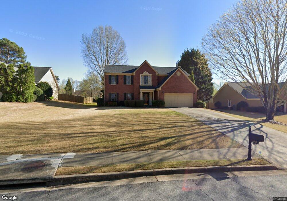
3660 Glennvale Ct Unit 3B Cumming, GA 30041
Big Creek NeighborhoodEstimated Value: $639,355 - $657,000
4
Beds
3
Baths
2,484
Sq Ft
$262/Sq Ft
Est. Value
About This Home
This home is located at 3660 Glennvale Ct Unit 3B, Cumming, GA 30041 and is currently estimated at $649,589, approximately $261 per square foot. 3660 Glennvale Ct Unit 3B is a home located in Forsyth County with nearby schools including Brookwood Elementary School, South Forsyth Middle School, and Lambert High School.
Ownership History
Date
Name
Owned For
Owner Type
Purchase Details
Closed on
Jul 21, 2022
Sold by
Bowman Albert W
Bought by
Bowman Family Trust
Current Estimated Value
Purchase Details
Closed on
Sep 30, 2002
Sold by
Bowman Albert W
Bought by
Bowman Albert W and Bowman Jacqueline A
Home Financials for this Owner
Home Financials are based on the most recent Mortgage that was taken out on this home.
Original Mortgage
$133,800
Interest Rate
5.64%
Mortgage Type
New Conventional
Purchase Details
Closed on
Jun 27, 1997
Sold by
Ryland Grp Inc
Bought by
Bowman Albert W
Home Financials for this Owner
Home Financials are based on the most recent Mortgage that was taken out on this home.
Original Mortgage
$154,400
Interest Rate
7.98%
Mortgage Type
New Conventional
Purchase Details
Closed on
Sep 30, 1996
Sold by
Ryland Group
Bought by
Parker Randall C and Seymour Jane
Create a Home Valuation Report for This Property
The Home Valuation Report is an in-depth analysis detailing your home's value as well as a comparison with similar homes in the area
Home Values in the Area
Average Home Value in this Area
Purchase History
| Date | Buyer | Sale Price | Title Company |
|---|---|---|---|
| Bowman Family Trust | -- | James M Miskell Pc | |
| Bowman Albert W | -- | -- | |
| Bowman Albert W | $171,600 | -- | |
| Parker Randall C | $194,500 | -- |
Source: Public Records
Mortgage History
| Date | Status | Borrower | Loan Amount |
|---|---|---|---|
| Previous Owner | Bowman Albert W | $133,800 | |
| Previous Owner | Bowman Albert W | $154,400 | |
| Closed | Parker Randall C | $0 |
Source: Public Records
Tax History Compared to Growth
Tax History
| Year | Tax Paid | Tax Assessment Tax Assessment Total Assessment is a certain percentage of the fair market value that is determined by local assessors to be the total taxable value of land and additions on the property. | Land | Improvement |
|---|---|---|---|---|
| 2025 | $4,231 | $242,312 | $78,000 | $164,312 |
| 2024 | $4,231 | $220,828 | $68,000 | $152,828 |
| 2023 | $3,394 | $191,980 | $60,000 | $131,980 |
| 2022 | $3,552 | $138,772 | $40,000 | $98,772 |
| 2021 | $3,268 | $138,772 | $40,000 | $98,772 |
| 2020 | $3,246 | $137,716 | $40,000 | $97,716 |
| 2019 | $3,147 | $132,656 | $40,000 | $92,656 |
| 2018 | $3,142 | $131,280 | $30,000 | $101,280 |
| 2017 | $2,726 | $110,976 | $30,000 | $80,976 |
| 2016 | $2,726 | $110,976 | $30,000 | $80,976 |
| 2015 | $2,394 | $95,016 | $26,000 | $69,016 |
| 2014 | $2,070 | $85,200 | $22,000 | $63,200 |
Source: Public Records
Map
Nearby Homes
- 7530 Newstead Dr
- 3180 Caney Creek Ln
- 3055 Rocky Brook Dr
- 3585 Lakeheath Dr
- 3115 Arbor Song Ct
- 3250 Caney Estates Place
- 7105 Brookwood Way
- 140 Ashewoode Downs Ln
- 3715 Lakeheath Dr
- 680 Evening Pine Ln
- 3730 Lakeheath Dr
- 2875 Caney Rd
- 7170 Collingsworth Place
- 640 Evening Pine Ln
- 3030 Brookwater Dr Unit 1
- 5635 Ashewoode Downs Dr
- 2005 Brook Meadow Dr
- 3670 Glennvale Ct
- 3650 Glennvale Ct
- 3525 Evonvale Overlook
- 3680 Glennvale Ct
- 3630 Glennvale Ct Unit 1
- 3510 Evonvale Glen
- 3520 Evonvale Glen Unit 1
- 3655 Glennvale Ct
- 3665 Glennvale Ct
- 3645 Glennvale Ct Unit 3B
- 3545 Evonvale Overlook
- 3690 Glennvale Ct
- 3540 Evonvale Glen
- 3675 Glennvale Ct Unit 3B
- 3550 Evonvale Glen
- 3560 Evonvale Glen
- 3610 Glennvale Ct Unit 1
- 3635 Glennvale Ct
- 0 Evonvale Glen Unit 8804775
- 0 Evonvale Glen Unit 7286365