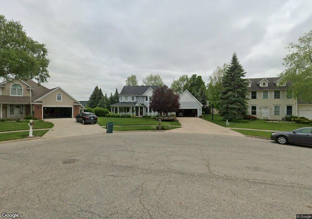
3664 Hillside Dr Hudsonville, MI 49426
Estimated Value: $458,000 - $556,000
4
Beds
3
Baths
2,404
Sq Ft
$212/Sq Ft
Est. Value
About This Home
This home is located at 3664 Hillside Dr, Hudsonville, MI 49426 and is currently estimated at $508,730, approximately $211 per square foot. 3664 Hillside Dr is a home located in Ottawa County with nearby schools including South Elementary School, Hudsonville Freshman Campus, and Riley Street Middle School.
Ownership History
Date
Name
Owned For
Owner Type
Purchase Details
Closed on
Jan 27, 2016
Sold by
Vink Dale E and Vink Vickie S
Bought by
Dale E & Vickie S Vink Trust
Current Estimated Value
Purchase Details
Closed on
Jul 2, 2009
Sold by
Pols John W and Pols Patricia J
Bought by
Vink Dale E and Vink Vickie S
Home Financials for this Owner
Home Financials are based on the most recent Mortgage that was taken out on this home.
Original Mortgage
$50,000
Interest Rate
5.49%
Mortgage Type
Purchase Money Mortgage
Create a Home Valuation Report for This Property
The Home Valuation Report is an in-depth analysis detailing your home's value as well as a comparison with similar homes in the area
Home Values in the Area
Average Home Value in this Area
Purchase History
| Date | Buyer | Sale Price | Title Company |
|---|---|---|---|
| Dale E & Vickie S Vink Trust | -- | Attorney | |
| Vink Dale E | $268,000 | Chicago Title |
Source: Public Records
Mortgage History
| Date | Status | Borrower | Loan Amount |
|---|---|---|---|
| Previous Owner | Vink Dale E | $50,000 |
Source: Public Records
Tax History Compared to Growth
Tax History
| Year | Tax Paid | Tax Assessment Tax Assessment Total Assessment is a certain percentage of the fair market value that is determined by local assessors to be the total taxable value of land and additions on the property. | Land | Improvement |
|---|---|---|---|---|
| 2025 | $4,760 | $233,100 | $0 | $0 |
| 2024 | $4,567 | $224,500 | $0 | $0 |
| 2023 | $4,358 | $194,100 | $0 | $0 |
| 2022 | $4,322 | $184,300 | $0 | $0 |
| 2021 | $4,195 | $179,200 | $0 | $0 |
| 2020 | $4,148 | $173,700 | $0 | $0 |
| 2019 | $4,079 | $169,600 | $0 | $0 |
| 2018 | $3,852 | $142,300 | $0 | $0 |
| 2017 | -- | $144,700 | $0 | $0 |
| 2016 | -- | $140,800 | $0 | $0 |
| 2015 | -- | $124,600 | $0 | $0 |
| 2014 | -- | $113,500 | $0 | $0 |
Source: Public Records
Map
Nearby Homes
- 3751 Hillside Dr
- 1750
- 4646 Canterbury Dr
- 3699 Teton Dr
- 7346 Yellowstone Dr
- 3879 Quincy St
- 4853 Meadowview Ct Unit 25
- Bay Harbor Plan at Valley Point - Landmark Series
- Sequoia Plan at Valley Point - Woodland Series
- Redwood Plan at Valley Point - Woodland Series
- Oakwood Plan at Valley Point - Woodland Series
- Ashton Plan at Valley Point
- Cascade Plan at Valley Point
- Camden Plan at Valley Point - Cottage Series
- Northport Plan at Valley Point - Landmark Series
- Cedarwood Plan at Valley Point - Woodland Series
- Elmwood Plan at Valley Point - Woodland Series
- Enclave Plan at Valley Point
- Whitby Plan at Valley Point - Cottage Series
- Carson Plan at Valley Point
- 3650 Hillside Dr
- 3678 Hillside Dr
- 4254 Vista Dr
- 4246 Vista Dr
- 3653 Hillside Dr
- 3681 Hillside Dr
- 3691 Hillside Dr
- 4238 Vista Dr
- 3706 Hillside Dr
- 3709 Hillside Dr
- 3667 Hillside Dr
- 4255 Vista Dr
- 3723 Hillside Dr
- 4230 Vista Dr
- 3720 Hillside Dr
- 4239 Vista Dr
- 4247 Vista Dr
- 3737 Hillside Dr
- 3734 Hillside Dr
- 3748 Hillside Dr