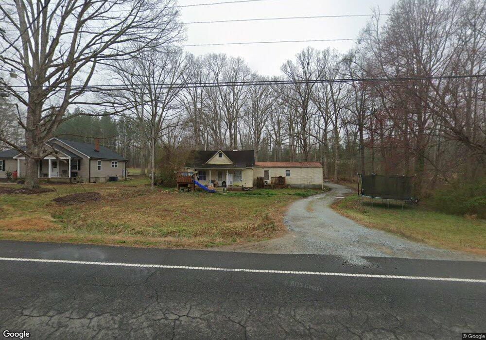
3664 Oxford Rd Roxboro, NC 27574
Estimated Value: $106,090 - $142,000
2
Beds
1
Bath
914
Sq Ft
$133/Sq Ft
Est. Value
About This Home
This home is located at 3664 Oxford Rd, Roxboro, NC 27574 and is currently estimated at $121,523, approximately $132 per square foot. 3664 Oxford Rd is a home located in Person County with nearby schools including Person High School.
Ownership History
Date
Name
Owned For
Owner Type
Purchase Details
Closed on
Sep 1, 2021
Sold by
Denny Franklin Arnold and Denny Ruth L
Bought by
Turner Pamela
Current Estimated Value
Home Financials for this Owner
Home Financials are based on the most recent Mortgage that was taken out on this home.
Original Mortgage
$90,000
Outstanding Balance
$56,882
Interest Rate
2.7%
Mortgage Type
Seller Take Back
Estimated Equity
$64,641
Purchase Details
Closed on
Nov 6, 1996
Bought by
Denny Franklin A and Denny Ruth L
Create a Home Valuation Report for This Property
The Home Valuation Report is an in-depth analysis detailing your home's value as well as a comparison with similar homes in the area
Purchase History
| Date | Buyer | Sale Price | Title Company |
|---|---|---|---|
| Turner Pamela | $90,000 | None Available | |
| Denny Franklin A | $30,000 | -- |
Source: Public Records
Mortgage History
| Date | Status | Borrower | Loan Amount |
|---|---|---|---|
| Open | Turner Pamela | $90,000 |
Source: Public Records
Tax History
| Year | Tax Paid | Tax Assessment Tax Assessment Total Assessment is a certain percentage of the fair market value that is determined by local assessors to be the total taxable value of land and additions on the property. | Land | Improvement |
|---|---|---|---|---|
| 2025 | $603 | $87,587 | $0 | $0 |
| 2024 | $312 | $38,321 | $0 | $0 |
| 2023 | $312 | $38,321 | $0 | $0 |
| 2022 | $311 | $38,321 | $0 | $0 |
| 2021 | $302 | $38,321 | $0 | $0 |
| 2020 | $269 | $33,790 | $0 | $0 |
| 2019 | $272 | $33,790 | $0 | $0 |
| 2018 | $256 | $33,790 | $0 | $0 |
| 2017 | $253 | $33,791 | $0 | $0 |
| 2016 | $253 | $33,791 | $0 | $0 |
| 2015 | $253 | $33,791 | $0 | $0 |
| 2014 | $253 | $33,791 | $0 | $0 |
Source: Public Records
Map
Nearby Homes
- 122 Old Surl Rd
- 200 Griesch Rd
- 2735 Lucy Garrett Rd
- Tract D Antioch Church Rd
- 175 Glendale Ln
- 00 Antioch Church Rd
- 152 Crystal Lake Dr
- 910 Pulliam-Tingen Mine Rd
- Tract 5 Old Allensville Rd
- 4762 Old Allensville Rd
- 12 Crow Field St
- 1221 Antioch Church Rd
- 26 Crow Field St
- 1519 Oxford Rd
- 427 Fletcher Ridge Rd
- 0 Allensville Rd Unit 10141749
- 2551 Old Durham Rd
- 0 Durham Rd Unit 10062439
- 66 Allensville Rd
- 54 Hillcrest Ave