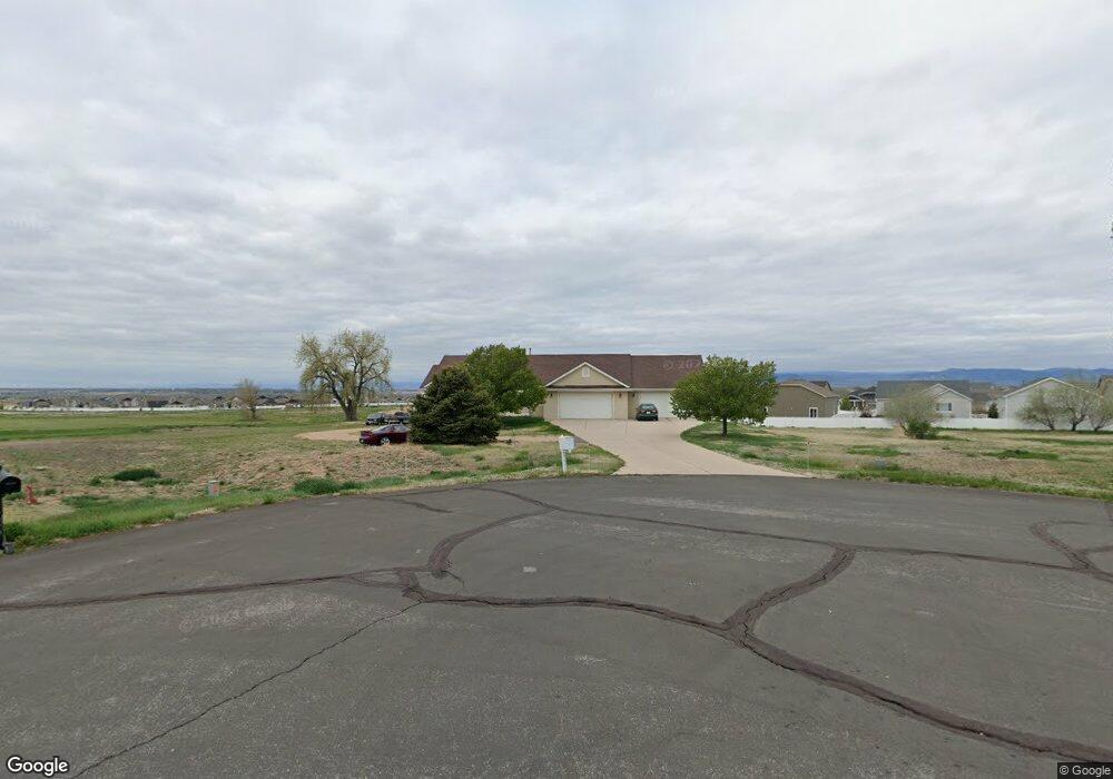
36667 Brian Ave Windsor, CO 80550
Estimated Value: $747,000 - $1,100,000
3
Beds
3
Baths
2,246
Sq Ft
$431/Sq Ft
Est. Value
About This Home
This home is located at 36667 Brian Ave, Windsor, CO 80550 and is currently estimated at $968,197, approximately $431 per square foot. 36667 Brian Ave is a home located in Weld County with nearby schools including Grandview Elementary School, Windsor Middle School, and Windsor High School.
Ownership History
Date
Name
Owned For
Owner Type
Purchase Details
Closed on
Oct 20, 2000
Sold by
Roth Harvey A and Roth Sally M
Bought by
Roth Darrell G and Roth Karen K
Current Estimated Value
Purchase Details
Closed on
Dec 31, 1999
Sold by
Roth Harvey A and Roth Sally M
Bought by
Roth Darrell G and Roth Karen K
Purchase Details
Closed on
Dec 31, 1998
Sold by
Roth Harvey A and Roth Sally M
Bought by
Roth Darrell G and Roth Karen K
Purchase Details
Closed on
Jun 24, 1993
Bought by
Roth Albert E and Roth Harvey A
Create a Home Valuation Report for This Property
The Home Valuation Report is an in-depth analysis detailing your home's value as well as a comparison with similar homes in the area
Home Values in the Area
Average Home Value in this Area
Purchase History
| Date | Buyer | Sale Price | Title Company |
|---|---|---|---|
| Roth Darrell G | -- | -- | |
| Roth Darrell G | -- | -- | |
| Roth Darrell G | -- | -- | |
| Roth Albert E | -- | -- |
Source: Public Records
Tax History Compared to Growth
Tax History
| Year | Tax Paid | Tax Assessment Tax Assessment Total Assessment is a certain percentage of the fair market value that is determined by local assessors to be the total taxable value of land and additions on the property. | Land | Improvement |
|---|---|---|---|---|
| 2025 | $5,109 | $58,980 | $12,810 | $46,170 |
| 2024 | $5,109 | $58,980 | $12,810 | $46,170 |
| 2023 | $4,689 | $57,800 | $15,220 | $42,580 |
| 2022 | $4,223 | $43,510 | $8,340 | $35,170 |
| 2021 | $3,936 | $44,770 | $8,580 | $36,190 |
| 2020 | $3,862 | $44,790 | $9,720 | $35,070 |
| 2019 | $3,828 | $44,790 | $9,720 | $35,070 |
| 2018 | $3,049 | $33,760 | $9,000 | $24,760 |
| 2017 | $3,228 | $33,760 | $9,000 | $24,760 |
| 2016 | $3,198 | $33,780 | $9,150 | $24,630 |
| 2015 | $2,974 | $33,780 | $9,150 | $24,630 |
| 2014 | $2,813 | $29,960 | $7,480 | $22,480 |
Source: Public Records
Map
Nearby Homes
- 5176 Chantry Dr
- 1760 Ruddlesway Dr
- 1576 Illingworth Dr
- 4535 Waltham Dr
- 4586 Binfield Dr
- 5612 Osbourne Dr
- 5664 Osbourne Dr
- 4550 Bishopsgate Dr
- 1834 Holloway Dr
- 6074 Carmon Dr
- 1829 Holloway Dr
- 1853 Holloway Dr
- 1897 Holloway Dr
- 6776 County Road 74
- 3794 Tall Grass Ct
- 3795 Tall Grass Ct
- 3970 Portrush Ln
- 3711 Tall Grass Ct
- 4264 Grand Park Dr
- 4268 Ardglass Ln
- 5337 Chantry Dr
- 5381 Chantry Dr
- 36699 Brian Ave
- 5265 Chantry Dr
- 5443 Chantry Dr
- 5159 Chantry Dr
- 36656 Brian Ave
- 5487 Chantry Dr
- 1680 Northcroft Dr
- 6650 Alexander Dr
- 5398 Chantry Dr
- 5434 Chantry Dr
- 5376 Chantry Dr
- 5452 Chantry Dr
- 5232 Chantry Dr
- 5519 Chantry Dr
- 1660 Northcroft Dr
- 5470 Chantry Dr
- 5144 Chantry Dr
- 5006 Hollycomb Dr