367 Catnip Rd Del Rio, TN 37727
Estimated payment $1,233/month
Highlights
- Barn
- Farm
- Wooded Lot
- Home fronts a creek
- Creek On Lot
- No HOA
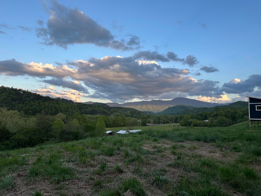
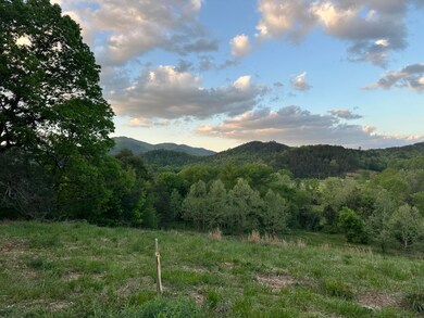
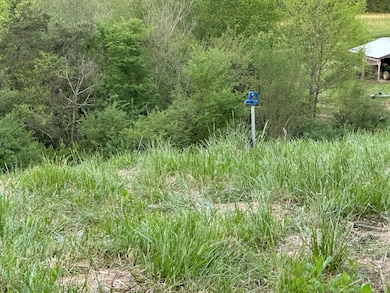
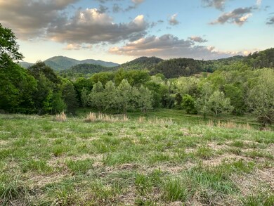
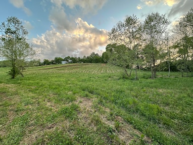
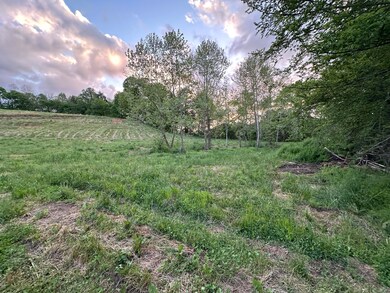
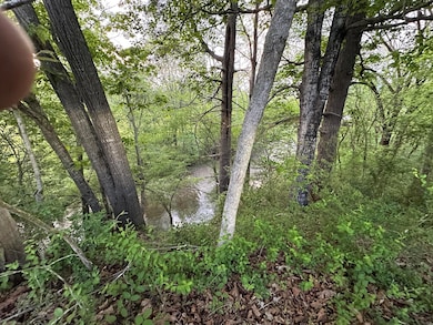
About This Lot
This unrestricted 5.12 acres located in Del Rio TN with frontage to the Gulf Fork Big Creek has everything you need to get started. This lot has phenomenal mtn views, creek frontage with access, a barn, enough room to have a mini-farm, public water meter with water line and spigot located a the top of the property, a 3 bedroom septic system permit and installed, and access to Newport Utilities fiber optic internet. So, bring your camper, mobile homes, tiny home, or build the Tennessee Mountain home you have always wanted and dreamed about.
Listing Agent
Weichert, REALTORS - Tiger Real Estate License #351579 Listed on: 04/28/2025

Property Details
Property Type
- Land
Est. Annual Taxes
- $271
Lot Details
- 5.12 Acre Lot
- Home fronts a creek
- Property fronts a county road
- Irregular Lot
- Lot Has A Rolling Slope
- Wooded Lot
Schools
- Del Rio K-8 Elementary School
- Cocke High School
Farming
- Barn
- Farm
- Agricultural
- Pasture
Mobile Home
- Mobile Home Allowed
Utilities
- Propane
- Natural Gas Not Available
- Septic Tank
- Fiber Optics Available
Additional Features
- Property Views
Listing and Financial Details
- Assessor Parcel Number 077 00813 000
Community Details
Overview
- No Home Owners Association
Recreation
- Creek On Lot
Map
Home Values in the Area
Average Home Value in this Area
Tax History
| Year | Tax Paid | Tax Assessment Tax Assessment Total Assessment is a certain percentage of the fair market value that is determined by local assessors to be the total taxable value of land and additions on the property. | Land | Improvement |
|---|---|---|---|---|
| 2024 | $271 | $10,600 | $9,875 | $725 |
| 2023 | $271 | $10,600 | $9,875 | $725 |
Property History
| Date | Event | Price | List to Sale | Price per Sq Ft |
|---|---|---|---|---|
| 04/28/2025 04/28/25 | For Sale | $229,900 | -- | -- |
Source: Lakeway Area Association of REALTORS®
MLS Number: 707360
APN: 015077 00813
Disclaimer: Certain information contained herein is derived from information provided by parties other than Homes.com. All information provided is deemed reliable, but is not guaranteed to be accurate and should be independently verified.
![]() IDX information is provided exclusively for personal, non-commercial use, and may not be used for any purpose other than to identify prospective properties consumers may be interested in purchasing. Information is deemed reliable but not guaranteed.
IDX information is provided exclusively for personal, non-commercial use, and may not be used for any purpose other than to identify prospective properties consumers may be interested in purchasing. Information is deemed reliable but not guaranteed.
- 0 Catnip Rd
- 130 & 110 Only Way
- 467 Tennessee 107
- 376 Summer House Hollow Rd
- 151 Tennessee 107
- Par 24.00 Fugate Rd
- Par. 24.00 Fugate Rd
- 155 Tennessee 107
- 201 Flat Rock Way
- 1875 E Highway 25-70
- 11 acres Off Hwy 107s
- 5.72 ac Off Hwy 107s
- 805 Punkton Rd
- 5.29 acres Off Hwy 107s
- 2720 E Hwy 25-70
- 1015 Kizzy Patch Way
- 580 Jessica Way
- 565 Travis Way
- 563 Travis Way
- 584 Flatwoods Way
- 574 Banjo Way
- 1426 Mountain Ranch Rd
- 103 Boone Rd
- 275 Sub Rd
- 2390 W Allens Bridge Rd Unit 3
- 264 Sonshine Ridge Rd Unit ID1051674P
- 4557 Hooper Hwy Unit ID1051752P
- 58 Haney Park
- 47 Haney Park
- 4945 Ledford Rd Unit ID1051753P
- 4949 Ledford Rd Unit ID1051743P
- 152 Baxter Rd Unit ID1221043P
- 152 Baxter Rd Unit ID1224114P
- 4355 Wilhite Rd Unit 2
- 4355 Wilhite Rd Unit 1
- 4355 Wilhite Rd Unit 3