Estimated Value: $437,000 - $470,000
4
Beds
3
Baths
2,874
Sq Ft
$158/Sq Ft
Est. Value
About This Home
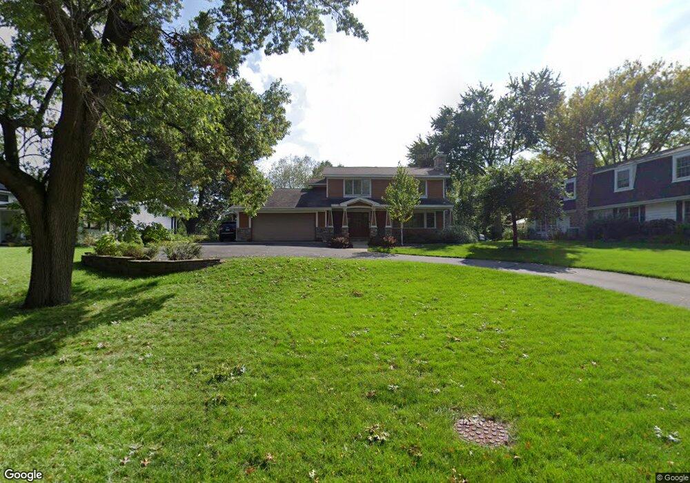
This home is located at 367 High Rd, Cary, IL 60013 and is currently estimated at $454,222, approximately $158 per square foot. 367 High Rd is a home located in McHenry County with nearby schools including Briargate Elementary School, Cary Jr High School, and Cary-Grove High School.
Ownership History
Date
Name
Owned For
Owner Type
Purchase Details
Closed on
Oct 9, 2003
Sold by
Harris Trust & Savings Bank
Bought by
Henry David C and Henry Catherine M
Current Estimated Value
Home Financials for this Owner
Home Financials are based on the most recent Mortgage that was taken out on this home.
Original Mortgage
$180,000
Outstanding Balance
$71,123
Interest Rate
4%
Mortgage Type
New Conventional
Estimated Equity
$383,099
Purchase Details
Closed on
Dec 10, 2002
Sold by
Williams Virginia L
Bought by
Harris Trust & Savings Bank and Trust #Htb1250
Create a Home Valuation Report for This Property
The Home Valuation Report is an in-depth analysis detailing your home's value as well as a comparison with similar homes in the area
Home Values in the Area
Average Home Value in this Area
Purchase History
| Date | Buyer | Sale Price | Title Company |
|---|---|---|---|
| Henry David C | $280,000 | Nlt Title Llc | |
| Harris Trust & Savings Bank | -- | -- |
Source: Public Records
Mortgage History
| Date | Status | Borrower | Loan Amount |
|---|---|---|---|
| Open | Henry David C | $180,000 |
Source: Public Records
Tax History
| Year | Tax Paid | Tax Assessment Tax Assessment Total Assessment is a certain percentage of the fair market value that is determined by local assessors to be the total taxable value of land and additions on the property. | Land | Improvement |
|---|---|---|---|---|
| 2024 | $11,221 | $141,250 | $30,454 | $110,796 |
| 2023 | $10,953 | $126,330 | $27,237 | $99,093 |
| 2022 | $10,374 | $116,787 | $39,587 | $77,200 |
| 2021 | $9,892 | $108,801 | $36,880 | $71,921 |
| 2020 | $9,601 | $104,949 | $35,574 | $69,375 |
| 2019 | $10,800 | $114,350 | $34,049 | $80,301 |
| 2018 | $10,460 | $108,230 | $34,049 | $74,181 |
| 2017 | $10,269 | $101,959 | $32,076 | $69,883 |
| 2016 | $10,205 | $95,628 | $30,084 | $65,544 |
| 2013 | -- | $82,751 | $28,064 | $54,687 |
Source: Public Records
Map
Nearby Homes
- 266 Charlotte Ct Unit 266
- 341 Cold Spring St
- 403 Cold Spring St
- 371 Cold Spring St
- 204 Country Commons Rd
- 603 W Main St
- 551 Cary Woods Cir
- 2016 Grove Ln
- Lots 2,3,4 Northwest Hwy
- 582 Arthur Dr
- 543 Norman Dr
- 417 Haber Rd Unit 6
- 421 Haber Rd Unit 7
- 425 Haber Rd Unit 6
- 316 Haber Rd Unit 34125
- 401 Cold Springs St
- 349 Park Ave
- 363 Milano Dr Unit 41
- 112 Pearl St
- 735 Royal Glen Dr
Your Personal Tour Guide
Ask me questions while you tour the home.