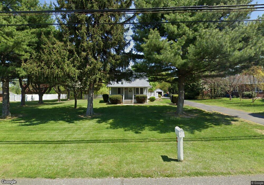
367 Jessup Rd West Deptford, NJ 08086
West Deptford Township NeighborhoodEstimated Value: $392,410
--
Bed
--
Bath
1,359
Sq Ft
$289/Sq Ft
Est. Value
About This Home
This home is located at 367 Jessup Rd, West Deptford, NJ 08086 and is currently estimated at $392,410, approximately $288 per square foot. 367 Jessup Rd is a home located in Gloucester County with nearby schools including Green-Fields Elementary School, Red Bank Elementary School, and Oakview Elementary School.
Ownership History
Date
Name
Owned For
Owner Type
Purchase Details
Closed on
Apr 14, 2006
Sold by
Dubrink Jeanette
Bought by
Partridge Ralph J and Partridge Nancy A
Current Estimated Value
Home Financials for this Owner
Home Financials are based on the most recent Mortgage that was taken out on this home.
Original Mortgage
$195,200
Outstanding Balance
$112,239
Interest Rate
6.37%
Mortgage Type
Purchase Money Mortgage
Estimated Equity
$280,171
Purchase Details
Closed on
Dec 16, 1996
Sold by
Wyzykowski Andrew and Wyzykowski Geraldine
Bought by
Melson Gary M and Melson Alicia L
Home Financials for this Owner
Home Financials are based on the most recent Mortgage that was taken out on this home.
Original Mortgage
$94,939
Interest Rate
7.75%
Mortgage Type
FHA
Purchase Details
Closed on
Mar 17, 1995
Sold by
Dubrink George T and Dubrink Alice Jeanette
Bought by
Angelini Michael A and Angelini Barbara A
Create a Home Valuation Report for This Property
The Home Valuation Report is an in-depth analysis detailing your home's value as well as a comparison with similar homes in the area
Home Values in the Area
Average Home Value in this Area
Purchase History
| Date | Buyer | Sale Price | Title Company |
|---|---|---|---|
| Partridge Ralph J | $244,000 | -- | |
| Melson Gary M | $95,000 | Pilgrim Title Agency | |
| Angelini Michael A | $10,000 | Continental Title Abstract C |
Source: Public Records
Mortgage History
| Date | Status | Borrower | Loan Amount |
|---|---|---|---|
| Open | Partridge Ralph J | $195,200 | |
| Previous Owner | Melson Gary M | $94,939 |
Source: Public Records
Tax History Compared to Growth
Tax History
| Year | Tax Paid | Tax Assessment Tax Assessment Total Assessment is a certain percentage of the fair market value that is determined by local assessors to be the total taxable value of land and additions on the property. | Land | Improvement |
|---|---|---|---|---|
| 2025 | -- | $178,500 | $56,400 | $122,100 |
| 2024 | -- | $178,500 | $56,400 | $122,100 |
| 2023 | -- | $178,500 | $56,400 | $122,100 |
| 2022 | -- | $178,500 | $56,400 | $122,100 |
| 2021 | $2,754 | $178,500 | $56,400 | $122,100 |
| 2020 | $2,754 | $178,500 | $56,400 | $122,100 |
| 2019 | $5,335 | $178,500 | $56,400 | $122,100 |
| 2018 | $5,758 | $178,500 | $56,400 | $122,100 |
| 2017 | $5,625 | $178,500 | $56,400 | $122,100 |
| 2016 | $5,217 | $178,500 | $56,400 | $122,100 |
| 2015 | $4,959 | $178,500 | $56,400 | $122,100 |
| 2014 | $4,700 | $178,500 | $56,400 | $122,100 |
Source: Public Records
Map
Nearby Homes
- 740 Carter Hill Dr
- 64 Tilden Rd
- 1810 Fernwood Dr
- 433 Crown Point Rd
- 1311 Barnesdale Rd
- 97 Church St
- 439 Crown Point Rd
- 4 Saint Emilion Ct
- 863 Doncaster Dr
- 1102 Barnesdale Rd
- 640 Worcester Dr
- 121 Cape May Ave
- 10 Kennedy Ct
- 247 Crown Point Rd
- 1220 Royal Ln
- 87 Woodway Dr Unit 87
- 266 Passaic Ave
- 67 Pelican Place
- 107 Audubon Ave
- 558 Prince St
- 369 Jessup Rd
- 363 Jessup Rd
- 317 Jessup Mill Rd
- 371 Jessup Rd
- 1509 Cobblestone Ct
- 361 Jessup Rd
- 373 Jessup Rd
- 1508 Cobblestone Ct
- 1505 Cobblestone Ct
- 359 Jessup Rd
- 357 Jessup Rd
- 1503 Cobblestone Ct
- 375 Jessup Rd
- 1506 Cobblestone Ct
- 355 Jessup Rd
- 1504 Cobblestone Ct
- 372 Jessup Rd
- 336 Jessup Mill Rd
- 1502 Cobblestone Ct
- 374 Jessup Rd