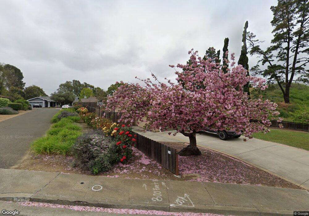
367 Locust Dr Vallejo, CA 94591
Vallejo AreaEstimated Value: $554,944 - $651,000
About This Home
This home is located at 367 Locust Dr, Vallejo, CA 94591 and is currently estimated at $611,986, approximately $394 per square foot. 367 Locust Dr is a home located in Solano County with nearby schools including Joseph H. Wardlaw Elementary School, Hogan Middle School, and Jesse M. Bethel High School.
Ownership History
We collect this data history from publicly available records. To have your information removed, we recommend requesting removal directly through your county’s website.
Purchase Details
Purchase Details
Home Financials for this Owner
Home Financials are based on the most recent Mortgage that was taken out on this home.Purchase History
We collect this data history from publicly available records. To have your information removed, we recommend requesting removal directly through your county’s website.
| Date | Buyer | Sale Price | Title Company |
|---|---|---|---|
| -- | None Available | ||
| -- | Alliance Title Co |
Mortgage History
We collect this data history from publicly available records. To have your information removed, we recommend requesting removal directly through your county’s website.
| Date | Status | Borrower | Loan Amount |
|---|---|---|---|
| Open | $175,000 | ||
| Closed | $162,674 | ||
| Closed | $170,000 |
Tax History
We collect this data history from publicly available records. To have your information removed, we recommend requesting removal directly through your county’s website.
| Year | Tax Paid | Tax Assessment Tax Assessment Total Assessment is a certain percentage of the fair market value that is determined by local assessors to be the total taxable value of land and additions on the property. | Land | Improvement |
|---|---|---|---|---|
| 2025 | $2,885 | $144,951 | $27,173 | $117,778 |
| 2024 | $2,885 | $142,110 | $26,641 | $115,469 |
| 2023 | $2,686 | $139,324 | $26,119 | $113,205 |
| 2022 | $2,577 | $136,593 | $25,607 | $110,986 |
| 2021 | $2,519 | $133,915 | $25,105 | $108,810 |
| 2020 | $2,509 | $132,543 | $24,848 | $107,695 |
| 2019 | $2,417 | $129,945 | $24,361 | $105,584 |
| 2018 | $2,257 | $127,398 | $23,884 | $103,514 |
| 2017 | $2,143 | $124,901 | $23,416 | $101,485 |
| 2016 | $1,557 | $122,453 | $22,957 | $99,496 |
| 2015 | $1,537 | $120,615 | $22,613 | $98,002 |
| 2014 | $1,515 | $118,254 | $22,171 | $96,083 |
Map
- 401 Avian Dr
- 1025 Columbus Pkwy
- 118 Lytham Way
- 1221 Andrea Way
- 102 Avian Dr
- 113 Pierre Ct
- 2500 Springs Rd Unit 116
- 2500 Springs Rd Unit 130
- 2500 Springs Rd Unit 225
- 213 Parkwood Dr
- 8608 Rockaway Dr
- 0 Hiddenbrook Trail Unit AR26155394
- N/A N A
- 1 Carolina St
- 143 Royal Ct
- 113 Parkwood Dr
- 873 Knights Cir
- 1200 Skyline Dr
- 230 Grapewood St
- 587 Birkdale Dr
- 379 Locust Dr
- 391 Locust Dr
- 372 Locust Dr
- 390 Locust Dr
- 385 Locust Dr
- 366 Locust Dr
- 396 Locust Dr
- 113 Ken Ct
- 397 Locust Dr
- 119 Ron Ct
- 131 Ron Ct
- 119 Ken Ct
- 401 Locust Dr
- 400 Locust Dr
- 125 Ken Ct Unit I
- 106 Ken Ct
- 300 Locust Dr Unit 33
- 300 Locust Dr Unit 22
- 300 Locust Dr Unit 21
- 300 Locust Dr Unit 34
Ask me questions while you tour the home.