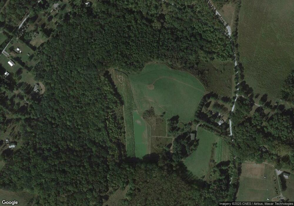
367 Mccurdy Trail Ligonier, PA 15658
Estimated Value: $75,921 - $371,000
--
Bed
--
Bath
1,995
Sq Ft
$141/Sq Ft
Est. Value
About This Home
This home is located at 367 Mccurdy Trail, Ligonier, PA 15658 and is currently estimated at $282,230, approximately $141 per square foot. 367 Mccurdy Trail is a home located in Westmoreland County with nearby schools including R.K. Mellon Elementary School, Ligonier Valley Middle School, and Ligonier Valley High School.
Ownership History
Date
Name
Owned For
Owner Type
Purchase Details
Closed on
Sep 18, 2001
Sold by
Kish John J and Kish Jeanne C
Bought by
Valley James E and Valley Nancy J
Current Estimated Value
Home Financials for this Owner
Home Financials are based on the most recent Mortgage that was taken out on this home.
Original Mortgage
$146,205
Outstanding Balance
$56,970
Interest Rate
6.98%
Estimated Equity
$225,260
Create a Home Valuation Report for This Property
The Home Valuation Report is an in-depth analysis detailing your home's value as well as a comparison with similar homes in the area
Home Values in the Area
Average Home Value in this Area
Purchase History
| Date | Buyer | Sale Price | Title Company |
|---|---|---|---|
| Valley James E | $153,900 | -- |
Source: Public Records
Mortgage History
| Date | Status | Borrower | Loan Amount |
|---|---|---|---|
| Open | Valley James E | $146,205 |
Source: Public Records
Tax History Compared to Growth
Tax History
| Year | Tax Paid | Tax Assessment Tax Assessment Total Assessment is a certain percentage of the fair market value that is determined by local assessors to be the total taxable value of land and additions on the property. | Land | Improvement |
|---|---|---|---|---|
| 2025 | $2,592 | $21,530 | $2,900 | $18,630 |
| 2024 | $2,592 | $21,530 | $2,900 | $18,630 |
| 2023 | $2,420 | $21,530 | $2,900 | $18,630 |
| 2022 | $2,420 | $21,530 | $2,900 | $18,630 |
| 2021 | $2,420 | $21,530 | $2,900 | $18,630 |
| 2020 | $2,352 | $21,530 | $2,900 | $18,630 |
| 2019 | $2,301 | $21,530 | $2,900 | $18,630 |
| 2018 | $2,260 | $21,530 | $2,900 | $18,630 |
| 2017 | $2,224 | $21,010 | $2,900 | $18,110 |
| 2016 | $2,153 | $21,010 | $2,900 | $18,110 |
| 2015 | $2,153 | $21,010 | $2,900 | $18,110 |
| 2014 | $2,122 | $21,010 | $2,900 | $18,110 |
Source: Public Records
Map
Nearby Homes
- 513 Austraw Rd
- 232 Red Arrow Rd
- 205 Woods Rd
- 311 Derry Ridge Rd
- 0 Matson Rd
- 911 Gravel Hill Rd
- 101 Lake Dr
- 211 Oakview Dr Unit 13
- 211 Oakview Dr Unit 18
- 211 Oakview Dr Unit 16
- 127 Singer Way
- 404 Kastner St Unit 1A
- 248 Plum Alley
- 305 Hickory Alley
- LOT 32 Whitefield Way
- LOT 5 Settler Rd
- LOT 3 Settler Rd
- LOT 2 Settler Rd
- LOT 1 Settler Rd
- 617 S Summit St
- 361 Mccurdy Trail
- 358 Mccurdy Trail
- 306 Mccurdy Trail
- 107 Osprey Ln
- 488 Austraw Rd
- 236 Berkley Rd Unit 1
- 520 Austraw Rd
- 352 Mccurdy Trail
- 544 Austraw Rd
- 516 Austraw Rd
- 111 Weber Ln
- 506 Austraw Rd
- 502 Austraw Rd
- 102 Weber Ln
- 570 Austraw Rd
- 570 Austraw Rd
- 0 Mccurdy Trail Unit 976604
- 0 Mccurdy Trail Unit 1028139
- 00 Mccurdy Trail
- 0 Austraw Unit 1011731
