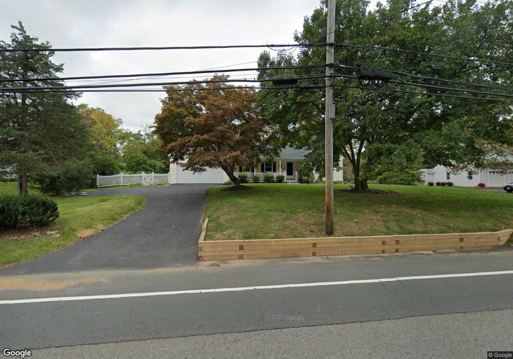
367 Mount Airy Rd Basking Ridge, NJ 07920
Bernards NeighborhoodEstimated Value: $756,262 - $1,272,000
Studio
--
Bath
1,728
Sq Ft
$561/Sq Ft
Est. Value
About This Home
This home is located at 367 Mount Airy Rd, Basking Ridge, NJ 07920 and is currently estimated at $968,816, approximately $560 per square foot. 367 Mount Airy Rd is a home located in Somerset County with nearby schools including Liberty Corner Elementary School, Oak Street Elementary School, and William Annin Middle School.
Ownership History
Date
Name
Owned For
Owner Type
Purchase Details
Closed on
Apr 17, 1997
Sold by
Brion Donna
Bought by
Sperduto Alphones and Sperduto Bernadette
Current Estimated Value
Purchase Details
Closed on
Jan 20, 1994
Sold by
Lytle Theodore
Bought by
Brion Donna
Home Financials for this Owner
Home Financials are based on the most recent Mortgage that was taken out on this home.
Original Mortgage
$75,000
Interest Rate
7.08%
Create a Home Valuation Report for This Property
The Home Valuation Report is an in-depth analysis detailing your home's value as well as a comparison with similar homes in the area
Home Values in the Area
Average Home Value in this Area
Purchase History
| Date | Buyer | Sale Price | Title Company |
|---|---|---|---|
| Sperduto Alphones | $252,000 | -- | |
| Brion Donna | $259,000 | -- |
Source: Public Records
Mortgage History
| Date | Status | Borrower | Loan Amount |
|---|---|---|---|
| Previous Owner | Brion Donna | $75,000 |
Source: Public Records
Tax History
| Year | Tax Paid | Tax Assessment Tax Assessment Total Assessment is a certain percentage of the fair market value that is determined by local assessors to be the total taxable value of land and additions on the property. | Land | Improvement |
|---|---|---|---|---|
| 2025 | $10,432 | $659,600 | $381,300 | $278,300 |
| 2024 | $10,432 | $586,400 | $354,300 | $232,100 |
Source: Public Records
Map
Nearby Homes
- 12 Wayne Terrace
- 436 Mount Airy Rd
- 105 Annin Rd
- 247 Lyons Rd
- 24 Chelsea Ct
- 28 Lafayette Ln
- 36 Debra Ln
- 7 Valley View Dr
- 23 Charlotte Hill Dr
- 213 Liberty Corner Rd
- 365 Mine Brook Rd
- 173 W Oak St
- 26 Woodward Ln
- 275 Crabtree Ct
- 496 Mine Brook Rd
- 570 Mine Brook Rd
- 40 Chestnut Ct
- 227 Arrowood Way
- 279 English Place
- 167 Douglas Rd
- 363 Mount Airy Rd
- 371 Mount Airy Rd
- 357 Mount Airy Rd
- 375 Mount Airy Rd
- 370 Mt Airy Rd
- 9 Fairview Dr E
- 364 Mount Airy Rd
- 360 Mount Airy Rd
- 13 Fairview Dr E
- 356 Mount Airy Rd
- 370 Mount Airy Rd
- 9 Nancy Ln
- 3 Fairview Dr E
- 17 Fairview Dr E
- 381 Mount Airy Rd
- 345 Mount Airy Rd
- 21 Fairview Dr E
- 376 Mount Airy Rd
- 350 Mount Airy Rd
- 25 Fairview Dr E
Your Personal Tour Guide
Ask me questions while you tour the home.