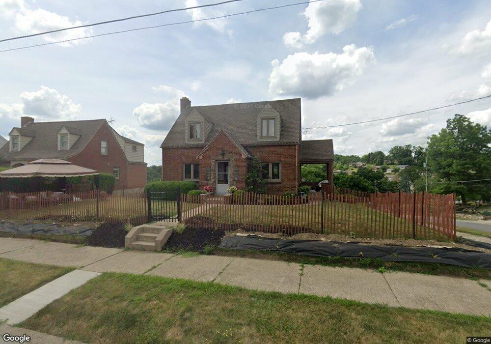
367 Thornwood Dr Canonsburg, PA 15317
Estimated Value: $221,912 - $231,000
2
Beds
1
Bath
1,432
Sq Ft
$158/Sq Ft
Est. Value
About This Home
This home is located at 367 Thornwood Dr, Canonsburg, PA 15317 and is currently estimated at $225,728, approximately $157 per square foot. 367 Thornwood Dr is a home located in Washington County with nearby schools including Canon-Mcmillan Senior High School and Central Christian Academy.
Ownership History
Date
Name
Owned For
Owner Type
Purchase Details
Closed on
Aug 20, 2021
Sold by
Spadaro John D and Spadaro Corrine A
Bought by
Barnes Shannon and Kresock Richard J
Current Estimated Value
Home Financials for this Owner
Home Financials are based on the most recent Mortgage that was taken out on this home.
Original Mortgage
$181,390
Outstanding Balance
$164,691
Interest Rate
2.8%
Mortgage Type
New Conventional
Estimated Equity
$61,037
Purchase Details
Closed on
May 17, 2021
Sold by
Riethmuller Mark S and Estate Of Frank A Dezomba
Bought by
Spadaro John D and Spadaro Corrine A
Home Financials for this Owner
Home Financials are based on the most recent Mortgage that was taken out on this home.
Original Mortgage
$140,000
Interest Rate
3%
Mortgage Type
Purchase Money Mortgage
Create a Home Valuation Report for This Property
The Home Valuation Report is an in-depth analysis detailing your home's value as well as a comparison with similar homes in the area
Home Values in the Area
Average Home Value in this Area
Purchase History
| Date | Buyer | Sale Price | Title Company |
|---|---|---|---|
| Barnes Shannon | $187,000 | Accommodation | |
| Spadaro John D | $140,000 | Commonwealth Abstract & Clos |
Source: Public Records
Mortgage History
| Date | Status | Borrower | Loan Amount |
|---|---|---|---|
| Open | Barnes Shannon | $181,390 | |
| Previous Owner | Spadaro John D | $140,000 |
Source: Public Records
Tax History Compared to Growth
Tax History
| Year | Tax Paid | Tax Assessment Tax Assessment Total Assessment is a certain percentage of the fair market value that is determined by local assessors to be the total taxable value of land and additions on the property. | Land | Improvement |
|---|---|---|---|---|
| 2025 | $2,904 | $142,600 | $38,800 | $103,800 |
| 2024 | $2,706 | $142,600 | $38,800 | $103,800 |
| 2023 | $2,706 | $142,600 | $38,800 | $103,800 |
| 2022 | $2,700 | $142,600 | $38,800 | $103,800 |
| 2021 | $2,671 | $142,600 | $38,800 | $103,800 |
| 2020 | $2,614 | $142,600 | $38,800 | $103,800 |
| 2019 | $2,534 | $142,600 | $38,800 | $103,800 |
| 2018 | $2,490 | $142,600 | $38,800 | $103,800 |
| 2017 | $548 | $142,600 | $38,800 | $103,800 |
| 2016 | $470 | $11,943 | $2,163 | $9,780 |
| 2015 | $470 | $11,943 | $2,163 | $9,780 |
| 2014 | $1,906 | $11,943 | $2,163 | $9,780 |
| 2013 | $1,906 | $11,943 | $2,163 | $9,780 |
Source: Public Records
Map
Nearby Homes
- 438 Canyon Dr
- 229 Glenn Ave
- 221 Glenn Ave
- 212 Glenn Ave
- 221 Belmont Ave
- 337 N Jefferson Ave
- 217 Belmont Ave
- 660 Woodland Rd
- 409 N Jefferson Ave
- 16 Chestnut St
- 326 W Pike St
- 118 Oak Spring Rd
- 148 Oak Spring Rd
- 659 Alpine Dr
- 707 Alpine Dr
- 514 Ridge Ave
- 126 Church Way
- 31 W College St
- 129 N Jefferson Ave
- 407 Greenside Ave
- 363 Thornwood Dr
- 363 Thornwood Dr
- 359 Thornwood Dr
- 511 Hutchinson Ave
- 524 Hutchinson Ave
- 524 Hutchinson Ave
- 524 Hutchinson Ave
- 343 Thornwood Dr
- 522 Hutchinson Ave
- 531 Hutchinson Ave
- 520 Hutchinson Ave
- 430 Bluff St
- 530 Hutchinson Ave
- 341 Thornwood Dr
- 509 Hutchinson Ave
- 340 Thornwood Dr
- 516 Hutchinson Ave
- 337 Thornwood Dr
- 507 Hutchinson Ave
- 514 Hutchinson Ave