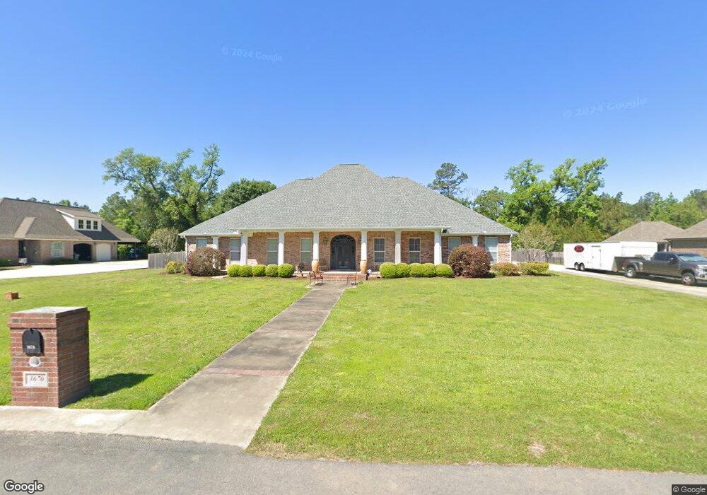
3670 W Weatherby Dr Sulphur, LA 70665
Estimated Value: $414,554 - $509,000
3
Beds
4
Baths
3,650
Sq Ft
$126/Sq Ft
Est. Value
About This Home
This home is located at 3670 W Weatherby Dr, Sulphur, LA 70665 and is currently estimated at $458,639, approximately $125 per square foot. 3670 W Weatherby Dr is a home located in Calcasieu Parish with nearby schools including Cypress Cove Elementary School, W.W. Lewis Middle School, and Sulphur High School.
Ownership History
Date
Name
Owned For
Owner Type
Purchase Details
Closed on
Apr 13, 2007
Sold by
Gmac Global Relocation Services Inc
Bought by
Bartis Abraham Jr and Abraham Tammy Marie
Current Estimated Value
Home Financials for this Owner
Home Financials are based on the most recent Mortgage that was taken out on this home.
Original Mortgage
$311,000
Outstanding Balance
$188,452
Interest Rate
6.19%
Mortgage Type
New Conventional
Estimated Equity
$270,187
Purchase Details
Closed on
Feb 14, 2005
Sold by
Sandia Estates Llc
Bought by
Jones William Fred and Jones Donna Lynn
Create a Home Valuation Report for This Property
The Home Valuation Report is an in-depth analysis detailing your home's value as well as a comparison with similar homes in the area
Home Values in the Area
Average Home Value in this Area
Purchase History
| Date | Buyer | Sale Price | Title Company |
|---|---|---|---|
| Bartis Abraham Jr | $340,000 | None Available | |
| Gmac Global Relocation Services Inc | $340,000 | None Available | |
| Jones William Fred | $27,600 | None Available |
Source: Public Records
Mortgage History
| Date | Status | Borrower | Loan Amount |
|---|---|---|---|
| Open | Bartis Abraham Jr | $311,000 |
Source: Public Records
Tax History Compared to Growth
Tax History
| Year | Tax Paid | Tax Assessment Tax Assessment Total Assessment is a certain percentage of the fair market value that is determined by local assessors to be the total taxable value of land and additions on the property. | Land | Improvement |
|---|---|---|---|---|
| 2024 | $3,645 | $32,460 | $3,240 | $29,220 |
| 2023 | $3,581 | $32,460 | $3,240 | $29,220 |
| 2022 | $1,919 | $32,460 | $3,240 | $29,220 |
| 2021 | $1,951 | $32,460 | $3,240 | $29,220 |
| 2020 | $3,228 | $29,410 | $3,110 | $26,300 |
| 2019 | $3,613 | $32,220 | $3,000 | $29,220 |
| 2018 | $1,957 | $32,220 | $3,000 | $29,220 |
| 2017 | $3,749 | $32,220 | $3,000 | $29,220 |
| 2016 | $3,950 | $32,220 | $3,000 | $29,220 |
| 2015 | $3,950 | $32,220 | $3,000 | $29,220 |
Source: Public Records
Map
Nearby Homes
- 1940 Currie Dr
- 0 Pete Seay Rd Unit SWL25003393
- 0 Pete Seay Rd Unit 189234
- 4108 Linda Ln
- 3724 Thompson Rd
- 2022 Gay Dr
- 2375 Jane Dr
- 2595 Bayou Cir
- 4191 Judy Dr
- 1265 Staci Ln
- 4360 Dean Dr
- 4331 Dorothy Jane Dr
- 1617 Walker Rd
- 0 Lawton Dr Unit SWL21008795
- 3584 Sierra Cir
- 1332 Lawton Dr
- 1474 Walker Rd
- 4672 Pete Seay Rd
- 2265 Leonard Rd
- 0 N Red Oak Forest Ln
- 0 W Weatherby Dr
- 3658 W Weatherby Dr
- 3682 W Weatherby Dr
- 3677 W Weatherby Dr
- 3659 W Weatherby Dr
- 1945 Currie Dr
- 3646 W Weatherby Dr
- 3647 W Weatherby Dr
- 3672 E Weatherby Dr
- 3684 E Weatherby Dr
- 3660 E Weatherby Dr
- 3586 W Weatherby Dr
- 1969 Currie Dr
- 0 Currie Rd
- 3648 E Weatherby Dr
- 3587 W Weatherby Dr
- 0 E Weatherby Dr
- 3574 W Weatherby Dr
- 3588 E Weatherby Dr
- 3675 E Weatherby Dr