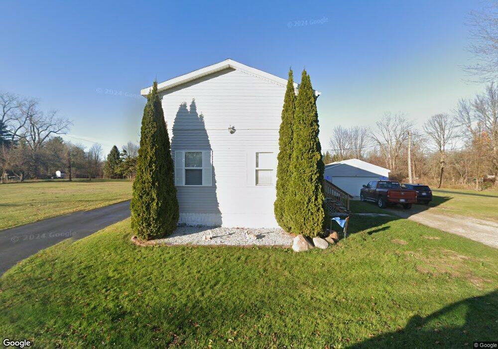
3672 Ravenswood Rd Port Huron, MI 48060
Estimated Value: $140,000 - $231,000
3
Beds
2
Baths
1,900
Sq Ft
$99/Sq Ft
Est. Value
About This Home
This home is located at 3672 Ravenswood Rd, Port Huron, MI 48060 and is currently estimated at $187,995, approximately $98 per square foot. 3672 Ravenswood Rd is a home located in St. Clair County with nearby schools including Kimball Elementary School, Central Middle School, and Port Huron High School.
Ownership History
Date
Name
Owned For
Owner Type
Purchase Details
Closed on
May 22, 2024
Sold by
Farnsworth William T and Farnsworth Shirley M
Bought by
Beckman Robert and Beckman Kelly
Current Estimated Value
Purchase Details
Closed on
May 12, 2021
Sold by
Farnsworth William T and Farnsworth Shirley M
Bought by
Beckman Robert and Beckman Kelly
Purchase Details
Closed on
Aug 23, 2006
Sold by
Siebert Louis F and Gaw Elien Marie
Bought by
Farnsworth William T and Farnsworth Shirley M
Purchase Details
Closed on
Apr 2, 2001
Sold by
Farnsworth Richard E and Farnsworth Charlotte A
Bought by
Seibert Louis E and Gaw Elien Marie
Create a Home Valuation Report for This Property
The Home Valuation Report is an in-depth analysis detailing your home's value as well as a comparison with similar homes in the area
Home Values in the Area
Average Home Value in this Area
Purchase History
| Date | Buyer | Sale Price | Title Company |
|---|---|---|---|
| Beckman Robert | $99,700 | None Listed On Document | |
| Beckman Robert | -- | Liberty Title | |
| Farnsworth William T | $75,000 | Lawyers Title Insurance Corp | |
| Seibert Louis E | -- | Lawyers Title Insurance Corp |
Source: Public Records
Tax History Compared to Growth
Tax History
| Year | Tax Paid | Tax Assessment Tax Assessment Total Assessment is a certain percentage of the fair market value that is determined by local assessors to be the total taxable value of land and additions on the property. | Land | Improvement |
|---|---|---|---|---|
| 2025 | $2,299 | $86,300 | $0 | $0 |
| 2024 | $1,150 | $68,300 | $0 | $0 |
| 2023 | $1,062 | $63,000 | $0 | $0 |
| 2022 | $2,019 | $56,300 | $0 | $0 |
| 2021 | $2,161 | $54,700 | $0 | $0 |
| 2020 | $2,161 | $54,800 | $54,800 | $0 |
| 2019 | $2,156 | $47,400 | $0 | $0 |
| 2018 | $2,078 | $47,400 | $0 | $0 |
| 2017 | $2,036 | $46,700 | $0 | $0 |
| 2016 | $1,348 | $46,700 | $0 | $0 |
| 2015 | -- | $39,700 | $39,700 | $0 |
| 2014 | -- | $38,000 | $38,000 | $0 |
| 2013 | -- | $36,800 | $0 | $0 |
Source: Public Records
Map
Nearby Homes
- 0 39th St Unit 25046693
- 0 39th St Unit 20251028136
- 3333 Ravenswood Rd Unit 4A
- 3333 Ravenswood Rd
- V/L Michigan
- 00 Moak St
- 104 Oldbrook Ln
- 0000 Wisconsin Ave
- 153 Meadow Ln
- 42 Liberty Ave
- 174 Meadow Ln
- 000 Gratiot Blvd
- 00 Gratiot Blvd
- 69 Gratiot Blvd
- 0 Busha Hwy Unit 50194246
- 3548 Cleveland St
- 260 Capitol Dr
- 277 Liberty Ave
- 720 Arlington Cir
- 3369 Dove Rd
- 3666 Ravenswood Rd
- 3666 Ravenswood Rd
- 3644 Ravenswood Rd
- 3636 Ravenswood Rd
- 3681 Ravenswood Rd
- 3665 Ravenswood Rd
- 3620 Ravenswood Rd
- 3706 Ravenswood Rd
- 3703 Ravenswood Rd
- 3716 Ravenswood Rd
- 3614 Ravenswood Rd
- 3645 Ravenswood Rd
- 3617 Ravenswood Rd
- 3717 Ravenswood Rd
- 3604 Ravenswood Rd
- 1035 40th St
- 3655 Ravenswood Rd
- 3731 Ravenswood Rd
- 3693 Ravenswood Rd
- 1045 40th St