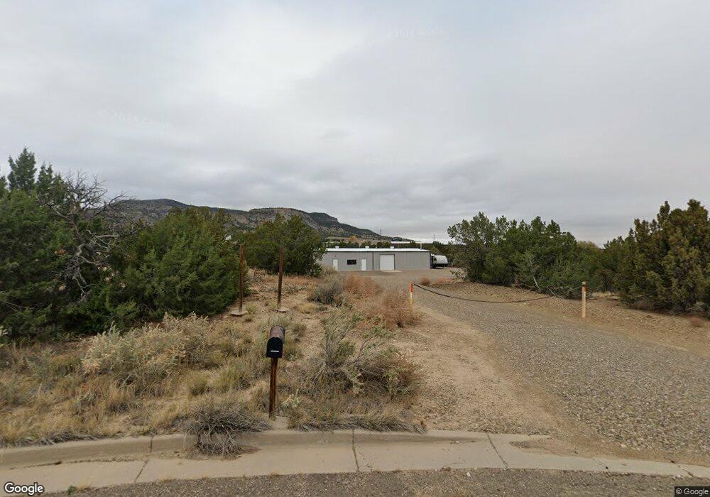
36720 Democracy Dr Unit Site 9 Trinidad, CO 81082
--
Bed
1
Bath
3,200
Sq Ft
4.65
Acres
About This Home
This home is located at 36720 Democracy Dr Unit Site 9, Trinidad, CO 81082. 36720 Democracy Dr Unit Site 9 is a home located in Las Animas County with nearby schools including Fisher's Peak Elementary School, Trinidad Middle School, and Trinidad High School.
Ownership History
Date
Name
Owned For
Owner Type
Purchase Details
Closed on
Apr 23, 2015
Sold by
The First National Bank In Trinidad
Bought by
Pachelli Tony C
Home Financials for this Owner
Home Financials are based on the most recent Mortgage that was taken out on this home.
Original Mortgage
$175,000
Outstanding Balance
$135,449
Interest Rate
3.89%
Mortgage Type
Future Advance Clause Open End Mortgage
Purchase Details
Closed on
Jan 29, 2013
Sold by
Deakin Smith Helena J and Deakin David Smith
Bought by
The First National Bank Of Trinidad
Purchase Details
Closed on
Sep 2, 2009
Sold by
Smith Helena D
Bought by
Deakin Smith Helena J
Home Financials for this Owner
Home Financials are based on the most recent Mortgage that was taken out on this home.
Original Mortgage
$175,000
Interest Rate
5.2%
Mortgage Type
Credit Line Revolving
Purchase Details
Closed on
Oct 15, 2008
Sold by
Smith J David and Smith Helena D
Bought by
Smith Helena D
Create a Home Valuation Report for This Property
The Home Valuation Report is an in-depth analysis detailing your home's value as well as a comparison with similar homes in the area
Home Values in the Area
Average Home Value in this Area
Purchase History
| Date | Buyer | Sale Price | Title Company |
|---|---|---|---|
| Pachelli Tony C | $160,000 | None Available | |
| The First National Bank Of Trinidad | -- | None Available | |
| Deakin Smith Helena J | -- | None Available | |
| Smith Helena D | -- | None Available |
Source: Public Records
Mortgage History
| Date | Status | Borrower | Loan Amount |
|---|---|---|---|
| Open | Pachelli Tony C | $175,000 | |
| Previous Owner | Deakin Smith Helena J | $175,000 |
Source: Public Records
Tax History Compared to Growth
Tax History
| Year | Tax Paid | Tax Assessment Tax Assessment Total Assessment is a certain percentage of the fair market value that is determined by local assessors to be the total taxable value of land and additions on the property. | Land | Improvement |
|---|---|---|---|---|
| 2025 | $2,168 | $54,470 | $24,000 | $30,470 |
| 2024 | $2,168 | $44,540 | $24,000 | $20,540 |
| 2023 | $2,168 | $38,410 | $24,000 | $14,410 |
| 2022 | $2,755 | $50,560 | $24,950 | $25,610 |
| 2021 | $2,729 | $50,560 | $24,950 | $25,610 |
| 2020 | $2,812 | $52,890 | $24,950 | $27,940 |
| 2019 | $28 | $52,890 | $24,950 | $27,940 |
| 2018 | $2,697 | $49,770 | $24,950 | $24,820 |
| 2017 | $2,620 | $49,770 | $0 | $0 |
| 2015 | $2,161 | $42,078 | $0 | $0 |
| 2013 | $2,230 | $42,078 | $17,261 | $24,817 |
Source: Public Records
Map
Nearby Homes
- 15308 County Road 71 1
- 0 Rancho Verde Unit Lot 56 25-911
- 1240 Congress Dr Unit Parcel 1C
- 1240 Congress Dr
- 2331 Colorado 239
- 2331 State Highway 239
- 1015 Independence Rd
- 1015 Independence Rd Unit Parcel A
- 17115 County Road 75
- Trinidad Unit Colorado
- 0 County Rd 73 3
- 209 Bloom St
- 11799 County Road 73 2
- 508 E North Ave
- 312 E North Ave
- 322 E North Ave
- 1712 Rosita Ave
- 318 E Goddard Ave
- 1710 Arizona Ave
- 1715 Nevada Ave
- 36720 Democracy Dr
- 36730 Democracy Dr
- 1104 Constitution Dr
- 13500 Democracy Dr
- 1105 Constitution Dr
- 1105 Constitution Dr
- 108 Democracy Dr
- 3710 Freedom Rd
- 3705 Freedom Rd
- 36700 Liberty Dr
- 100 Liberty Dr
- 16040 County Road 71.1
- 3620 Freedom Rd
- 3614 Freedom Rd
- 3613 Freedom Rd
- 30 County Rd 71 1
- 15110 County Road 71
- Unassigned C R 71 1 Unit 11.51 AC
- Unassigned C R 71 1 Unit Parcel 4
- Unassigned C R 71 1 Unit 5.08 AC