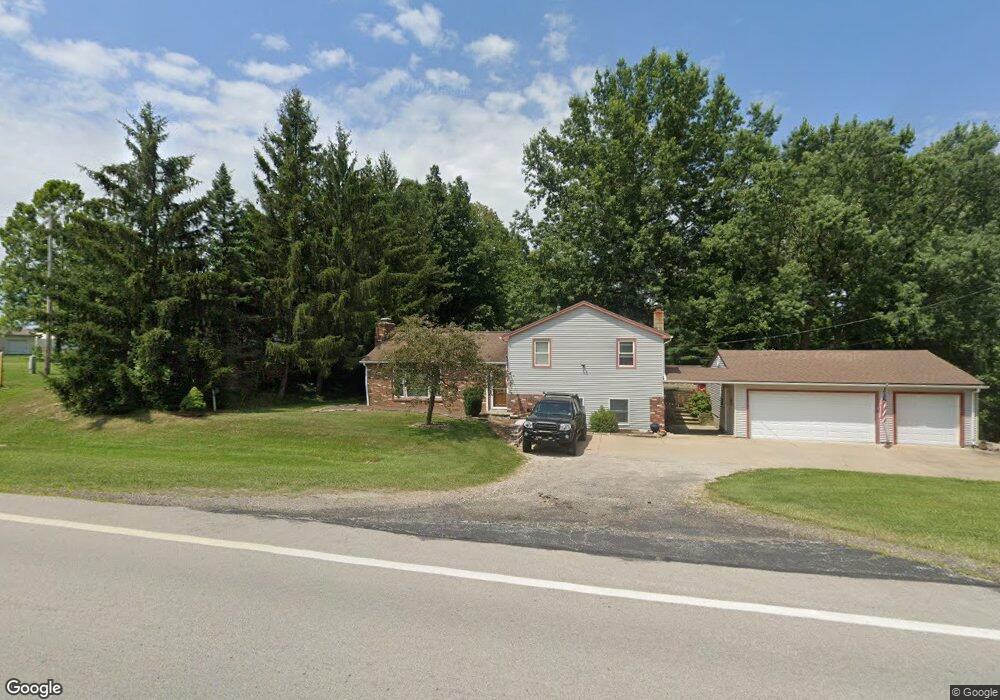
36730 State Route 303 Grafton, OH 44044
Estimated Value: $303,542 - $382,000
3
Beds
2
Baths
1,872
Sq Ft
$185/Sq Ft
Est. Value
About This Home
This home is located at 36730 State Route 303, Grafton, OH 44044 and is currently estimated at $345,386, approximately $184 per square foot. 36730 State Route 303 is a home located in Lorain County with nearby schools including Midview West Elementary School, Midview North Elementary School, and Midview East Intermediate School.
Ownership History
Date
Name
Owned For
Owner Type
Purchase Details
Closed on
Jun 3, 2002
Sold by
Buescher Bradley D and Buescher Lizabeth L
Bought by
Ostrander David J and Ostrander Billie J
Current Estimated Value
Home Financials for this Owner
Home Financials are based on the most recent Mortgage that was taken out on this home.
Original Mortgage
$112,800
Interest Rate
6.87%
Purchase Details
Closed on
Sep 15, 1999
Sold by
Edgar John H
Bought by
Buescher D Bradley and Buescher Lizabeth J
Home Financials for this Owner
Home Financials are based on the most recent Mortgage that was taken out on this home.
Original Mortgage
$140,000
Interest Rate
7.62%
Purchase Details
Closed on
Jan 27, 1998
Sold by
Gross Dianne M and Gross Edgar Dianne
Bought by
Edgar John H
Create a Home Valuation Report for This Property
The Home Valuation Report is an in-depth analysis detailing your home's value as well as a comparison with similar homes in the area
Home Values in the Area
Average Home Value in this Area
Purchase History
| Date | Buyer | Sale Price | Title Company |
|---|---|---|---|
| Ostrander David J | $141,000 | Progressive Land Title Agenc | |
| Buescher D Bradley | $136,900 | American Title & Trust Agenc | |
| Edgar John H | -- | -- |
Source: Public Records
Mortgage History
| Date | Status | Borrower | Loan Amount |
|---|---|---|---|
| Previous Owner | Ostrander David J | $112,800 | |
| Previous Owner | Buescher D Bradley | $140,000 |
Source: Public Records
Tax History Compared to Growth
Tax History
| Year | Tax Paid | Tax Assessment Tax Assessment Total Assessment is a certain percentage of the fair market value that is determined by local assessors to be the total taxable value of land and additions on the property. | Land | Improvement |
|---|---|---|---|---|
| 2024 | $4,255 | $93,478 | $24,255 | $69,223 |
| 2023 | $2,985 | $59,539 | $18,165 | $41,374 |
| 2022 | $2,924 | $59,539 | $18,165 | $41,374 |
| 2021 | $2,932 | $59,539 | $18,165 | $41,374 |
| 2020 | $2,644 | $49,870 | $15,220 | $34,650 |
| 2019 | $2,633 | $49,870 | $15,220 | $34,650 |
| 2018 | $2,662 | $49,870 | $15,220 | $34,650 |
| 2017 | $2,619 | $45,320 | $15,070 | $30,250 |
| 2016 | $2,654 | $45,320 | $15,070 | $30,250 |
| 2015 | $2,667 | $45,320 | $15,070 | $30,250 |
| 2014 | $2,598 | $43,580 | $14,490 | $29,090 |
| 2013 | $2,398 | $40,160 | $14,490 | $25,670 |
Source: Public Records
Map
Nearby Homes
- 36449 Law Rd
- 34630 N Legends Way
- 16000 Island Rd
- 1065 Sunshine Ct
- 1013 N Willow St
- 966 Oak St
- 34433 Law Rd
- 697 Main St
- 551 N Main St
- 1129 Novak Rd
- 1041 Plymouth Dr
- 636 Us Grant St
- 1077 Yarmouth Rd
- 632 Rundle St
- 0 Dill Ct Unit 5072837
- 614 Rundle St
- 0 Yost Rd Unit 5142533
- 800 Buckingham Dr
- 1040 Timber Trail
- 613 Rundle St
- 36800 State Route 303
- 36698 State Route 303
- 36711 State Route 303
- 36806 State Route 303
- 36791 State Route 303
- 36850 State Route 303
- 34120 Ohio 303
- 36580 State Route 303
- 36620 State Route 303
- 36841 State Route 303
- 17041 Mennell Rd
- 36814 State Route 303
- 36518 State Route 303
- 16957 Mennell Rd
- 17095 Mennell Rd
- 16985 Mennell Rd
- 36492 State Route 303
- 16953 Mennell Rd
- 16955 Mennell Rd
- 36521 State Route 303