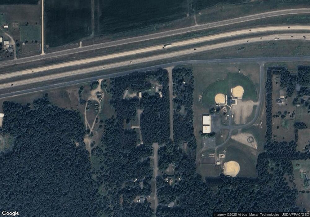
3675 State Highway 29 Elk Mound, WI 54739
Estimated Value: $265,000 - $446,000
--
Bed
--
Bath
--
Sq Ft
2.86
Acres
About This Home
This home is located at 3675 State Highway 29, Elk Mound, WI 54739 and is currently estimated at $336,788. 3675 State Highway 29 is a home located in Chippewa County with nearby schools including Hillcrest Elementary School, Chippewa Falls Middle School, and Chippewa Falls High School.
Ownership History
Date
Name
Owned For
Owner Type
Purchase Details
Closed on
Aug 27, 2010
Sold by
Dirty Red Llc
Bought by
Daniels Carol J
Current Estimated Value
Purchase Details
Closed on
Mar 31, 2010
Sold by
Farlin Chad E Mc
Bought by
Dirty Red Llc
Purchase Details
Closed on
Mar 22, 2010
Sold by
Secretary Of Hud
Bought by
Mcfarlin Chad E
Purchase Details
Closed on
Mar 19, 2009
Sold by
Citimortgage Inc
Bought by
The Secretary Of Housing And Urban Devel
Purchase Details
Closed on
Jan 25, 2009
Sold by
Gausmann Aaron J
Bought by
Citimortgage Inc
Purchase Details
Closed on
Jul 14, 2005
Sold by
Seidlitz Joel G
Bought by
Gausmann Aaron J and Gausmann Sarah C
Home Financials for this Owner
Home Financials are based on the most recent Mortgage that was taken out on this home.
Original Mortgage
$130,935
Interest Rate
5.71%
Mortgage Type
FHA
Create a Home Valuation Report for This Property
The Home Valuation Report is an in-depth analysis detailing your home's value as well as a comparison with similar homes in the area
Home Values in the Area
Average Home Value in this Area
Purchase History
| Date | Buyer | Sale Price | Title Company |
|---|---|---|---|
| Daniels Carol J | $117,000 | None Available | |
| Dirty Red Llc | $56,000 | None Available | |
| Mcfarlin Chad E | -- | None Available | |
| The Secretary Of Housing And Urban Devel | -- | None Available | |
| Citimortgage Inc | -- | None Available | |
| Gausmann Aaron J | $135,000 | None Available |
Source: Public Records
Mortgage History
| Date | Status | Borrower | Loan Amount |
|---|---|---|---|
| Previous Owner | Gausmann Aaron J | $130,935 |
Source: Public Records
Tax History Compared to Growth
Tax History
| Year | Tax Paid | Tax Assessment Tax Assessment Total Assessment is a certain percentage of the fair market value that is determined by local assessors to be the total taxable value of land and additions on the property. | Land | Improvement |
|---|---|---|---|---|
| 2024 | $2,148 | $159,500 | $31,400 | $128,100 |
| 2023 | $1,945 | $159,500 | $31,400 | $128,100 |
| 2022 | $1,956 | $159,500 | $31,400 | $128,100 |
| 2021 | $1,918 | $159,500 | $31,400 | $128,100 |
| 2020 | $2,043 | $159,500 | $31,400 | $128,100 |
| 2019 | $1,914 | $159,500 | $31,400 | $128,100 |
| 2018 | $2,057 | $126,500 | $23,600 | $102,900 |
| 2017 | $1,838 | $126,500 | $23,600 | $102,900 |
| 2016 | $1,872 | $126,500 | $23,600 | $102,900 |
| 2015 | $1,793 | $126,500 | $23,600 | $102,900 |
| 2014 | $1,800 | $126,500 | $23,600 | $102,900 |
Source: Public Records
Map
Nearby Homes
- 4574 50th St
- 3739 20th St
- Lot #8 23rd St
- Lot #7 23rd St
- Lot #9 23rd St
- Lot #10 23rd St
- Lot #5 23rd St
- 2097 20th St
- Lot #4 14th Ave
- Lot #3 14th Ave
- 6574 55th St
- 5221 Stonewood Dr Unit 13
- 0000 80th Ave
- 8103 35th St
- 4122 Mill Run Rd
- 4039 John Hart Place
- 4028 Mill Run Rd
- 6474 (Lot 41) Burr Oak Ln
- 4278 Mill Ridge Cir Unit 2
- 4264 Mill Ridge Cir
