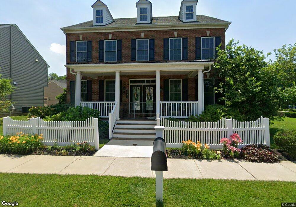
3676 Christopher Day Rd Doylestown, PA 18902
Plumstead NeighborhoodEstimated Value: $808,000 - $843,000
4
Beds
4
Baths
2,796
Sq Ft
$296/Sq Ft
Est. Value
About This Home
This home is located at 3676 Christopher Day Rd, Doylestown, PA 18902 and is currently estimated at $826,479, approximately $295 per square foot. 3676 Christopher Day Rd is a home with nearby schools including Groveland Elementary School, Tohickon Middle School, and Central Bucks High School-West.
Ownership History
Date
Name
Owned For
Owner Type
Purchase Details
Closed on
May 4, 2012
Sold by
Nvr Inc
Bought by
Zolty Richard and Zolty Linda
Current Estimated Value
Home Financials for this Owner
Home Financials are based on the most recent Mortgage that was taken out on this home.
Original Mortgage
$382,490
Interest Rate
4.62%
Mortgage Type
Adjustable Rate Mortgage/ARM
Purchase Details
Closed on
Nov 4, 2011
Sold by
Carriage Hill Jv Llc
Bought by
Nvr Inc and Nv Homes
Create a Home Valuation Report for This Property
The Home Valuation Report is an in-depth analysis detailing your home's value as well as a comparison with similar homes in the area
Home Values in the Area
Average Home Value in this Area
Purchase History
| Date | Buyer | Sale Price | Title Company |
|---|---|---|---|
| Zolty Richard | $509,990 | None Available | |
| Nvr Inc | $170,000 | None Available |
Source: Public Records
Mortgage History
| Date | Status | Borrower | Loan Amount |
|---|---|---|---|
| Closed | Zolty Richard | $382,490 |
Source: Public Records
Tax History Compared to Growth
Tax History
| Year | Tax Paid | Tax Assessment Tax Assessment Total Assessment is a certain percentage of the fair market value that is determined by local assessors to be the total taxable value of land and additions on the property. | Land | Improvement |
|---|---|---|---|---|
| 2025 | $9,442 | $54,340 | $6,400 | $47,940 |
| 2024 | $9,442 | $54,340 | $6,400 | $47,940 |
| 2023 | $9,142 | $54,340 | $6,400 | $47,940 |
| 2022 | $9,039 | $54,340 | $6,400 | $47,940 |
| 2021 | $8,938 | $54,340 | $6,400 | $47,940 |
| 2020 | $8,938 | $54,340 | $6,400 | $47,940 |
| 2019 | $8,884 | $54,340 | $6,400 | $47,940 |
| 2018 | $8,884 | $54,340 | $6,400 | $47,940 |
| 2017 | $8,762 | $54,340 | $6,400 | $47,940 |
| 2016 | $8,762 | $54,340 | $6,400 | $47,940 |
| 2015 | -- | $57,220 | $6,400 | $50,820 |
| 2014 | -- | $5,120 | $5,120 | $0 |
Source: Public Records
Map
Nearby Homes
- 3711 Jacob Stout Rd Unit 5
- 3723 William Daves Rd
- 3765 William Daves Rd
- 4748 Bishop Cir
- 3838 Jacob Stout Rd
- 3600 Jacob Stout Rd Unit 3
- 301 Windy Run Rd
- 3923 Ferry Rd
- 100 Bishops Gate Ln Unit 67
- 114 Blackfriars Cir
- 194 Victoria Ct Unit 143
- Madison Plan at Clover Hill Crossing
- Rittenhouse Plan at Clover Hill Crossing
- Harrison Plan at Clover Hill Crossing
- Chapel Hill Plan at Clover Hill Crossing
- Georgetown Plan at Clover Hill Crossing
- Fenimore Plan at Clover Hill Crossing
- 4263 Kleinot Dr
- 4317 Kleinot Dr
- 4464 Kleinot Dr
- 3688 Christopher Day Rd
- 1 Christopher Day Rd
- 2 Christopher Day Rd
- 3 Christopher Day Rd
- 4 Christopher Day Rd
- 5 Christopher Day Rd
- 6 Christopher Day Rd
- 110 Christopher Day Rd
- 3694 Christopher Day Rd
- 3656 Christopher Day Rd
- 3675 William Daves Rd
- 3679 William Daves Rd
- 3687 William Daves Rd
- 3689 Christopher Day Rd
- 3700 Christopher Day Rd
- 3677 Christopher Day Rd
- 3691 William Daves Rd
- 3642 Christopher Day Rd
- 3695 William Daves Rd
- 3699 William Daves Rd