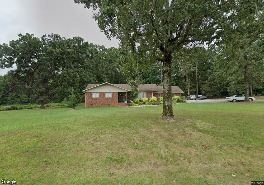
3676 Randleman Rd Iron Station, NC 28080
Estimated Value: $276,000 - $358,000
3
Beds
2
Baths
1,343
Sq Ft
$227/Sq Ft
Est. Value
About This Home
This home is located at 3676 Randleman Rd, Iron Station, NC 28080 and is currently estimated at $304,721, approximately $226 per square foot. 3676 Randleman Rd is a home located in Lincoln County with nearby schools including Iron Station Elementary School, East Lincoln Middle School, and East Lincoln High School.
Ownership History
Date
Name
Owned For
Owner Type
Purchase Details
Closed on
Jan 23, 2025
Sold by
Taylor Sherry and Iron Station Llc
Bought by
Taylor Sherry
Current Estimated Value
Purchase Details
Closed on
Jan 22, 2013
Sold by
Phillips Stephanie Lynn and Phillips Christopher Michael
Bought by
Tylor Sherry
Purchase Details
Closed on
Feb 18, 2010
Sold by
Poole Richard Steven
Bought by
Taylor Sherry and Phillips Stephanie
Create a Home Valuation Report for This Property
The Home Valuation Report is an in-depth analysis detailing your home's value as well as a comparison with similar homes in the area
Purchase History
| Date | Buyer | Sale Price | Title Company |
|---|---|---|---|
| Taylor Sherry | -- | None Listed On Document | |
| Iron Station Llc | -- | None Listed On Document | |
| Tylor Sherry | -- | None Available | |
| Taylor Sherry | -- | None Available |
Source: Public Records
Tax History
| Year | Tax Paid | Tax Assessment Tax Assessment Total Assessment is a certain percentage of the fair market value that is determined by local assessors to be the total taxable value of land and additions on the property. | Land | Improvement |
|---|---|---|---|---|
| 2025 | $1,971 | $293,382 | $39,692 | $253,690 |
| 2024 | $1,951 | $293,382 | $39,692 | $253,690 |
| 2023 | $1,946 | $293,382 | $39,692 | $253,690 |
| 2022 | $1,303 | $159,635 | $29,779 | $129,856 |
| 2021 | $1,303 | $159,635 | $29,779 | $129,856 |
| 2020 | $1,156 | $159,635 | $29,779 | $129,856 |
| 2019 | $1,124 | $159,635 | $29,779 | $129,856 |
| 2018 | $1,092 | $138,335 | $27,460 | $110,875 |
| 2017 | $983 | $138,335 | $27,460 | $110,875 |
| 2016 | $983 | $138,335 | $27,460 | $110,875 |
| 2015 | $1,050 | $138,335 | $27,460 | $110,875 |
| 2014 | $1,043 | $139,054 | $27,948 | $111,106 |
Source: Public Records
Map
Nearby Homes
- 853 Spring Lake Dr
- 1481 Depot St
- 3132 Fox Den Cir
- 4432 E Highway 27
- 429 Link Dr
- 1279 Craig Dr
- 000 N Carolina 73
- 141 Woodward Way
- 00 Timber Rd
- 00 Southmont Rd
- 375 Timber Rd
- 341 Camp Creek Rd
- Lot 6 Walnut Ridge Rd Unit 6
- 1987 & 1981 Magnolia Grove Rd
- 2595 Southmont Rd
- 1460 Adkin Dr
- 1485 Adkin Dr
- 3164 Andrew Link Rd
- 1473 Morningside Dr
- 1710 Oak Park Ct
- 3716 Randleman Rd
- 3609 Randleman Rd
- 3697 Randleman Rd
- 3661 Randleman Rd
- 3583 Randleman Rd
- 3665 Randleman Rd
- 3565 Randleman Rd
- 3868 Randleman Rd
- 27 Randleman Rd
- 00000 Randleman Rd
- 3830 Randleman Rd
- 1082 Dragtown Rd
- 3561 Randleman Rd
- 741 Low Bridge Rd
- 765 Low Bridge Rd
- 3514 Randleman Rd
- 721 Low Bridge Rd
- 3869 Randleman Rd
- 703 Low Bridge Rd
- 3794 Waderidge Trail
Your Personal Tour Guide
Ask me questions while you tour the home.