$44,950
SOLD OCT 12, 2018
Last list price

3676 W 100 N Parowan, UT 84761

3.62 Acres
$12,417 Price per Acre
157,687 Sq Ft Lot

Recently Sold

95 Days on Market

About This Lot

As of August 2020

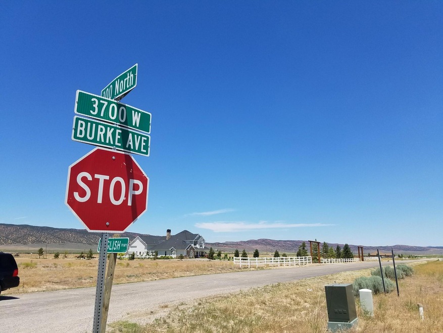
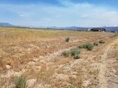
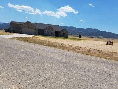
Level agricultural land with sweeping mountain views in all directions. Lot size provides good distance between neighbors. Community water system, power and paved street.

Last Agent to Sell the Property

Steve Brown

D&B Real Estate (Cedar City)

Last Buyer's Agent

CAROLYN RAY

Century 21 1st Choice Realty License #6140627-AB00

Century 21 1st Choice Realty

Property Details

Property Type

  • Land

Est. Annual Taxes

  • $384

Lot Details

  • 3.62 Acre Lot
  • Brush Vegetation
  • Native Plants
  • Level Lot
  • Property is zoned R-2

Utilities

  • Propane
  • Well
  • Community Well

Community Details

  • Property has a Home Owners Association
  • Summit Valley Ranchos Subdivision

Listing and Financial Details

  • Assessor Parcel Number C-1044-0011-0000

Property Details

Property Type

Land

Est. Annual Taxes

$384

Lot Details

0

Listing Details

  • Directions: I-15 to Exit 75 Go west on 200 South approx. 2 miles to 3700 West which is paved. Turn North and go to 100 North, property is on Northeast corner of intersection. See map tab.
  • Prop. Type: Land
  • Reso Property Sub Type: Lot
  • Road Surface Type: Paved, Unimproved, County Maintained
  • Subdivision Name: Summit Valley Ranchos
  • Master Plan Zoning: R-2
  • Terrain Flat: Yes
  • Utilities Electric-In Street: Yes
  • Utilities Electric-City: Yes
  • Utilities Propane-Available: Yes
  • VegetationCrops:Natural Grass: Yes
  • VegetationCrops:Sage Brush: Yes
  • VegetationCrops:Native Vegetation: Yes
  • Water Source Culinary-Well Private: Yes
  • Water Source Culinary-Well Community: Yes
  • Special Features: None
  • Property Sub Type: LotsLands

Exterior Features

  • Acres: 3.62

Condo/Co-op/Association

  • Association: Yes

Lot Info

  • Parcel #: C-1044-0011-0000
  • Lot Size Sq Ft: 157687.2
  • ResoLotSizeUnits: Acres
  • ResoLotSizeUnits: Acres

Tax Info

  • Tax Annual Amount: 384.42

Map

Range of Values:

Collateral Analytics

Collateral Analytics Collateral Analytics AVMs (Automated Valuation Model) employ a number of statistical approaches combined with neighborhood-specific comparable selection guarantees the most up-to-date and precise valuations.

Not Available

Collateral Analytics does not have data for the current month. Please view the chart for historical values.

ICE

ICE Mortgage Technology ICE Mortgage Technology’s AVM (Automated Valuation Model) is a state-of-the-art online residential property valuation tool that provides a quick and accurate estimate of the value of almost any home in the U.S.

Not Available

ICE Mortgage Technology does not have data for the current month. Please view the chart for historical values.

First American

First American First American Data & Analytics’ next-generation AVM combines unrivaled data assets with a blended ensemble of valuation models to produce highly accurate, reliable valuations you can trust.

Not Available

First American does not have data for the current month. Please view the chart for historical values.

Quantarium

Quantarium Quantarium’s valuation service, repeatedly proven the industry’s most accurate and comprehensive, is supercharged with a self-learning and auto-tuning AI engine that continually becomes smarter and more accurate as it processes daily inputs from the industry’s leading RE data lake.

Not Available

Quantarium does not have data for the current month. Please view the chart for historical values.

Average Value
Not Available
List Price
Sold Price
Create a Home Valuation Report for This Property
The Home Valuation Report is an in-depth analysis detailing your home's value as well as a comparison with similar homes in the area

Home Values in the Area

Source: Public Records

Average Home Value in this Area


Source: Public Records

Property History

Date Event Price Change Sq Ft Price
08/12/2020 08/12/20 Sold -- -- --
07/16/2020 07/16/20 Pending -- -- --
06/06/2020 06/06/20 For Sale $75,000 +66.9% --
10/12/2018 10/12/18 Sold -- -- --
09/10/2018 09/10/18 Pending -- -- --
06/07/2018 06/07/18 For Sale $44,950 -- --
Source: Iron County Board of REALTORS®

Tax History

Year Tax Paid Tax Assessment Tax Assessment Total Assessment is a certain percentage of the fair market value that is determined by local assessors to be the total taxable value of land and additions on the property. Land Improvement
2023 $1,151 $123,720 $123,720 $0
2022 $873 $103,100 $103,100 $0
2021 $450 $53,100 $53,100 $0
2020 $365 $38,100 $38,100 $0
2019 $381 $38,100 $38,100 $0
2018 $390 $38,100 $38,100 $0
2017 $347 $34,065 $34,065 $0
2016 $384 $34,065 $34,065 $0
2015 $403 $34,065 $0 $0
2014 $427 $34,065 $0 $0
Source: Public Records

Mortgage History

Date Status Loan Amount Loan Type
Open $89,188 New Conventional
Previous Owner $36,000 New Conventional
Previous Owner $23,800 Purchase Money Mortgage
Source: Public Records

Deed History

Date Type Sale Price Title Company
Warranty Deed -- Security Escrow & Ttl Ins Ag
Warranty Deed -- Security Escrow & Title Insu
Warranty Deed -- --
Source: Public Records

Source: Iron County Board of REALTORS®

MLS Number: 82812

APN: C-1044-0011-0000