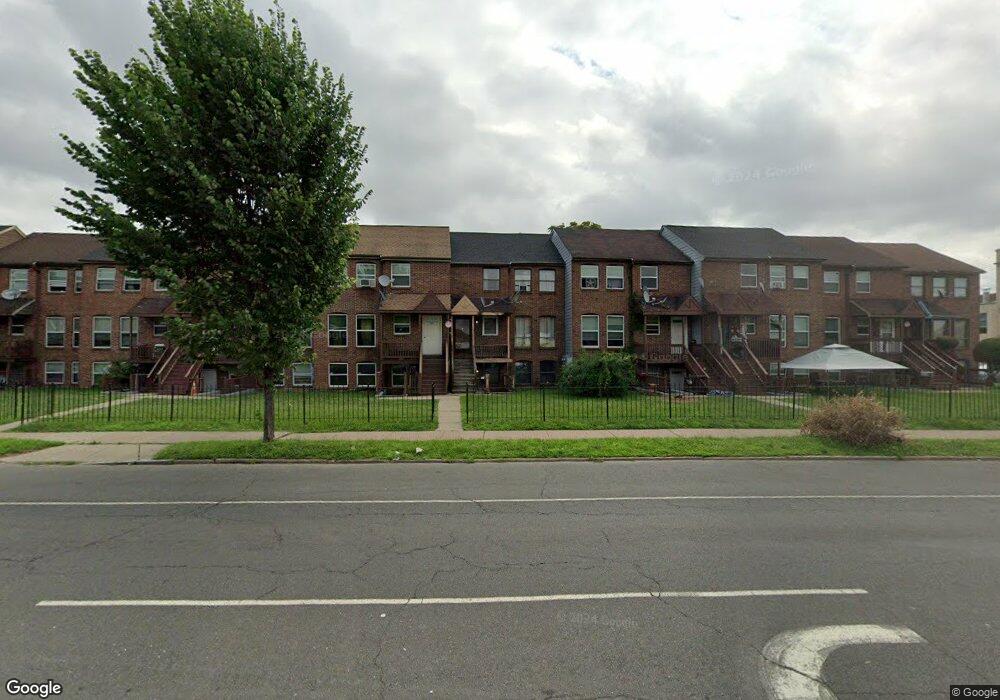
368 Wethersfield Ave Hartford, CT 06114
Barry Square NeighborhoodEstimated Value: $124,000 - $328,083
4
Beds
3
Baths
2,304
Sq Ft
$101/Sq Ft
Est. Value
About This Home
This home is located at 368 Wethersfield Ave, Hartford, CT 06114 and is currently estimated at $232,271, approximately $100 per square foot. 368 Wethersfield Ave is a home located in Hartford County with nearby schools including M. D. Fox School, Asian Studies School At Dwight/Belizzi School, and Dr. James H Naylor/Ccsu Leadership Academy.
Ownership History
Date
Name
Owned For
Owner Type
Purchase Details
Closed on
Apr 9, 2007
Sold by
Roberts Michelle and Roberts Phillip
Bought by
Drummond Trevor
Current Estimated Value
Home Financials for this Owner
Home Financials are based on the most recent Mortgage that was taken out on this home.
Original Mortgage
$101,405
Outstanding Balance
$61,345
Interest Rate
6.25%
Estimated Equity
$170,926
Create a Home Valuation Report for This Property
The Home Valuation Report is an in-depth analysis detailing your home's value as well as a comparison with similar homes in the area
Home Values in the Area
Average Home Value in this Area
Purchase History
| Date | Buyer | Sale Price | Title Company |
|---|---|---|---|
| Drummond Trevor | $121,000 | -- |
Source: Public Records
Mortgage History
| Date | Status | Borrower | Loan Amount |
|---|---|---|---|
| Open | Drummond Trevor | $101,405 | |
| Previous Owner | Drummond Trevor | $69,750 | |
| Previous Owner | Drummond Trevor | $37,100 |
Source: Public Records
Tax History Compared to Growth
Tax History
| Year | Tax Paid | Tax Assessment Tax Assessment Total Assessment is a certain percentage of the fair market value that is determined by local assessors to be the total taxable value of land and additions on the property. | Land | Improvement |
|---|---|---|---|---|
| 2025 | $2,014 | $29,216 | $0 | $29,216 |
| 2024 | $2,014 | $29,216 | $0 | $29,216 |
| 2023 | $2,014 | $29,216 | $0 | $29,216 |
| 2022 | $2,014 | $29,216 | $0 | $29,216 |
| 2021 | $1,883 | $25,340 | $0 | $25,340 |
| 2020 | $1,883 | $25,340 | $0 | $25,340 |
| 2019 | $1,883 | $25,340 | $0 | $25,340 |
| 2018 | $1,819 | $24,486 | $0 | $24,486 |
| 2016 | $1,888 | $25,414 | $0 | $25,414 |
| 2015 | $1,798 | $24,207 | $0 | $24,207 |
| 2014 | $1,754 | $23,615 | $0 | $23,615 |
Source: Public Records
Map
Nearby Homes
- 15 Bond St
- 17 Bond St
- 49 Benton St
- 26 Barker St Unit 28
- 30 Shultas Place Unit 32
- 213 Franklin Ave Unit 405
- 10 Warner St
- 497 Wethersfield Ave
- 3 Pawtucket St
- 114 Shultas Place Unit 116
- 71 Franklin Ave
- 61 Preston St Unit 63
- 68 Morris St Unit 102
- 51 Congress St Unit A
- 21 Wayland St
- 147 Preston St Unit 1
- 31 Wethersfield Ave Unit I
- 152 Otis St
- 183 Preston St Unit 185
- 71 Osten Blvd Unit 71
- 370 Wethersfield Ave
- 370 Wethersfield Ave Unit A & B
- 372 Wethersfield Ave
- 366 Wethersfield Ave
- 376 Wethersfield Ave
- 374 Wethersfield Ave
- 364 Wethersfield Ave
- 362 Wethersfield Ave
- 358 Wethersfield Ave
- 350 Wethersfield Ave
- 374 Wethersfield Ave Unit A & B
- 364 Wethersfield Ave Unit a&b
- 360 Wethersfield Ave
- 360 Wethersfield Ave Unit A & B
- 353 Wethersfield Ave Unit 6
- 356 Wethersfield Ave
- 354 Wethersfield Ave
- 352 Wethersfield Ave
- 359 Wethersfield Ave
- 347 Wethersfield Ave Unit 351