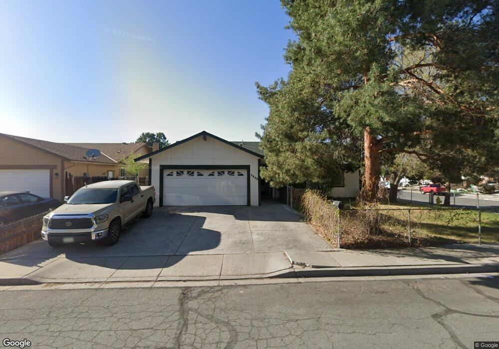
3680 Macarthur St Sparks, NV 89431
McCarran Boulevard-Probasco NeighborhoodEstimated Value: $427,000 - $463,000
3
Beds
2
Baths
1,336
Sq Ft
$332/Sq Ft
Est. Value
About This Home
This home is located at 3680 Macarthur St, Sparks, NV 89431 and is currently estimated at $443,691, approximately $332 per square foot. 3680 Macarthur St is a home located in Washoe County with nearby schools including Lena Juniper Elementary School, Lou Mendive Middle School, and Edward C Reed High School.
Ownership History
Date
Name
Owned For
Owner Type
Purchase Details
Closed on
Mar 29, 1994
Sold by
Watkins Donna Benadum
Bought by
Walker Scott M
Current Estimated Value
Home Financials for this Owner
Home Financials are based on the most recent Mortgage that was taken out on this home.
Original Mortgage
$88,700
Interest Rate
7.15%
Create a Home Valuation Report for This Property
The Home Valuation Report is an in-depth analysis detailing your home's value as well as a comparison with similar homes in the area
Home Values in the Area
Average Home Value in this Area
Purchase History
| Date | Buyer | Sale Price | Title Company |
|---|---|---|---|
| Walker Scott M | $111,000 | First Centennial Title Co |
Source: Public Records
Mortgage History
| Date | Status | Borrower | Loan Amount |
|---|---|---|---|
| Closed | Walker Scott M | $88,700 |
Source: Public Records
Tax History Compared to Growth
Tax History
| Year | Tax Paid | Tax Assessment Tax Assessment Total Assessment is a certain percentage of the fair market value that is determined by local assessors to be the total taxable value of land and additions on the property. | Land | Improvement |
|---|---|---|---|---|
| 2025 | $1,411 | $61,762 | $36,715 | $25,047 |
| 2024 | $1,411 | $60,708 | $34,755 | $25,953 |
| 2023 | $1,370 | $60,090 | $34,930 | $25,160 |
| 2022 | $1,331 | $49,900 | $28,455 | $21,445 |
| 2021 | $1,292 | $41,484 | $19,635 | $21,849 |
| 2020 | $1,253 | $40,200 | $17,850 | $22,350 |
| 2019 | $1,216 | $40,760 | $18,725 | $22,035 |
| 2018 | $1,181 | $35,497 | $13,545 | $21,952 |
| 2017 | $1,147 | $34,441 | $12,075 | $22,366 |
| 2016 | $1,118 | $34,724 | $11,550 | $23,174 |
| 2015 | $1,116 | $32,945 | $9,415 | $23,530 |
| 2014 | $1,084 | $30,998 | $7,980 | $23,018 |
| 2013 | -- | $28,984 | $5,985 | $22,999 |
Source: Public Records
Map
Nearby Homes
- 3607 Keogh Dr
- 3545 4th St
- 3465 Dawn Cir
- 3595 Rocky Ridge Ct
- 3245 Elaine Way
- 780 Emerson Way
- 120 E Lenwood Dr
- 465 Lenwood Dr
- 5530 High Rock Way
- 3252 Holman Way
- 3104 Sandy St
- 119 Devere Way
- 3071 Meadowlands Dr
- 510 S Sand Crane Cir
- 3200 Bristle Branch Dr
- 3198 Bristle Branch Dr
- 4719 Wood Thrush Ln
- 3188 Bristle Branch Dr
- 519 N Sand Crane Cir
- 4739 Wood Thrush Ln
- 3684 Macarthur St
- 3684 Koskela Dr
- 3693 Koskela Dr
- 3692 Macarthur St
- 3685 4th St
- 3674 Koskela Dr
- 3675 Macarthur St
- 3683 Koskela Dr
- 3679 Macarthur St
- 3671 Macarthur St
- 3683 Macarthur St
- 3675 4th St
- 3698 Macarthur St
- 3687 Macarthur St
- 3667 Macarthur St
- 3673 Koskela Dr Unit 2
- 3664 Koskela Dr
- 3665 4th St
- 3691 Macarthur St
- 3648 Keogh Dr Unit 3