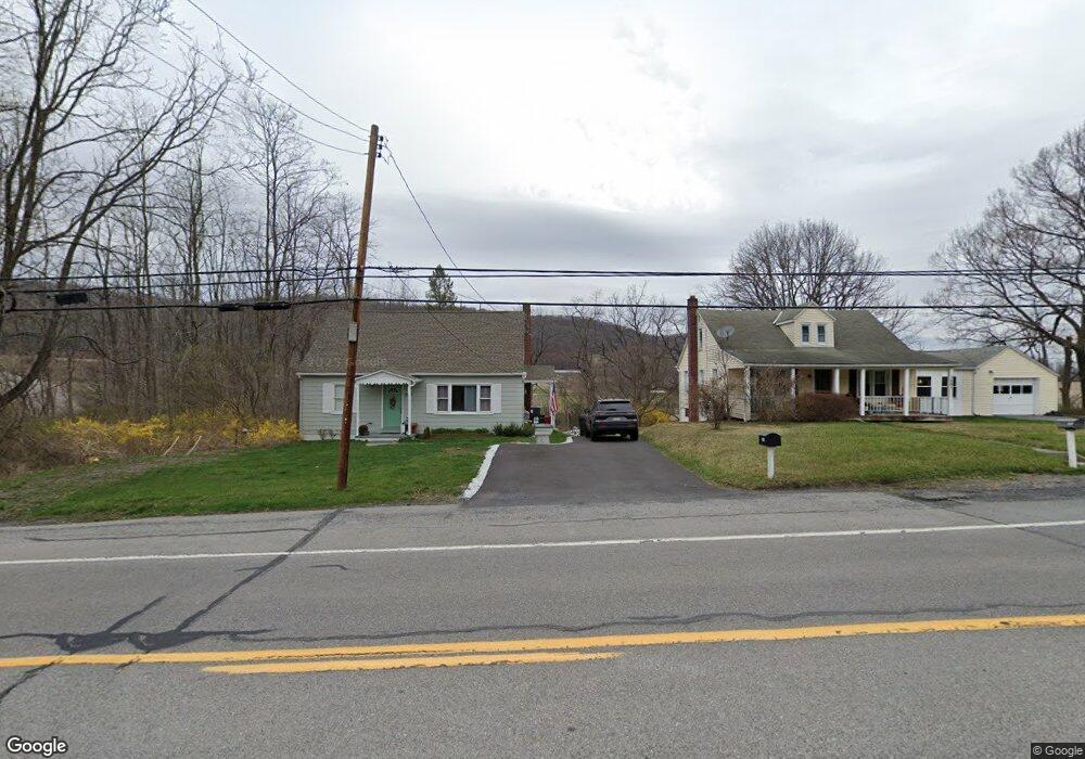
3681 N Atherton St Port Matilda, PA 16870
Patton NeighborhoodEstimated Value: $246,000 - $334,000
3
Beds
1
Bath
1,120
Sq Ft
$247/Sq Ft
Est. Value
About This Home
This home is located at 3681 N Atherton St, Port Matilda, PA 16870 and is currently estimated at $276,561, approximately $246 per square foot. 3681 N Atherton St is a home located in Centre County with nearby schools including Park Forest Elementary School, Park Forest Middle School, and State College Area High School.
Ownership History
Date
Name
Owned For
Owner Type
Purchase Details
Closed on
Feb 28, 2006
Sold by
Goss P Jane and Reigh Ronald E
Bought by
Tressler Timothy F and Fedor Michael C
Current Estimated Value
Home Financials for this Owner
Home Financials are based on the most recent Mortgage that was taken out on this home.
Original Mortgage
$40,000
Outstanding Balance
$1,711
Interest Rate
6.16%
Mortgage Type
Purchase Money Mortgage
Estimated Equity
$274,850
Create a Home Valuation Report for This Property
The Home Valuation Report is an in-depth analysis detailing your home's value as well as a comparison with similar homes in the area
Home Values in the Area
Average Home Value in this Area
Purchase History
| Date | Buyer | Sale Price | Title Company |
|---|---|---|---|
| Tressler Timothy F | $50,000 | None Available |
Source: Public Records
Mortgage History
| Date | Status | Borrower | Loan Amount |
|---|---|---|---|
| Open | Tressler Timothy F | $40,000 |
Source: Public Records
Tax History Compared to Growth
Tax History
| Year | Tax Paid | Tax Assessment Tax Assessment Total Assessment is a certain percentage of the fair market value that is determined by local assessors to be the total taxable value of land and additions on the property. | Land | Improvement |
|---|---|---|---|---|
| 2025 | $2,803 | $40,235 | $15,000 | $25,235 |
| 2024 | $2,615 | $40,235 | $15,000 | $25,235 |
| 2023 | $2,615 | $40,235 | $15,000 | $25,235 |
| 2022 | $2,552 | $40,235 | $15,000 | $25,235 |
| 2021 | $2,552 | $40,235 | $15,000 | $25,235 |
| 2020 | $2,552 | $40,235 | $15,000 | $25,235 |
| 2019 | $1,854 | $40,235 | $15,000 | $25,235 |
| 2018 | $2,474 | $40,235 | $15,000 | $25,235 |
| 2017 | $2,447 | $40,235 | $15,000 | $25,235 |
| 2016 | -- | $40,235 | $15,000 | $25,235 |
| 2015 | -- | $40,235 | $15,000 | $25,235 |
| 2014 | -- | $40,235 | $15,000 | $25,235 |
Source: Public Records
Map
Nearby Homes
- 112 Harvard Rd
- 111 Harvard Rd
- 111 Wildernest Ln
- 107 Wildernest Ln
- 113 Manhasset Dr
- 108 Heiskel Dr
- 95 Greenmeadow Ln
- 190 Michael Rd
- 112 Montauk Cir
- 209 Shadow Hawk Ln
- 991 Scotia Rd
- Brandywine Plan at Grays Pointe - Single Family Homes
- Dartmouth Plan at Grays Pointe - Single Family Homes
- Crestmont Plan at Grays Pointe - Single Family Homes
- Charlotte Plan at Grays Pointe - Single Family Homes
- Elmcrest Plan at Grays Pointe - Single Family Homes
- Bayberry Plan at Grays Pointe - Single Family Homes
- Aspen Plan at Grays Pointe - Single Family Homes
- Fairmont Plan at Grays Pointe - Single Family Homes
- Monroe Plan at Grays Pointe - Single Family Homes
- 3689 N Atherton St
- 101 Harvard Rd
- 3750 N Atherton St
- 103 Harvard Rd
- 3760 N Atherton St
- 3598 N Atherton St
- 144 Fernridge Rd
- 110 Fernridge Rd Unit 1
- 130 Fernridge Rd
- 106 Harvard Rd
- 3576 N Atherton St
- 160 Fernridge Rd
- 107 Harvard Rd
- 108 Harvard Rd
- 176 Fernridge Rd
- 233 Harvard Rd
- 110 Harvard Rd
- 109 Harvard Rd
- 00 Fernridge Rd
- Lot 16 Fernridge Rd