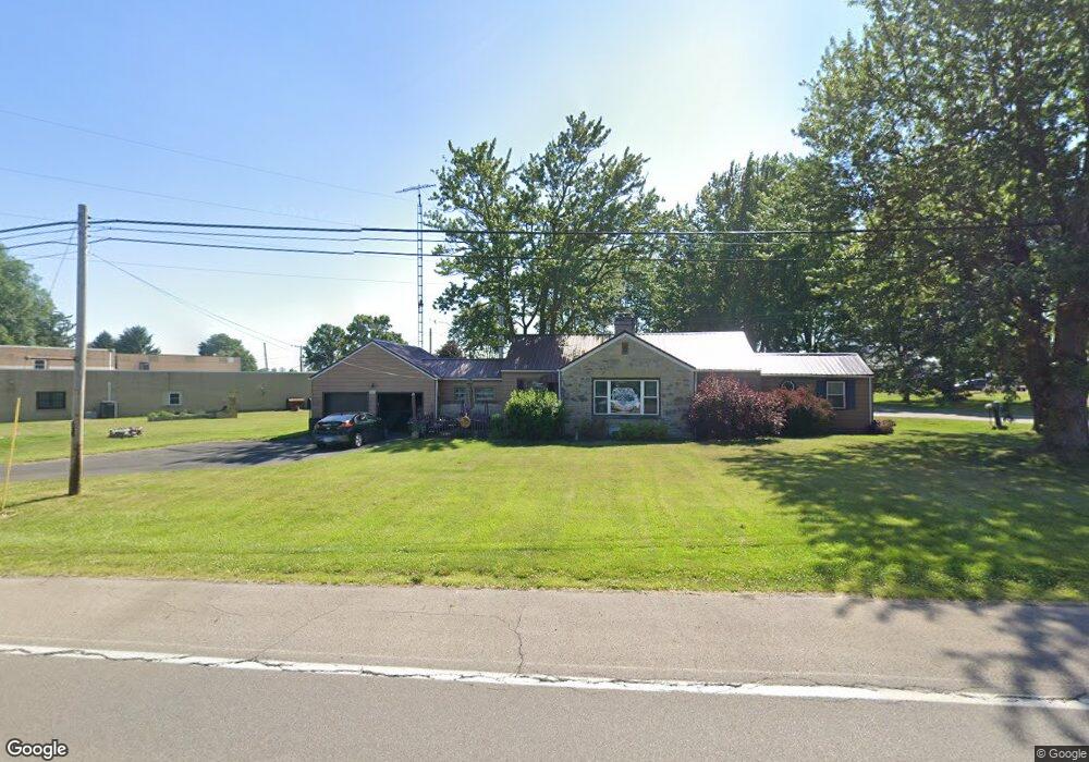
3685 State Route 39 Shelby, OH 44875
Estimated Value: $193,000 - $241,000
3
Beds
2
Baths
1,548
Sq Ft
$142/Sq Ft
Est. Value
About This Home
This home is located at 3685 State Route 39, Shelby, OH 44875 and is currently estimated at $220,086, approximately $142 per square foot. 3685 State Route 39 is a home located in Richland County with nearby schools including St. Mary's School.
Ownership History
Date
Name
Owned For
Owner Type
Purchase Details
Closed on
Sep 19, 2005
Sold by
Putnam Donald E and Putnam Brenda S
Bought by
Rowe Debra L
Current Estimated Value
Home Financials for this Owner
Home Financials are based on the most recent Mortgage that was taken out on this home.
Original Mortgage
$90,000
Outstanding Balance
$54,065
Interest Rate
7.87%
Mortgage Type
Fannie Mae Freddie Mac
Estimated Equity
$166,021
Purchase Details
Closed on
Nov 24, 2004
Sold by
White Joan L and White Roger D
Bought by
Putnam Donald E and Putnam Brenda S
Purchase Details
Closed on
Nov 19, 2004
Sold by
Allen Carol A and Allen William
Bought by
Putnam Donald E and Putnam Brenda S
Create a Home Valuation Report for This Property
The Home Valuation Report is an in-depth analysis detailing your home's value as well as a comparison with similar homes in the area
Home Values in the Area
Average Home Value in this Area
Purchase History
| Date | Buyer | Sale Price | Title Company |
|---|---|---|---|
| Rowe Debra L | $90,000 | Southern Title | |
| Putnam Donald E | $26,750 | Chicago Title | |
| Putnam Donald E | $26,750 | Chicago Title |
Source: Public Records
Mortgage History
| Date | Status | Borrower | Loan Amount |
|---|---|---|---|
| Open | Rowe Debra L | $90,000 |
Source: Public Records
Tax History Compared to Growth
Tax History
| Year | Tax Paid | Tax Assessment Tax Assessment Total Assessment is a certain percentage of the fair market value that is determined by local assessors to be the total taxable value of land and additions on the property. | Land | Improvement |
|---|---|---|---|---|
| 2024 | $1,697 | $44,770 | $8,120 | $36,650 |
| 2023 | $1,697 | $44,770 | $8,120 | $36,650 |
| 2022 | $1,559 | $36,690 | $7,850 | $28,840 |
| 2021 | $1,560 | $36,690 | $7,850 | $28,840 |
| 2020 | $1,562 | $36,690 | $7,850 | $28,840 |
| 2019 | $1,437 | $31,090 | $6,650 | $24,440 |
| 2018 | $1,408 | $31,090 | $6,650 | $24,440 |
| 2017 | $1,376 | $31,090 | $6,650 | $24,440 |
| 2016 | $1,359 | $30,580 | $5,540 | $25,040 |
| 2015 | $1,359 | $30,580 | $5,540 | $25,040 |
| 2014 | $1,304 | $30,580 | $5,540 | $25,040 |
| 2012 | $644 | $30,580 | $5,540 | $25,040 |
Source: Public Records
Map
Nearby Homes
- 3763 State Route 39
- 3596 Ohio 39
- 3400 Rock Rd
- 3389 Wareham Rd
- 0 Technology Pkwy
- 38 Woodland Rd
- 3619 Springmill Rd N
- 31 Sherwood Dr
- 116 Mansfield Ave
- 228 E Main St
- 226 E Main St
- 671 Bendle Ave
- 624 Bendle Ave
- 70 Mansfield Ave
- 221 S Gamble St
- 37 Grand Blvd
- 12 Wentz Ave Unit 12 1/2
- 2392 E Smiley Rd
- 2484 E Smiley Rd
- 16 Grace Ave
- 3685 Ohio 39
- 3697 Rock Rd
- 3758 State Route 39
- 3758 Ohio 39
- 3655 State Route 39
- 3754 State Route 39
- 3980 State Route 39
- 3730 Rock Road Extension
- 3667 Rock Rd
- 3746 Rock Road Extension
- 3645 Ohio 39
- 3645 State Route 39
- 3659 Rock Rd
- 3642 Rock Rd
- 2977 Taylortown Rd
- 3021 Taylortown Rd
- 3759 State Route 39
- 3010 Taylortown Rd
- 3759 Ohio 39
- 3768 -3772 St Rt 39